

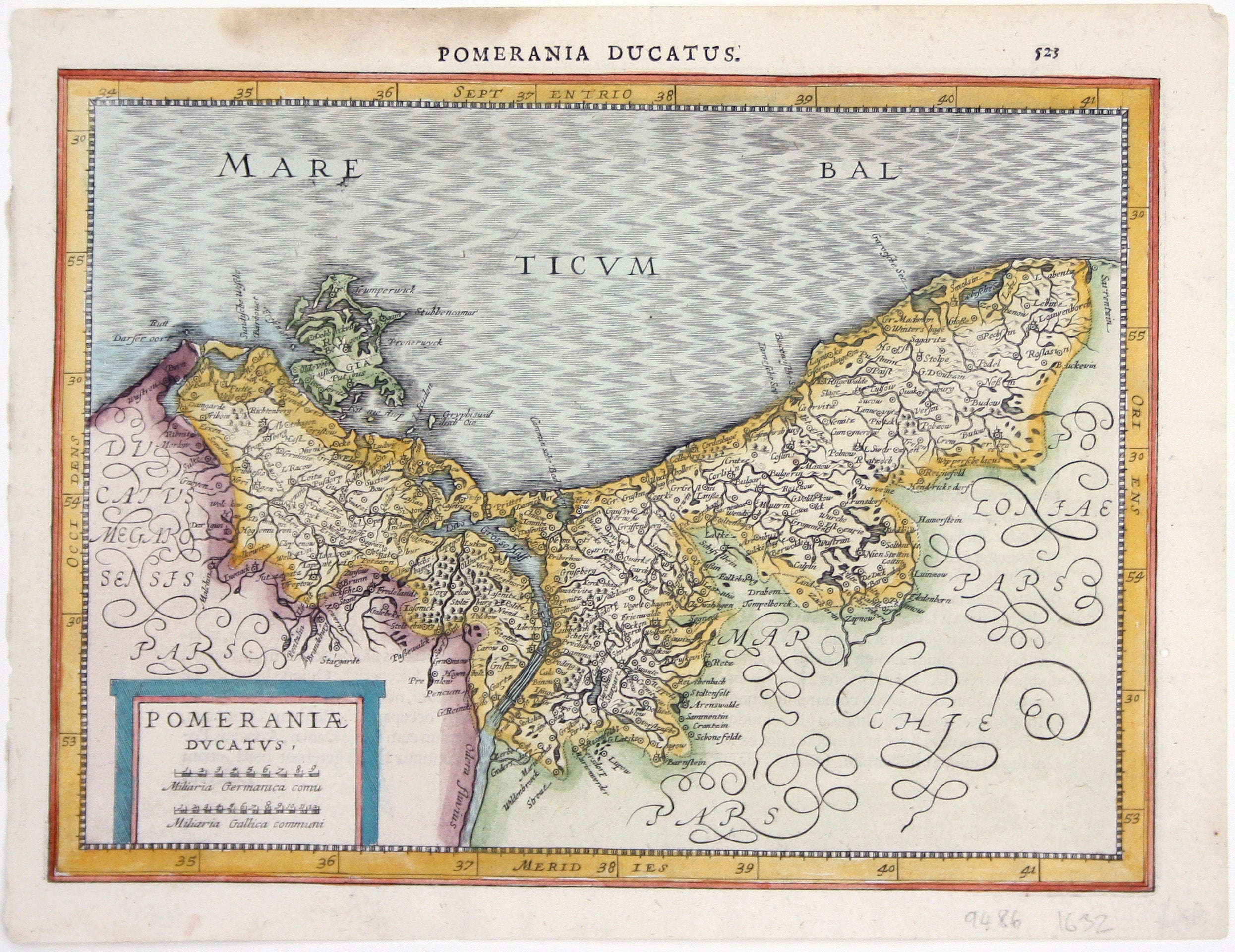
Mercator-Cloppenburgh Map of Pomerania
SKU: 9486
Title:
Mercator-Cloppenburgh Map of Pomerania
Date of publication:
Printed Measurement:
Colour:
Mapmaker:
Engraver:
Pomerania, running along the Baltic coast between Rostock and Gdansk, is now divided between Germany and Poland.
The 'Atlas Minor’ was a pocket atlas derived from Mercator's cartography, published from 1607 onward by Jodocus Hondius (the Dutch publisher who had purchased Mercator's original copper printing plates in 1604 and who issued his first, highly successful edition of the full-size atlas in 1606). Read more
In the 1630s Jan Cloppenburgh published a series of editions of Mercator’s Atlas Minor which have become scarce. The maps were engraved by Pieter van den Keere and are distinctively larger than the preceding examples.
Condition & Materials
Copper engraving, 19 x 25.5 cm, engraved by Pieter van den Keere, modern hand colour, light stain in upper margin, Latin text on verso. Read less