

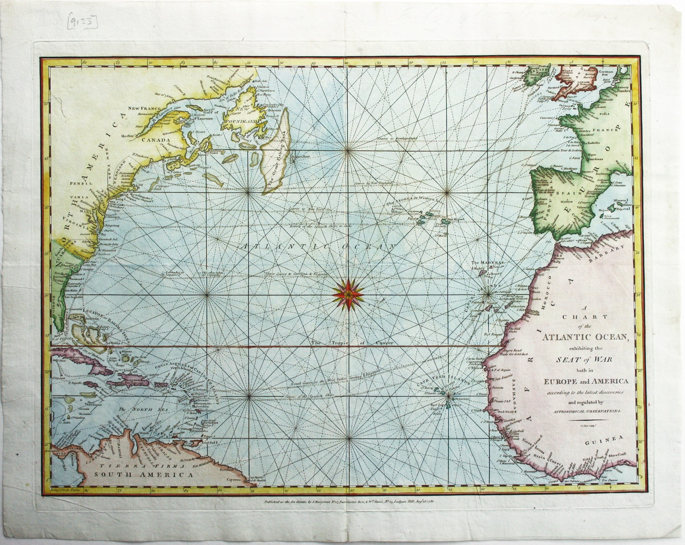
The Atlantic During the American Revolutionary War
SKU: 9133
Title:
The Atlantic During the American Revolutionary War
Date of publication:
Printed Measurement:
Colour:
Mapmaker:
A Chart of the Atlantic Ocean, exhibiting the seat of war both in Europe and America according to the latest discoveries and regulated by Astronomical Observations.
Published during the American Revolutionary War, this map of the Atlantic is one of the earliest maps engraved by John Cary, who became one of the leading cartographic engravers, publishers and globe-makers of the period. Read more
His first recorded map seems to have been ‘a plan of the navigable canals’ (1779), and he set up his own business in 1783. Cary’s map covers an area similar to other 18th century British maps, such as Emanuel Bowen’s ‘New & accurate chart of the Western or Atlantic Ocean’ (1744).
Condition & Materials
Copper engraving, 32 x 42.5 cm, modern hand colour, blank verso. Read less