

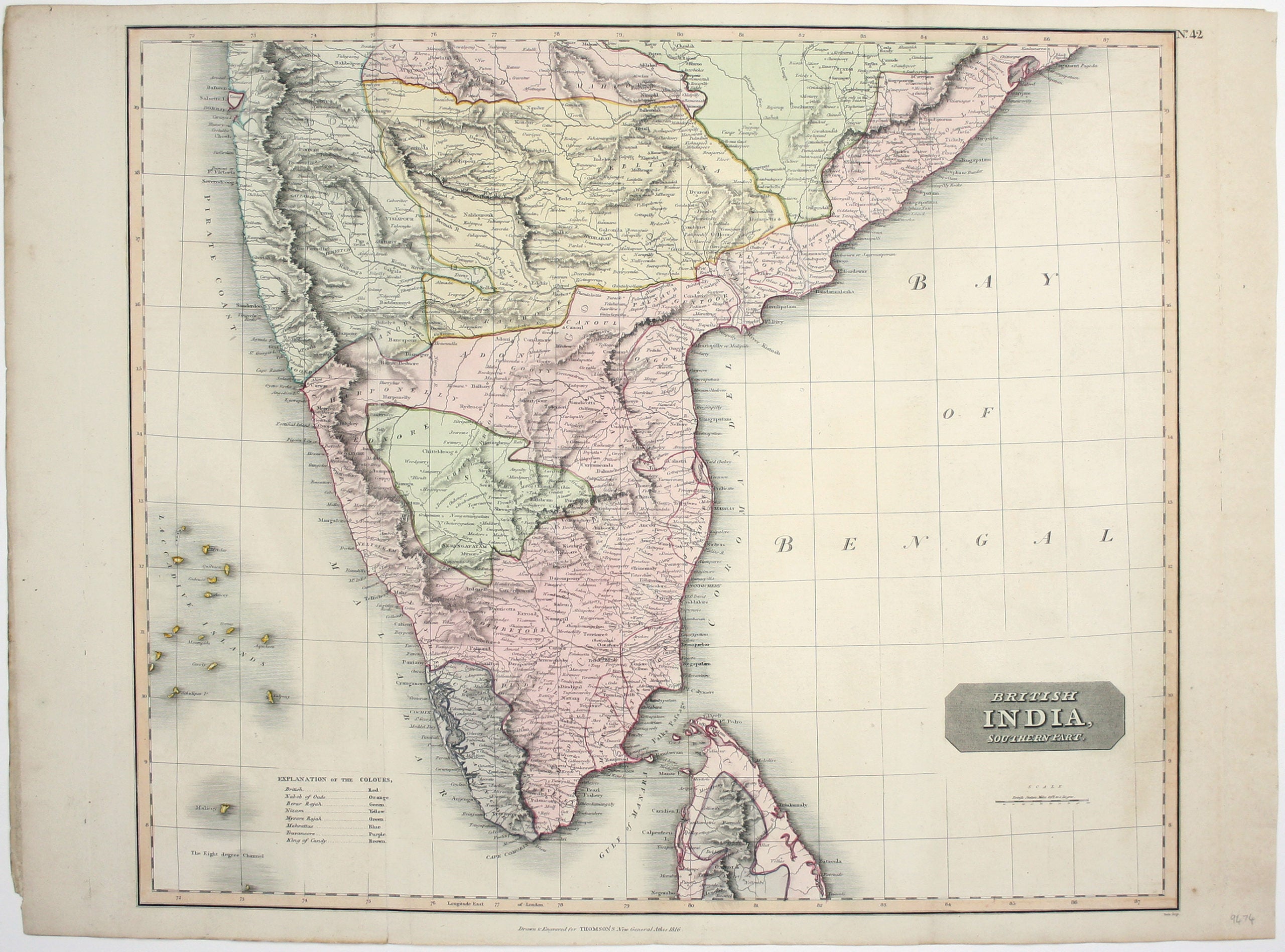
Thomson’s Map of Southern India
SKU: 9474
Title:
Thomson’s Map of Southern India
Date of publication:
Printed Measurement:
Colour:
Mapmaker:
Engraver:
This map covers the southern part of the subcontinent (Mumbai is near the upper border), and includes the northern part of Sri Lanka.
Pink denotes territory controlled by the British East India Company, although the political situation was constantly evolving. For example, the Kingdom of Kandy in Sri Lanka is coloured as an independent state, but had become a British protectorate following the Kandyan Convention of 1815 (it definitively lost its autonomy following the Uva Rebellion of 1817).
Read more
‘Neele’ could be either (or both) George or Samuel John Neele, brothers who collaborated in engraving maps for the highly successful 'New General Atlas', which made Thomson’s fortune. Unfortunately for Thomson he later bankrupted himself, twice, in the process of creating his large-scale 'Atlas of Scotland', and he disappears from the historical record. Thomson's maps are characteristic of the Edinburgh school of cartography which flourished at the beginning of the 19th century and is noted for its clarity and elegance; other exponents include John Cary and John Pinkerton.
Condition & Materials
Copper engraving, approx 53 x 65 cm, engraved by Neele, original hand-colour, vertical crease in left hand part of the map, blank verso, published in Thomson’s ‘New General Atlas’. Read less