

Thomson's Map of Korea & Japan
SKU: 9664
Title:
Thomson's Map of Korea & Japan
Date of publication:
Place of publication:
Colour:
Mapmaker:
Engraver:
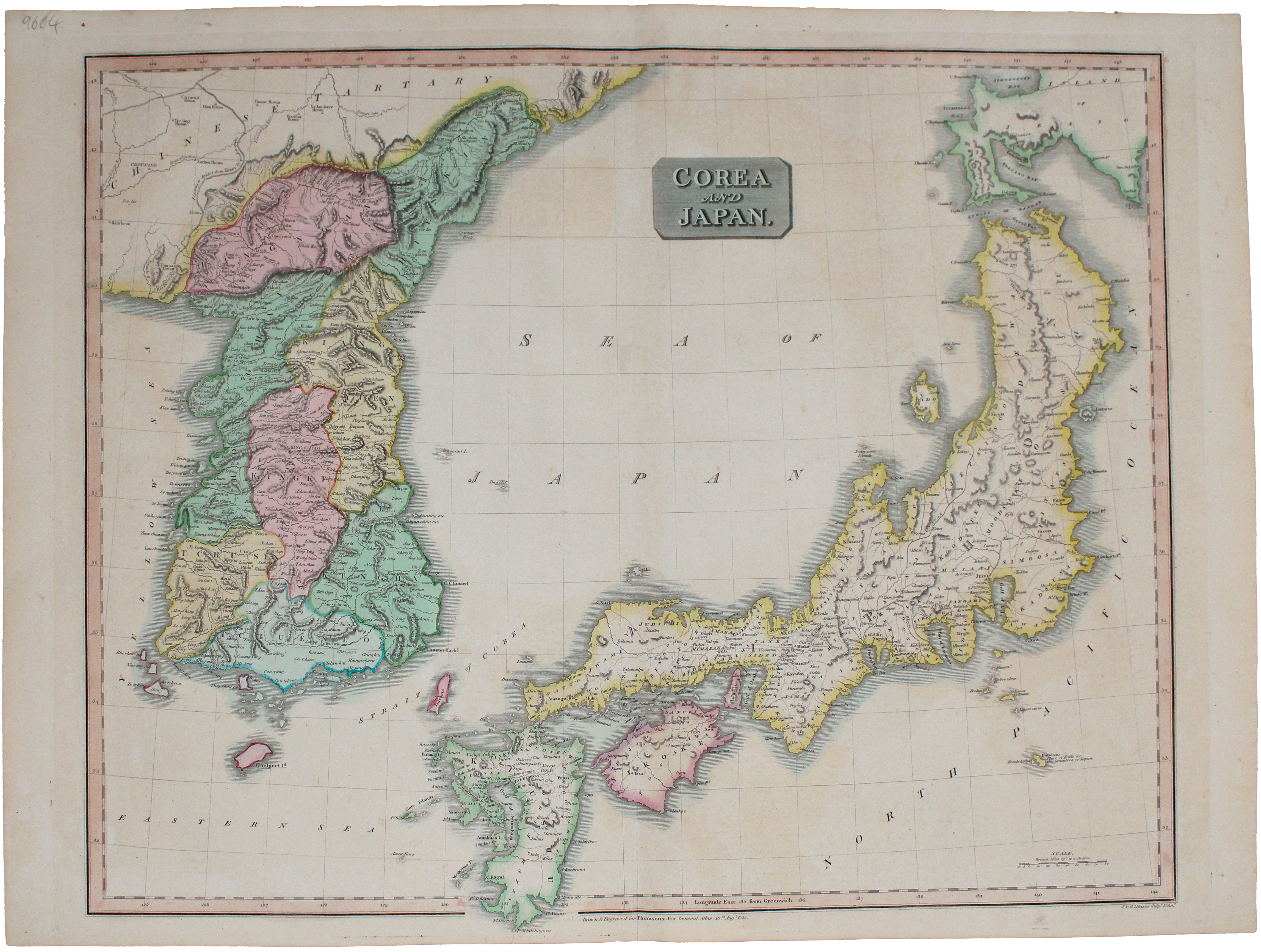
John Thomson's map of Korea and Japan was engraved by John and George Menzies in 1814 and published in his ‘New General Atlas’ in 1815.
Walter suggests the map has "several clear improvements" on its immediate predecessors, such as Jones’ map of 1813. Read more
Thomson's atlas was extremely successful and made his fortune, but in the 1820s he bankrupted himself. Twice. This happened in the process of creating his large-scale 'Atlas of Scotland' in a burst of patriotic pride. After this, he disappears from the historical record. Mapmaking is a very capital- and labour-intensive business, and Thomson was neither the first nor the last mapmaker to go bust in this fashion.
Thomson's maps are characteristic of the Edinburgh school of cartography which flourished at the beginning of the nineteenth-century and is noted for its clarity and elegance; other exponents include John Cary and John Pinkerton.
Condition & Materials
Copper engraving, 51.5 x 66 cm, engraved by John and George Menzies, original hand colour, blank verso.
References
Walter, Japan: A Cartographic Vision, 128 Read less