

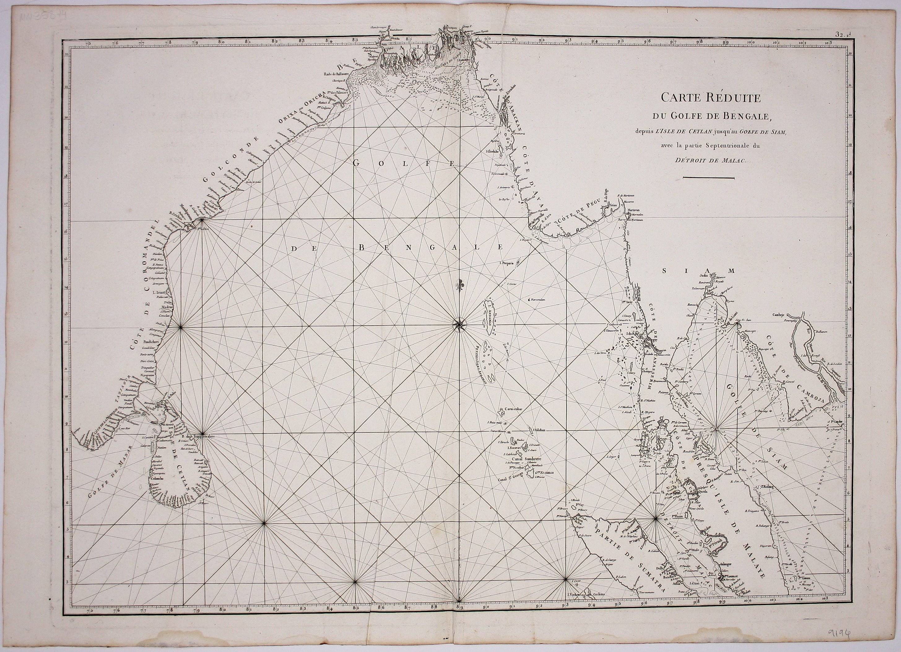
Mannevillette’s Chart of the Bay of Bengal
SKU: 9194
Title:
Mannevillette’s Chart of the Bay of Bengal
Date of publication:
Printed Measurement:
Colour:
Carte Reduite du Golfe de Bangale
D’Après de Mannevillette (1707-1780) was a practical seaman as well as a mapmaker; his sea atlas was published in Paris in 1745 with the backing of the Academie des Sciences under the title ‘Le Neptune Oriental’. He continued to revise and augment his charts over the next thirty years, and issued an expanded version of the Atlas and a supplement 1775-81.
Read more
Condition & Materials
Copper engraved chart of the Bay of Bengal, 50.5 x 69 cm, blank and white, slight creasing on either side of centrefold, light waterstain in lower margin, blank verso. Read less