

SDUK Map of Africa
SKU: 9465
Title:
SDUK Map of Africa
Date of publication:
Printed Measurement:
Publisher:
Colour:
Mapmaker:
Engraver:
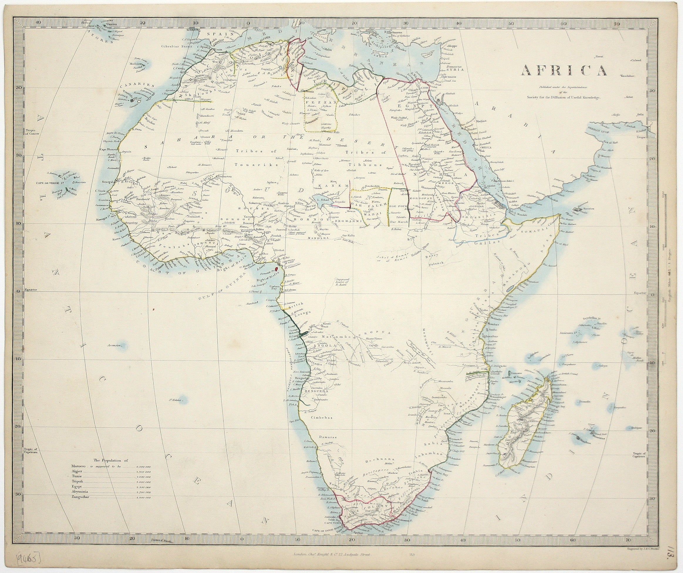
This map of Africa reflects the state of European knowledge of the interior before the mid 19th century search for the sources of the Nile.
It marks the routes of René Caillié, the first European to return alive from Timbuktu in 1828, Dixon Denham’s journey across the Sahara to Lake Chad in 1823 and Royal Geographical Society founder member James Edward Alexander’s journey through Namaqualand and Damaraland in 1837. Read more
Much of the other information is tentative or speculative, for example the ‘supposed sources of R. Zaire’. For this edition, some references have been revised; a symbol which denoted the ‘furthest Portuguese settlement’ in Angola in the first edition of 1839 has been replaced with more detailed information about the rivers and settlements in the region.
Further east, a tentative dotted line which denoted ‘Lake Zewa or Maravi’ has been erased, but equally tentative (and open ended) lines now denote ‘Nyassi or the sea’. The eye is drawn to Fernando Po (modern Bioko), an island in the Bight of Biafra which has been coloured red: between 1827 and 1843 it was a base for the Royal Navy’s African Slave Trade Patrol.
The SDUK was founded in 1826 with the high-minded aim of making 'useful' information available to the self-taught. Some of the material was decidedly abstruse, subscribers fell away and the Society was wound up in 1848; however, the series of 209 maps published over a 14 year period from 1829 onwards were highly praised for their superior quality, accuracy and aesthetic appeal and remain an outstanding achievement.
Condition & Materials
Steel engraving, 33 x 39 cm, engraved by John & Charles Walker, original hand colour in outline, slight spotting, numbered in an old hand in the margin, blank verso. Read less