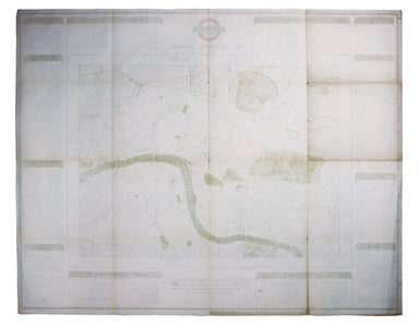
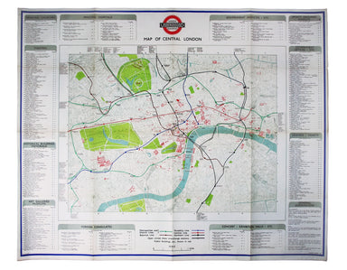
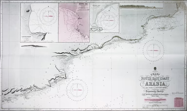
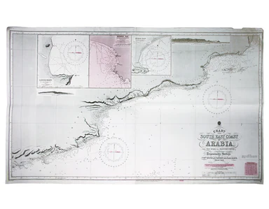
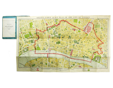
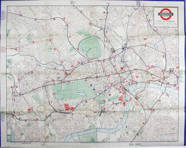
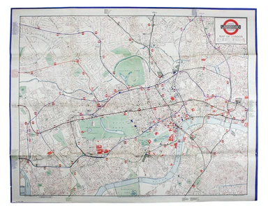
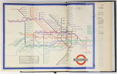
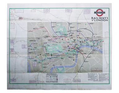
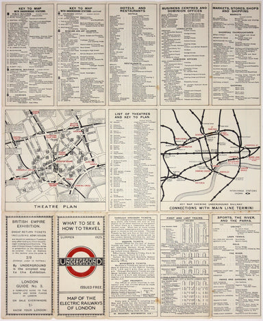
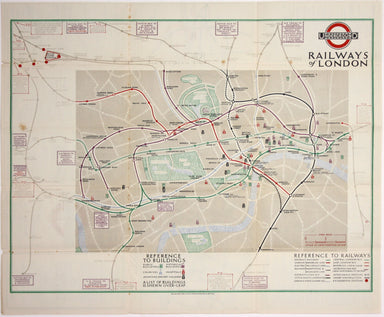
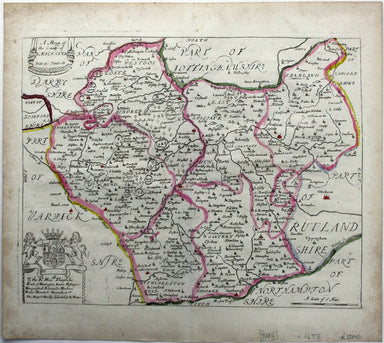

18th Century Folding Map of Normandy
Carte de la Normandie, divisée par Generalités et subdivisée par Elections Condition & Materials Folding map of Normandy, 68 x 102.5 cm, origin...
View full detailsCarte de la Normandie, divisée par Generalités et subdivisée par Elections Condition & Materials Folding map of Normandy, 68 x 102.5 cm, origin...
View full detailsA July 1910 map of the Uptown and Downtown Hudson Tubes, pairs of tunnels connecting Jersey City with Greenwich Village in New York and with the Hu...
View full detailsThis is an interesting example of the London underground map produced under difficult wartime conditions. A number of variants of this map were iss...
View full details
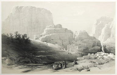
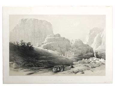
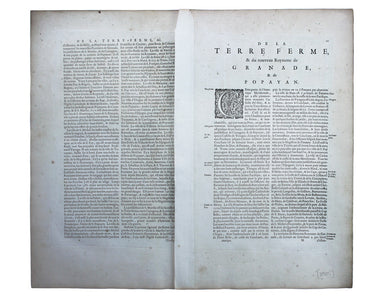
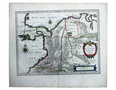
The introduction of Beck's diagram did not obviate the need for geographically accurate maps, which pinpointed the location of Underground stations...
View full detailsLondon: Day & Son for FG Moon, 1842-45. Tinted lithograph by Louis Haghe after Roberts, 33.5 x 53 cm, slight marginal waterstaining. From the ...
View full detailsChart of the South East Coast of Arabia from Ras Sukra to Palinurus Shoal, compiled from trigonometric Surveys First published in 1860 with correct...
View full detailsThough credited on the title-page under his pen-name ‘Aleph’, William Harvey himself gives all the credit for this series of comic maps to a “young...
View full detailsThus anthropomorphic map of Holland and Belgium was published in “Geographical Fun: Being Humorous Outlines of Various Countries.”. Though credited...
View full detailsThis anthropomorphic map of Ireland was published in “Geographical Fun: Being Humorous Outlines of Various Countries”. Though credited on the title...
View full detailsThis anthropomorphic map depicting Wales as "Owen Glendowr, in Bardic grandeur" is from 'Geographical Fun: Being Humorous Outlines of Various Count...
View full detailsLondon: Day & Son for FG Moon, 1842-45. Tinted lithograph by Louis Haghe after Roberts, 35.5 x 51 cm, minor spotting. From the first edition o...
View full detailsLondon: Day & Son for FG Moon, 1846-49. Tinted lithograph by Louis Haghe after Roberts, 33 x 48.5 cm, minor spotting. From the first edition o...
View full detailsBacon’s large scale plan of the City of London Condition & Materials Folding map, 42.5 x 71 cm, printed in colours, laid on linen as issued, a ...
View full detailsThis plan of Glasgow was published in Bacon’s ‘New Large Scale Ordnance Atlas of the British Isles’. Condition & Materials Lithographed town p...
View full detailsThe first edition of this map was printed in 1932 but the introduction of Beck's diagram in 1933 did not obviate the need for geographically accura...
View full detailsPlan of St Marylebone 1900 Detailed map of the Metropolitan Borough of St Marylebone as created by the London Government Act 1899, coloured to show...
View full detailsBacon’s Large Scale Plan of the City of London –Bacon’s Coloured Plan of the City of London… “Blitzed” areas shown A highly detailed map of London ...
View full detailsThis map of Middlesex was engraved by Toms for Thomas Badeslade’s ‘Chorographia Britanniae’, an attractive pocket atlas which according to Badeslad...
View full detailsCarta ilustrada del Muy Noble y Muy Leal Señorio de Vizcaya This map was published to mark the centenary of the Banco de Bilbao, one of the big fou...
View full detailsThis is a good example of the second ever edition of Harry Beck's famous diagram to appear in poster form; dated August 1933 it was the first to be...
View full detailsA first edition of the famous diagram from January 1933 Beck’s diagram is one of the most innovative and influential designs of the twentieth centu...
View full detailsBeck’s diagram is possibly one of the most innovative and influential designs of the 20th century. First published in 1933, Beck remained directly ...
View full detailsBeck’s diagram is possibly one of the most innovative and influential designs of the twentieth century. First published in 1933, Beck remained dire...
View full detailsOn the reverse of this London Underground map is an enlargement of the central area with interchange stations named inside large diamonds. Beck’s d...
View full details