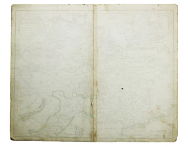
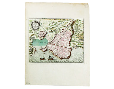
Deliverance from Russia
Signed limited edition screenprint Colour screenprint, sheet size 78 x 57.5 cms, signed by the artist and inscribed 'AP' (Artist’s Proof) in pencil...
View full detailsSigned limited edition screenprint Colour screenprint, sheet size 78 x 57.5 cms, signed by the artist and inscribed 'AP' (Artist’s Proof) in pencil...
View full detailsLondon: Day & Son for FG Moon, 1846-49. Subscribers’ edition. Lithograph by Louis Haghe after Roberts, 32.5 x 48.5 cm, with original hand col...
View full detailsSigned limited edition screenprint Colour screenprint, sheet size 78 x 57.5 cms, signed by the artist and inscribed 'AP' (Artist’s Proof) in pencil...
View full detailsLondon: Day & Son for FG Moon, 1842-45. Tinted lithograph by Louis Haghe after Roberts, 33 x 48.5 cm, minor spotting. From the first edition o...
View full detailsThe guide seems to have been aimed at an American audience, with several pages devoted to converting prices in pounds, shillings and pence into dol...
View full detailsSigned limited edition screenprint Colour screenprint, sheet size 78 x 57.5 cms, signed by the artist and inscribed 'AP' (Artist’s Proof) in pencil...
View full detailsThe District Railway Guide to the Greater Britain Exhibition, the Gigantic Wheel, &c, at Earls Court The Greater Britain Exhibition was one of ...
View full detailsThis District Railway map of Greater London shows the approximate extent from Epsom to Enfield and from Windsor to Grays, with inset of the Henley ...
View full detailsMotus in Coelo Spirales This chart shows the irregular orbits of Mercury and Venus on Tycho Brahe’s model, as observed from Earth, for the years 17...
View full detailsCondition & Materials Copper engraving, 10.5 x 12.6 cm, original hand-colour, lightly browned, blank verso; leaf from the same work, with the ...
View full detailsVoyage en ballon dirigeable a travers l’Europe No rule sheet, but fairly self explanatory: the board is a simplified map of Europe with vignettes o...
View full detailsUn-titled, undated and without a printer, this exceptionally scarce early poster was created for display in stations, but establishing which ones p...
View full detailsMap of the Great Western Railway and Connections This map illustrates how the Great Western Railway connected resources such as coal fields, china ...
View full detailsLondon: Day & Son for FG Moon, 1846-49. Subscribers’ edition. Lithograph by Louis Haghe after Roberts, 35.5 x 50 cm, with original hand colou...
View full detailsSigned limited edition screenprint Colour screenprint, sheet size 78 x 57.5 cms, signed by the artist and inscribed 'AP' (Artist’s Proof) in pencil...
View full detailsThis important map of the ‘Gulag’, the Soviet system of forced labour camps, is seemingly the earliest published example of what was to become one ...
View full detailsPlease note: this is not an 11th century manuscript map, it is the first printed edition (centuries after the map was drawn) following its rediscov...
View full details
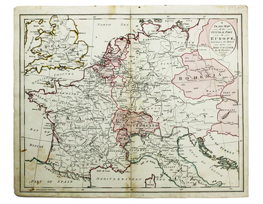
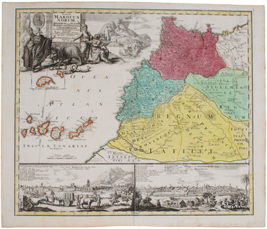
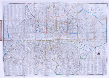
Plan Routiere de la Ville et Fauxbourgs de Paris divisé en douze Maries, revu et corrigé par Hérisson, géographe Our map shows the Paris of Charles...
View full detailsThéâtre de la Guerre: Carte de l’Empire Ottoman en Europe et en Asie With an inset of Sevastopol, our map covers the region at the outbreak of the ...
View full detailsBritish Empire Throughout the World Exhibited in One View This is a highly decorative map of the British Empire by John Bartholemew, with British p...
View full detailsGarbutt believed he had ‘rescued’ the London Underground map from the clutches of Harold Hutchison and his ‘ham-fisted parody’ of Beck’s designs ...
View full detailsGarbutt believed he had ‘rescued’ the London Underground map from the clutches of Harold Hutchison and his ‘ham-fisted parody’ of Beck’s designs. H...
View full detailsA Plain Map of the Central Part of Europe. According to the Method of the Abbé Gaultier by Mr Wauthier his Pupil This map of Central Europe is from...
View full detailsThis is the general title page for Blaeu’s town books of the Netherlands. The first volume features plans and views of the towns of the Northern p...
View full detailsMetropolitan Goods Conference Map of Collection & Delivery Boundary This map is a variant of the London plan typically issued with Kelly’s Dire...
View full detailsBlatt 29. Warmbad This map covers the Karas region in modern Namibia (then German South West Africa), which was the scene of one of the earliest at...
View full detailsMacDonald Gill, brother of Eric, was a successful commercial artist in his own right, and a noted calligrapher who designed the font used on all he...
View full detailsLondon: Day & Son for FG Moon, 1846-49. Subscribers’ edition. Lithograph by Louis Haghe after Roberts, 34.5 x 51 cm, with original hand colou...
View full detailsLondon: Day & Son for FG Moon, 1846-49. Tinted lithograph by Louis Haghe after Roberts, 48 x 32.5 cm, closed marginal tear (not affecting imag...
View full detailsMap of India and Birmah This map of India and Burma features an inset location map with British possessions coloured red, next to a distance table...
View full detailsThis wartime souvenir handkerchief map of Europe was issued ‘by permission of the Manchester Guardian’, who printed the map over a full broadsheet ...
View full detailsBy Green Line from Hyde Park Corner This pair poster was issued in April 1947 for the start of the first summer of the fully re-instated coach netw...
View full detailsMap of the County of Middlesex from an Actual Survey The Greenwood brothers were land-surveyors from Yorkshire who compiled one of the last indepen...
View full detailsMap of the North West Circuit of the Principality of Wales, comprising the Counties of Anglesey, Caernarfon & Merioneth, from an Actual Survey…...
View full detailsMap of the County of Surrey from an Actual Survey The Greenwood brothers were land-surveyors from Yorkshire who compiled one of the last independen...
View full detailsSigned limited edition screenprint Colour screenprint, sheet size 78 x 57.5 cms, signed by the artist and inscribed 'AP' (Artist’s Proof) in pencil...
View full detailsHistorical pastime, or, a new game of the history of England from the Conquest to the accession of George the Third This popular early nineteenth-c...
View full details“Hell on Wheels” War Against the Axis 1942 – 1943 – 1944 The lower panel of this map deals with operations in North Africa and Sicily, with the uni...
View full detailsA Map of the County Palatine of Lancaster Divided into Hundreds and Parishes from an accurate Survey made in the years 1828 and 1829, For Hennet’s ...
View full detailsCarte de Royaume d’Angleterre dressé par Hérisson, elêve du Sr. Bonne, ancien Ingénieur Hydrographe de la Marine Eustache Hérisson (1759-1816) was ...
View full detailsLes Vignobles de France – Vins de Champagne Government and national wine trade bodies sponsored Louis Larmat’s regional wine atlases in the 1940s a...
View full detailsThis map of Buckinghamshire was prepared for William Colling Hobson’s Fox-Hunting Atlas. It is overprinted with the names of the hunts and the plac...
View full detailsThis map of Cheshire wasprepared for William Colling Hobson’s Fox-Hunting Atlas. It is overprinted with the names of the hunts and the places of th...
View full detailsAmerica Septentrionalis a Domino d'Anville in Galliis edita nunc in Anglia Coloniis in Interiorem Virginiam deductis nec non Fluvii Ohio... This ma...
View full detailsScandinavia complectens Sveciae, Daniae et Norvegiae Regna ex novissimis subsidiis delineata et ad Leges Projectionis Stereographicae legitimae red...
View full detailsOur map of the Americas was prepared for the Homann firm by Johann Matthias Hase, professor of mathematics in Wittenberg, on his stereographic hori...
View full detailsKreigs Expeditions Karte in Bohmen I Blat, in welchern die Haubstadt Prag mit der Franzofsischen und Saechsischen Belegerug und Eroberung, so den 2...
View full details