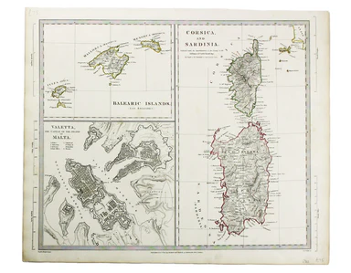

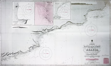
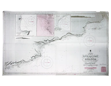
Admiralty Chart of Oman
Chart of the South East Coast of Arabia from Ras Sukra to Palinurus Shoal, compiled from trigonometric Surveys. Engraved chart of Oman, 112 x 68 cm...
View full detailsChart of the South East Coast of Arabia from Ras Sukra to Palinurus Shoal, compiled from trigonometric Surveys. Engraved chart of Oman, 112 x 68 cm...
View full detailsDurham Steel engraving, 23.5 x 18 cm; a map of County Durham engraved by J & C Walker after Creighton for Lewis’ Topographical Dictionary; orig...
View full detailsThis map of Africa reflects the state of European knowledge of the interior before the mid 19th century search for the sources of the Nile. It mar...
View full detailsSteel engraving, 32.5 x 40 cm, engraved by John and Charles Walker, original hand colour in outline, scale slightly trimmed and short tear in left...
View full detailsFrance in Provinces Steel engraving, approx 33 x 35 cm; map of France engraved by J & C Walker after T. Hewett Key, original hand colour in out...
View full detailsSteel engraving, 33 x 41 cm, engraved by John and Charles Walker after William Barnard Clarke, original hand colour, numbered in an old hand, blan...
View full detailsSouth Africa Steel engraving, 32 x 39.5 cm, engraved by John & Charles Walker, map of South Africa inset of Cape Town, original hand colour in ...
View full detailsBalearic Islands/Corsica and Sardinia/Valetta Steel engraving, 32 x 36.5 cm, engraved by J. & C. Walker, original hand colour, blank verso. Map...
View full details