

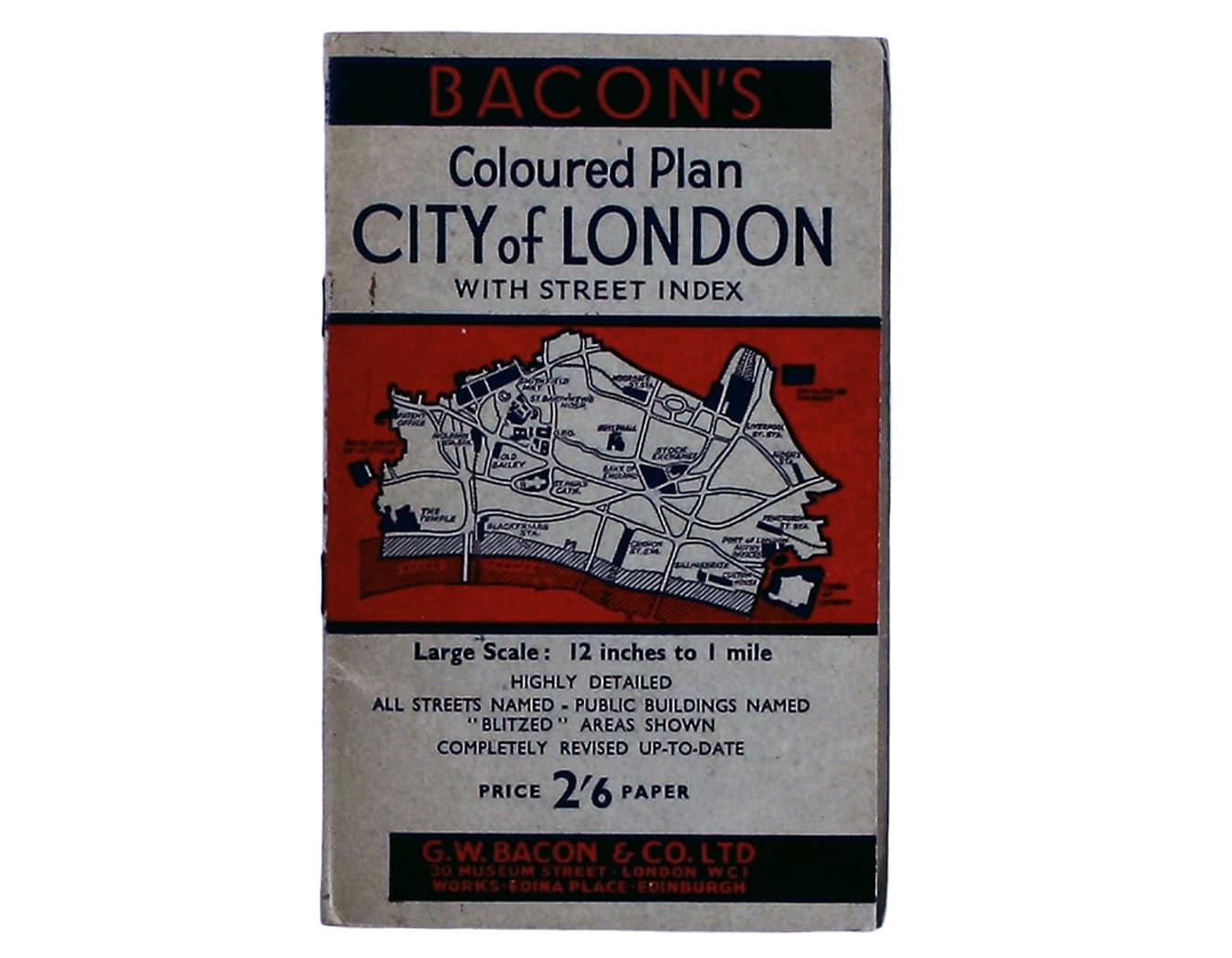
Bacon’s Postwar Map of the City of London
SKU: 8537
Title:
Bacon’s Postwar Map of the City of London
Date of publication:
Printed Measurement:
Colour:
Mapmaker:
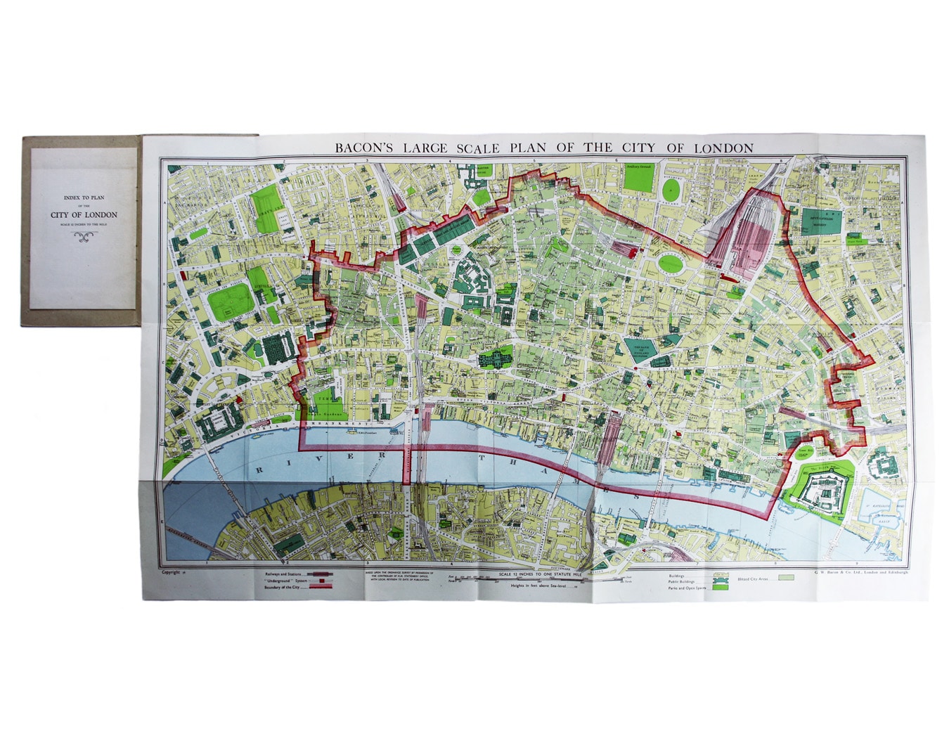
Bacon’s Large Scale Plan of the City of London –Bacon’s Coloured Plan of the City of London… “Blitzed” areas shown
A highly detailed map of London on a scale of 12 inches to one mile, this is also one of relatively few commercial maps to depict the extent of wartime bomb damage. ‘Blitzed City Areas’ account for roughly one third of the City.
Read more
Condition & Materials
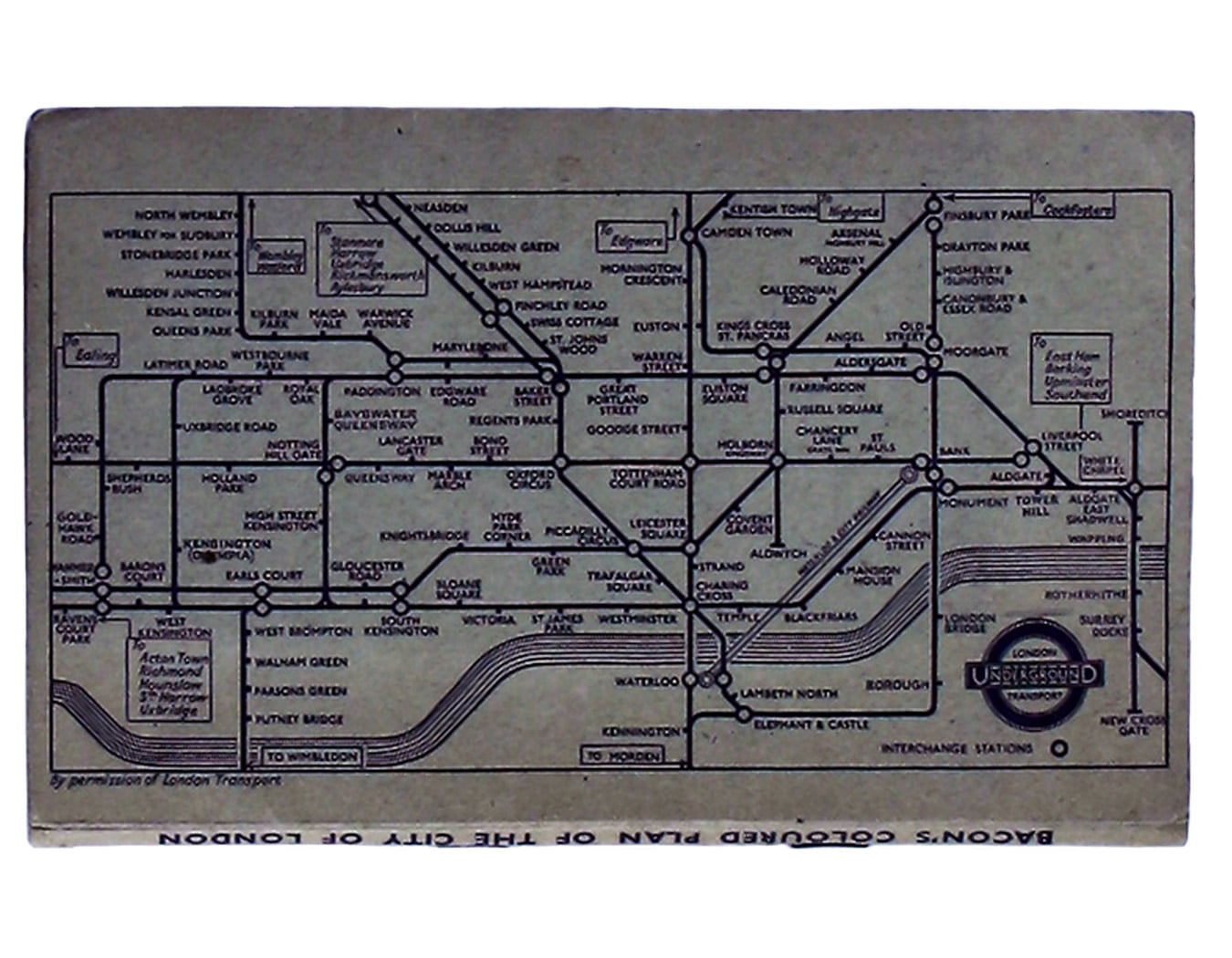
Folding map of the City, 42.5 x 71.5 cm, printed in colours, blank verso, folding into original stiff card wraps with 16 pp. index and b/w Underground map on the lower cover; ownership signature of L.W. Turner, dated 11.1.48. Read less