

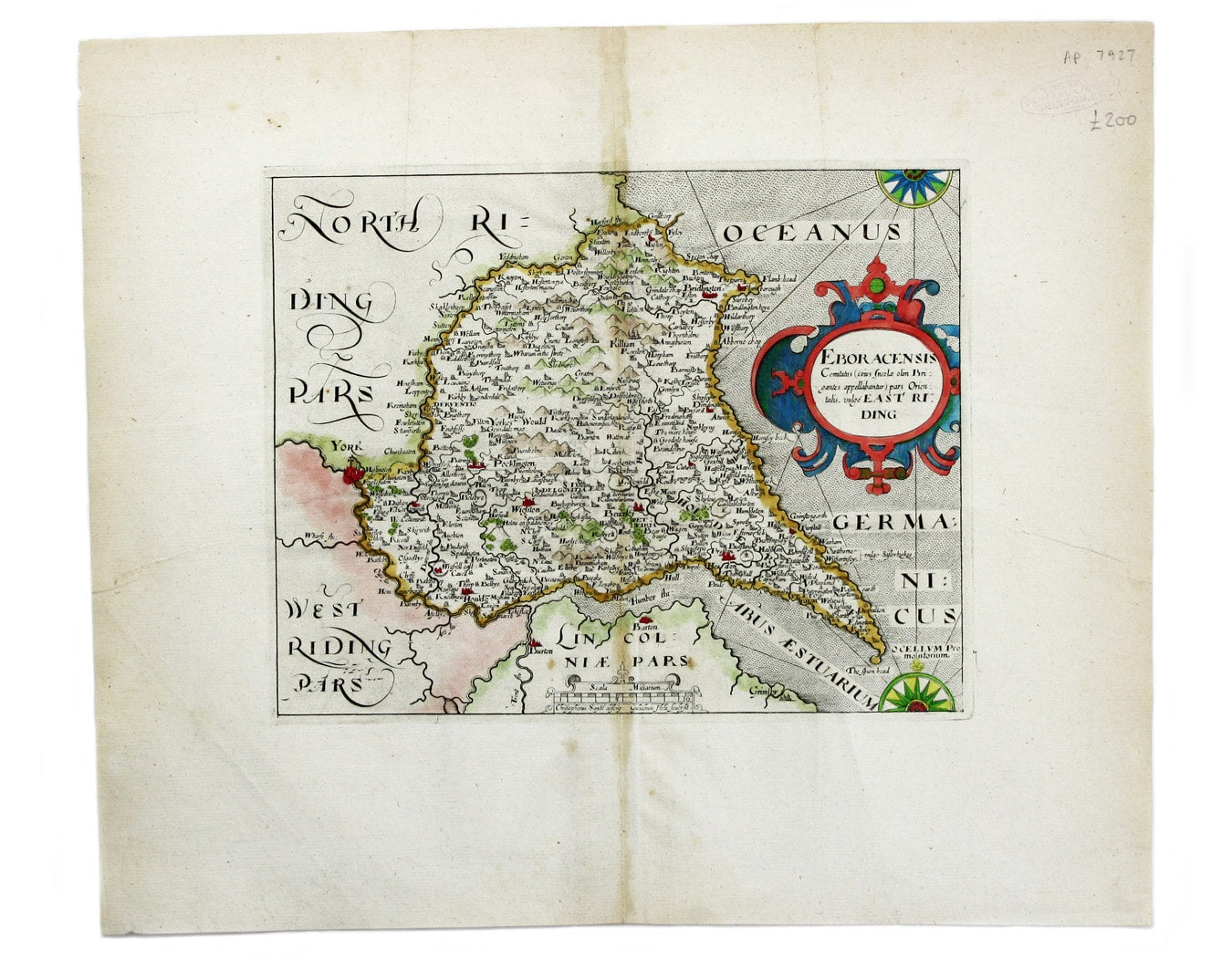
Saxton-Kip Map of the East Riding of Yorkshire
SKU: 7927
Title:
Saxton-Kip Map of the East Riding of Yorkshire
Date of publication:
Printed Measurement:
Colour:
Mapmaker:
Engraver:
Eboracensis Comitatus […] pars Orientalis, vulgo East Riding.
This map of the East Riding is from the second edition of Philemon Holland’s translation of Camden’s Britannia into English, the third printing overall illustrated by the series of maps engraved by Kip and Hole. Read more
Condition & Materials
Copper engraving, 20 x 25 cm; map of the East Riding of Yorkshire engraved by William Hole after Christopher Saxton, modern hand-colour, light toning at centrefold, faint ink stamp in upper margin, blank verso.
References
Skelton 23. Read less