

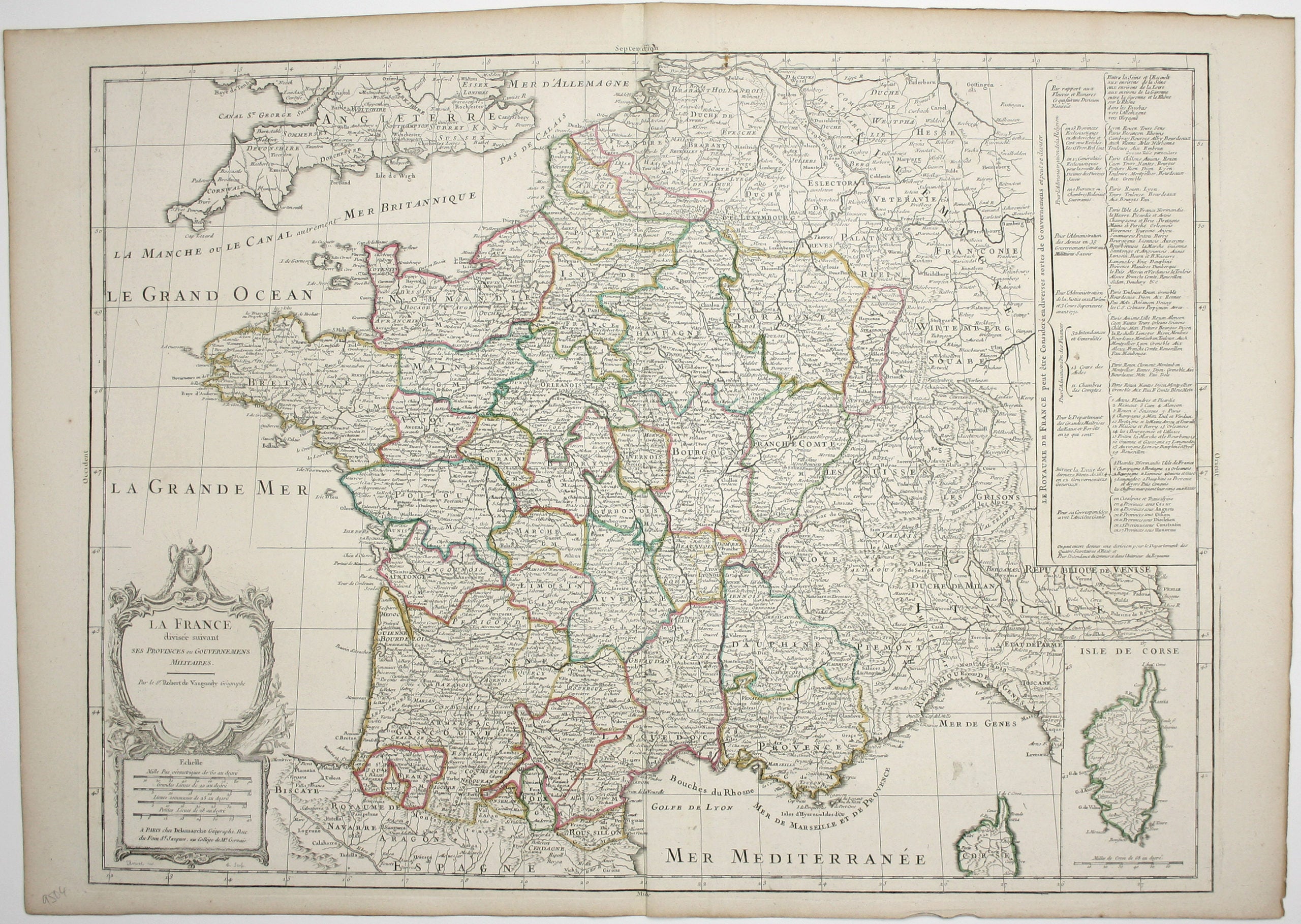
Robert de Vaugondy’s Map of France
SKU: 9504
Title:
Robert de Vaugondy’s Map of France
Date of publication:
Printed Measurement:
Publisher:
Colour:
Mapmaker:
Engraver:
La France divisée suivant ses Provinces ou Gouvernemens Militaires
This map of France is coloured by departments, with a table listing different forms of political and ecclesiastical organisational structures from antiquity to the present, and with an inset of Corsica bottom right. Read more
This is one of the scarcer maps produced by the firm, missing from the standard reference work on the subject (Pedley, Bel et Utile: the Work of the Robert de Vaugondy Family of Mapmakers).
Condition & Materials
Copper engraving, 51 x 69.5 cm, engraved by J Arrivet, original hand colour in outline, blank verso.
References
On WorldCat, only the British Library copy seems to have Delamarche’s imprint.
OCLC: 557426760
Read less