

Ortelius' Miniature Epitome Map of Normandy
This miniature map of Normandy was engraved by brothers Ambrose and Ferdinand Arsenius circa 1601 for a third ‘epitome’ (or pocket version) of Orte...
View full details

This miniature map of Normandy was engraved by brothers Ambrose and Ferdinand Arsenius circa 1601 for a third ‘epitome’ (or pocket version) of Orte...
View full details
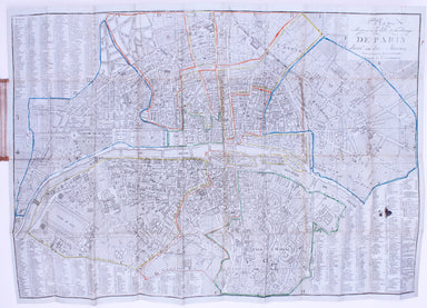
Plan Routiere de la Ville et Fauxbourgs de Paris divisé en douze Maries, revu et corrigé par Hérisson, géographe Our map shows the Paris of Charles...
View full details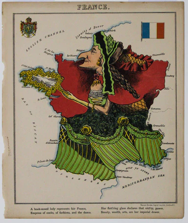
Though credited on the title-page under his pen-name ‘Aleph’, William Harvey himself gives all the credit for this series of comic maps to a “young...
View full details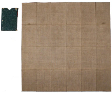
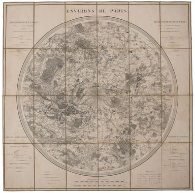
Condition & Materials Circular folding map of the environs of Paris, 79 x 79 cm, engraved by Barrière (Pére) after Bariolle, black and white, d...
View full details
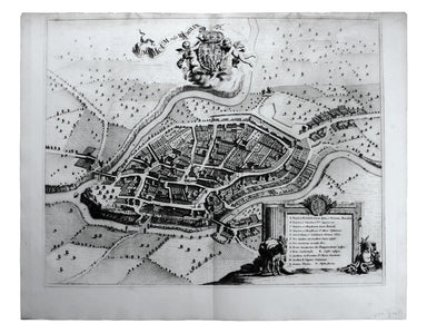
Rumiliacum vulgo Rumilly Blaeu’s townbook of Savoy and Piedmont was first published by the Blaeu heirs in 1682, but the plates were purchased and r...
View full details
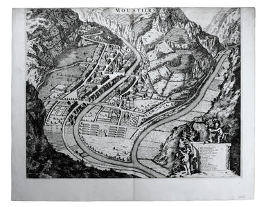
Moustiers Blaeu’s townbook of Savoy and Piedmont was first published by the Blaeu heirs in 1682, but the plates were purchased and reissued (with B...
View full details
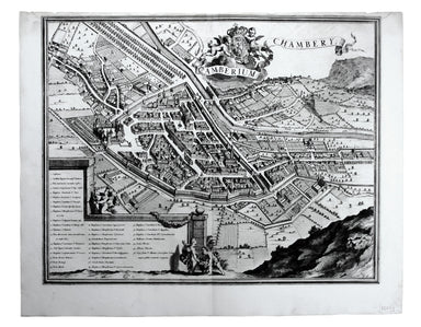
Camberium / Chambery Blaeu’s townbook of Savoy and Piedmont was first published by the Blaeu heirs in 1682, but the plates were purchased and reiss...
View full details
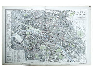
Ultimately derived from the SDUK but reflecting Haussman’s redevelopment of the city centre under Napoleon III, our example is from one of the last...
View full details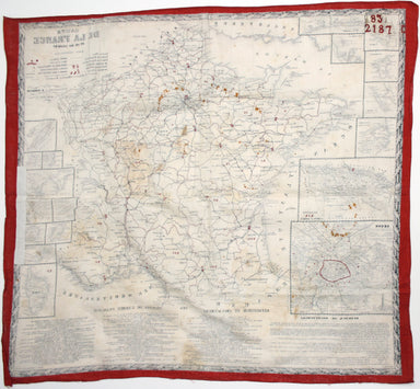
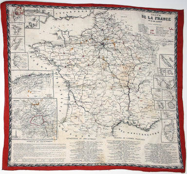
This educational handkerchief (why not?) is in the same format as the series of thirteen 'mouchoirs militaire d'instructions' patented by the comma...
View full details
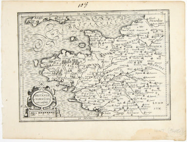
Britannia et Normandia cum consiniis This map of Brittany and Normandy was engraved by Jodocus Hondius for the ‘Atlas Minor’. Condition & Mater...
View full details
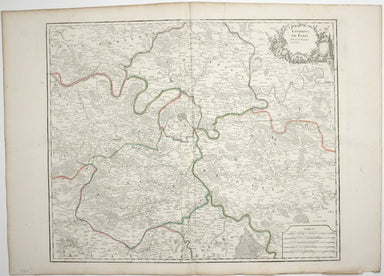
Environs de Paris This is a later state of Robert de Vaugondy’s road map of Italy, showing the Venetian Republic, Papal States, Kingdom of Naples e...
View full details
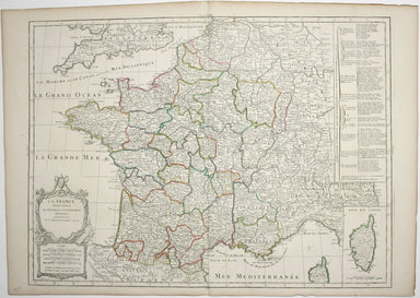
La France divisée suivant ses Provinces ou Gouvernemens Militaires This map of France is coloured by departments, with a table listing different fo...
View full details
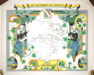
Les Vignobles de France – Vins de Champagne Government and national wine trade bodies sponsored Louis Larmat’s regional wine atlases in the 1940s a...
View full details

This plan of Douai (Duacum) in northern France was published in the Civitates Orbis Terrarum, one of the most significant cartographic works of the...
View full details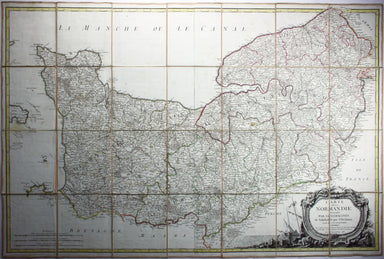
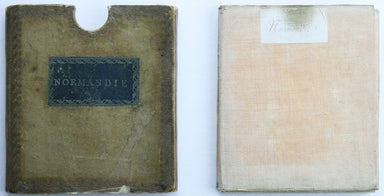
Carte de la Normandie, divisée par Generalités et subdivisée par Elections Condition & Materials Folding map of Normandy, 68 x 102.5 cm, origin...
View full details
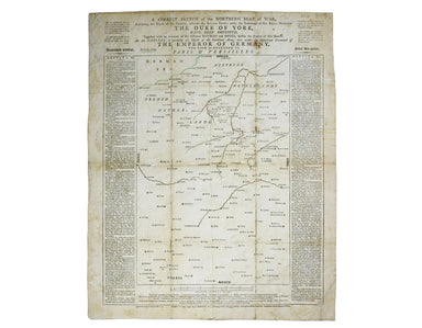
A correct sketch of the northern seat of war, exhibiting the whole of the country, wherein the British troops under the command of His Royal Highne...
View full details
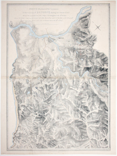
Sketch illustrative of the operations in the vicinity of Bayonne during the winter of 1813. Against the Light Division at the village of Arcangues ...
View full details
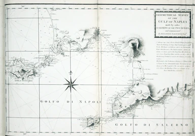
Faden, William: Le Petit Neptune Français; or, French Coasting Pilot, for the Coast of Flanders, Channel, Bay of Biscay, and Mediterranean. To whic...
View full details
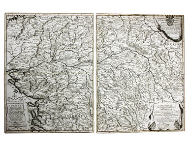
Parte Occidentale/Orientale del Governo Generale d’Orleans This map of the Duchy of Orleans is from Mercurio Geografico, an unusual and finely engr...
View full details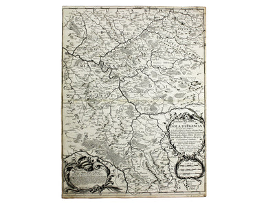
Governo Generale dell’Isola Di Francia (Île-de-France) This map of Île-de-France is from Mercurio Geografico, an unusual and finely engraved work. ...
View full details

Il Ducato di Bar diviso ne suoi tre Baliaggi de Barleduc, di S. Michel, e Bassigny […] e li Territorii della Citta e Vescovati di Metz, Tul e Verdu...
View full details
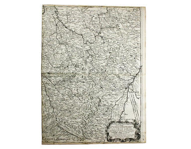
Il Ducato di Lorena (Lorraine) This map of Lorraine is from Mercurio Geografico, an unusual and finely engraved work. Condition & Materials Cop...
View full details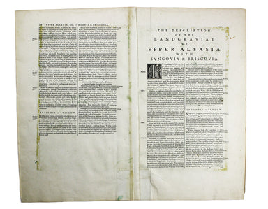
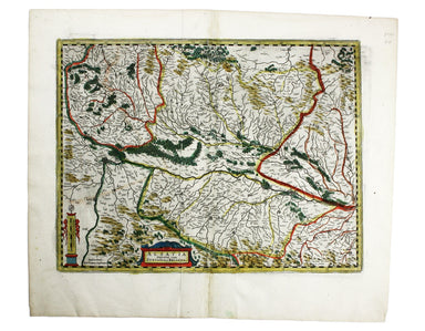
Alsatia Superior cum Suntgoia et Brisgoia The original Mercator Atlas (parts published from 1585 onwards) was not a commercial success; the copper ...
View full details
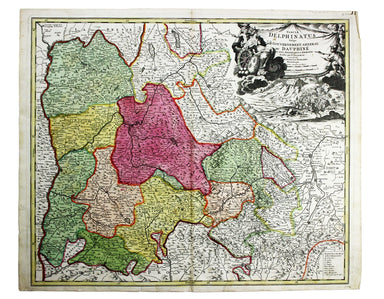
A map of the French Alps, the Dauphiné, incuding Grenoble. The borders are those defined by the Treaty of Utrecht (1713) and the cartouche (putti m...
View full details
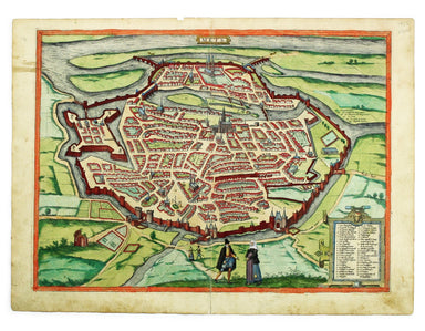
This plan of Metz in northeastern France is from the Civitates Orbis Terrarum, one of the most significant cartographic works of the late sixteenth...
View full details
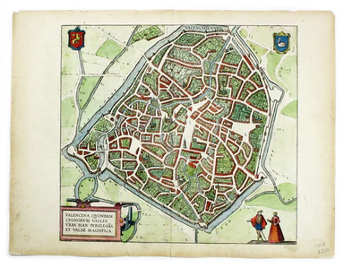
This plan of Valenciennes in northern France is from the Civitates Orbis Terrarum, one of the most significant cartographic works of the late sixte...
View full details
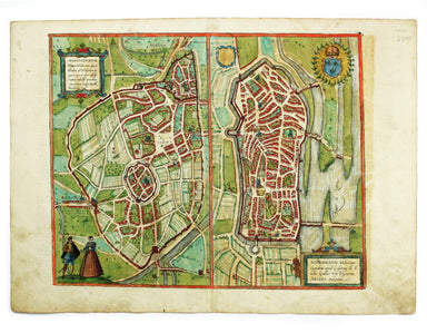
This map includes French town plans after Belleforest on one sheet: Autun in Burgundy and Nevers in Bourgogne. They are from the Civitates Orbis Te...
View full details
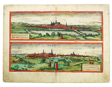
This map of Mons in Belgium is shown with Arras in northern France. It is from the Civitates Orbis Terrarum, one of the most significant cartograph...
View full details
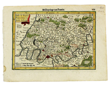
This map of Île-de-France, the Paris region north of the Seine, is from the Atlas Minor. The original plates were engraved by Jodocus Hondius, but ...
View full details
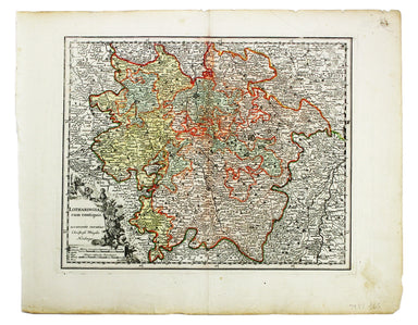
Condition & Materials Copper engraving, 28.5 x 35 cm, original hand-colour map of the Duchy of Lorraine, blank verso.
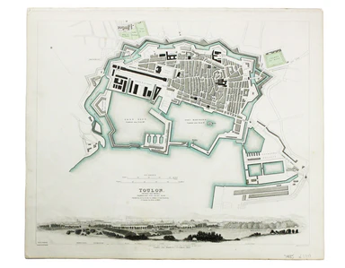
This map of Toulon was engraved by BR Davies after WB Clarke. Condition & Materials Steel engraving, 33 x 40 cm, original hand colour, blank ve...
View full details
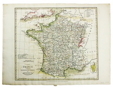
France divided into Metropolitan Circles and Departments This map was engraved by Samuel John Neele for the atlas volume to Cruttwell’s Gazeteer, p...
View full details
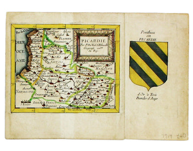
Condition & Materials Copper engraving, 10.5 x 12.6 cm, original hand-colour, lightly browned, blank verso; leaf from the same work, with the ...
View full details
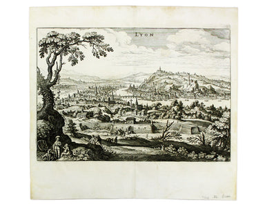
This map of Lyons was published by Merian and his heirs in various works, including the Archontologia Cosmica and Theatrum Europaeum. Condition &am...
View full details
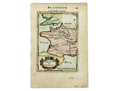
This regional map of France is from Mallet’s Description de l’Univers. Condition & Materials Copper engraving, 15 x 10.5 cm, recent hand-colo...
View full details
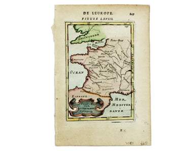
This map of France is from Mallet’s Description de l’Univers. Condition & Materials Copper engraving, 15 x 10.5 cm, recent hand-colour, French...
View full details
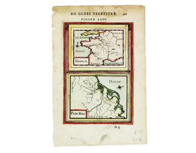
France/Paîs Bas This map of France and the Low Countries is from Mallet’s ‘Description de l’Univers. Condition & Materials Copper engraving, 15...
View full details
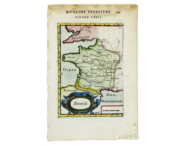
This map of France is from Mallet’s Description de l’Univers. Condition & Materials Copper engraving, 15 x 10.5 cm, recent hand-colour, light ...
View full details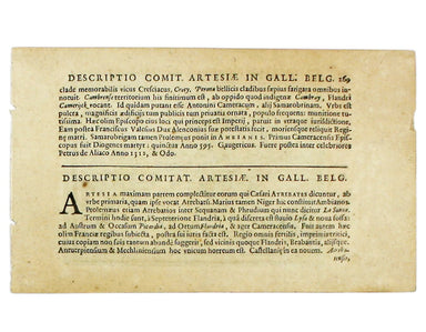
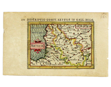
Condition & Materials Copper engraving, 9.5 x 13.4 cm, recent hand-colour, Latin text on verso; miniature map of Artois.
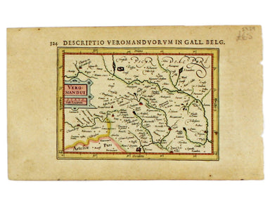
Veromandui This map of the modern Aisne is named here for the Viromandui, a Belgic tribal name. Condition & Materials Copper engraving, 9.5 x 1...
View full details
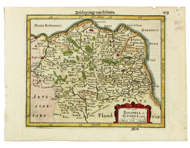
This is Mercator's map of Pays Boulonnais and Guînes from the Atlas Minor. The original plates were engraved by Jodocus Hondius, but after these we...
View full details
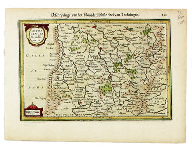
This map of Southern Lorraine is from the Atlas Minor. The original plates were engraved by Jodocus Hondius, but after these were sold to the Londo...
View full details
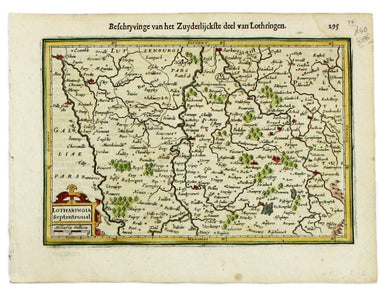
This map of Northern Lorraine is from the Atlas Minor. The original plates were engraved by Jodocus Hondius, but after these were sold to the Londo...
View full details
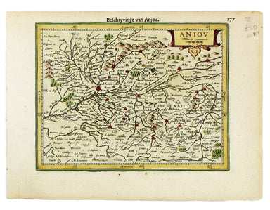
This map of Anjou is from the Atlas Minor. The original plates were engraved by Jodocus Hondius, but after these were sold to the London trade in t...
View full details
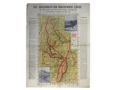
De Maginot – En Siegfried Line. Met alle steden, germeenten, spoorwegen, verstingen en versterkingen, bosschen, heuvels, enz. This map was publishe...
View full details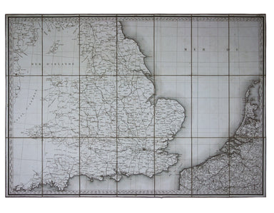
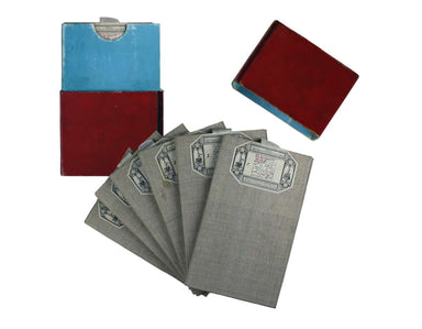
Carte Routière de la France dressée par ordre de Monsieur le Directeur Général des Ponts et Chaussées Though described in the title as a road map o...
View full details
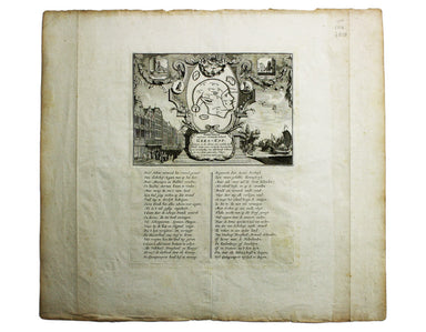
Afbeeldinge van’t zeer vermaarde Eiland Geks-Kop This Dutch ‘fool’s cap’ map satirises the bursting of the financial bubbles of 1720. Cartographic ...
View full details
