£200.00


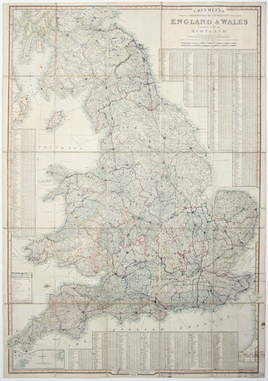
Cruchley’s Map of England & Wales, Annotated
Cruchley’s Improved Geographical Companion throughout England & Wales including part of Scotland In this map of England and Wales, we have an i...
View full detailsCruchley’s Improved Geographical Companion throughout England & Wales including part of Scotland In this map of England and Wales, we have an i...
View full detailsVoyage aux Iles de la Mer du Sud, en 1827 et 1828, et relation de la découverte du sort de La Pérouse. The French explorer Jean-François de La Péro...
View full detailsA Map of the County Palatine of Lancaster Divided into Hundreds and Parishes from an accurate Survey made in the years 1828 and 1829, For Hennet’s ...
View full detailsAt the foot of this map are architectural elevations of some of Rome’s most famous post-classical buildings, dominated by St Peter’s. Rome was then...
View full detailsAn Accurate Description of The Liverpool and Manchester Rail-Way, the tunnel, the bridges, and other works throughout the line; with a sketch objec...
View full details