

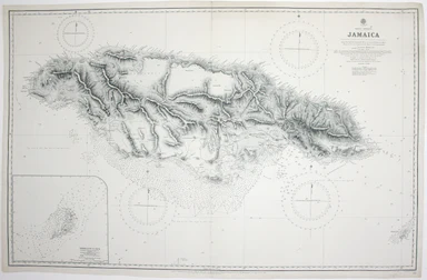
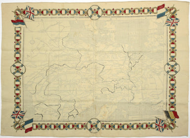
Admiralty Chart of Jamaica
West Indies – Jamaica This chart of Jamaica shows soundings etc, with interior detail of relief, roads and settlements, and inset of Morant Cays. F...
View full detailsWest Indies – Jamaica This chart of Jamaica shows soundings etc, with interior detail of relief, roads and settlements, and inset of Morant Cays. F...
View full detailsWest Indies – Santa Cruz [Saint Croix] This chart of Saint Croix shows soundings etc, with interior detail of relief, roads and settlements, coasta...
View full detailsBradshaw’s Railway Manual, Shareholder’s Guide and Official Directory, 1914; containing the History and Financial Position of every Railway Company...
View full detailsThis wartime souvenir handkerchief map of Europe was issued ‘by permission of the Manchester Guardian’, who printed the map over a full broadsheet ...
View full detailsHumoristische Karte von Europa im Jahre 1914 Satirical map of Europe, 35 x 50 cm, printed in colours, splits to folds, laid on tissue, blank verso....
View full details