

Admiralty Chart of Georgetown
SKU: 9013
Title:
Admiralty Chart of Georgetown
Date of publication:
Printed Measurement:
Colour:
Mapmaker:
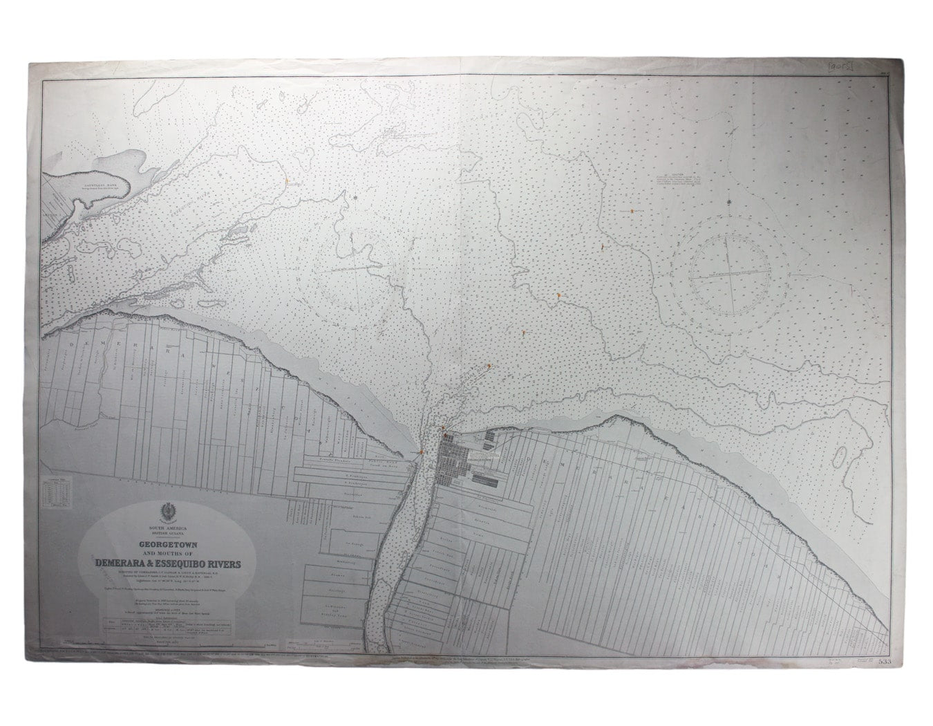
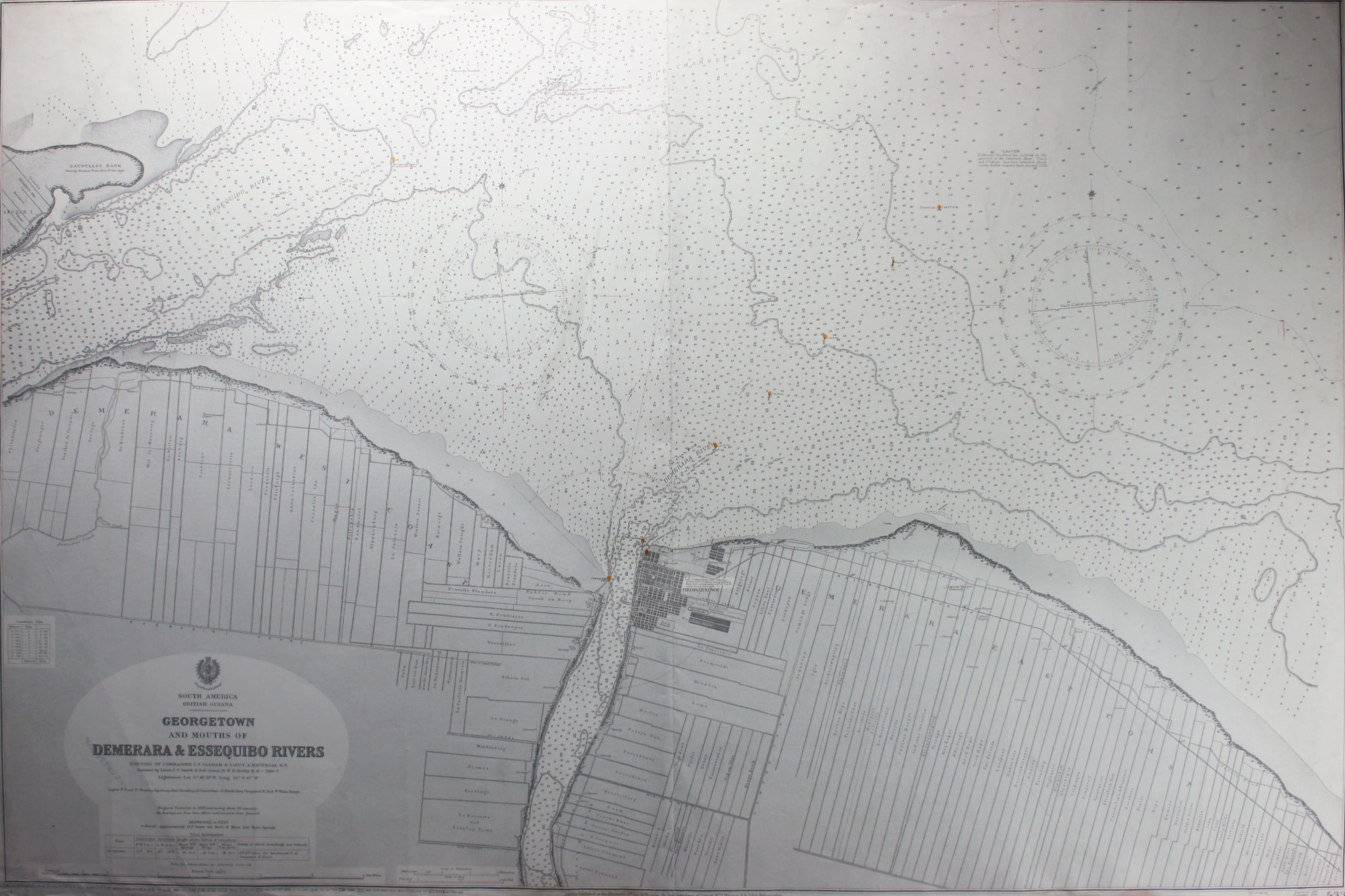
South America – British Guiana – Georgetown and mouths of Demerara and Essequibo Rivers
This British chart of Georgetown shows soundings etc, with interior detail of relief and settlements. Georgetown remains the capital of independent Guyana. Read more
Condition & Materials
Sheet size 70 x 103 cm, black and white, lights coloured, a couple of creases, some restoration to lower margin affecting imprint, faint ink stamp (instruction, ‘increase 50%’) to title, blank verso.
A Note on Shipping
Shipping rates are not available for this item. Select ‘pick up’ at checkout to collect it from the shop, or contact us for a custom quote. We will email you an invoice for the item price plus shipping, and you can complete the transaction securely online. Read less