£500.00


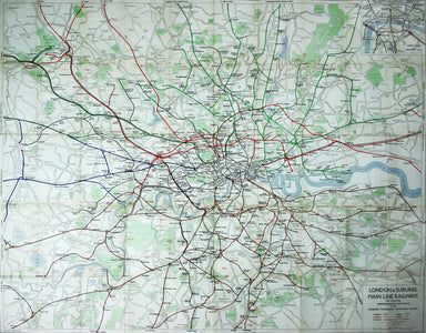
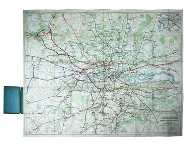
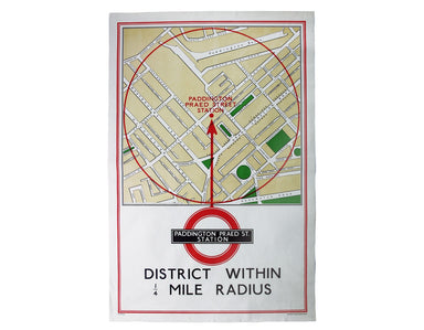
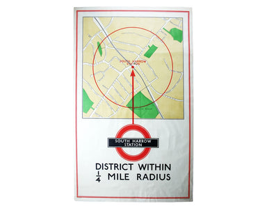
Philip’s Railways of London
London & Suburbs Main Line Railways and Connecting Underground Railways of the London Passenger Transport Board. Lithographed folding map of th...
View full detailsLondon & Suburbs Main Line Railways and Connecting Underground Railways of the London Passenger Transport Board. Lithographed folding map of th...
View full detailsLavenham in the Hundred of Babergh in the County of Suffolk Pictorial map of Lavenham, sheet size 50.5 x 54.5 cm, printed in colours, decorated wit...
View full detailsDistrict within ¼ mile radius [of] Paddington Praed Street Station Quarter mile radius map of the area around Paddington Station, 76 x 50.5 cm, a f...
View full detailsDistrict within ¼ mile radius [of] South Harrow Station Double royal quarter mile radius map centred on South Harrow Station, 105 x 62.5 cm, printe...
View full details