

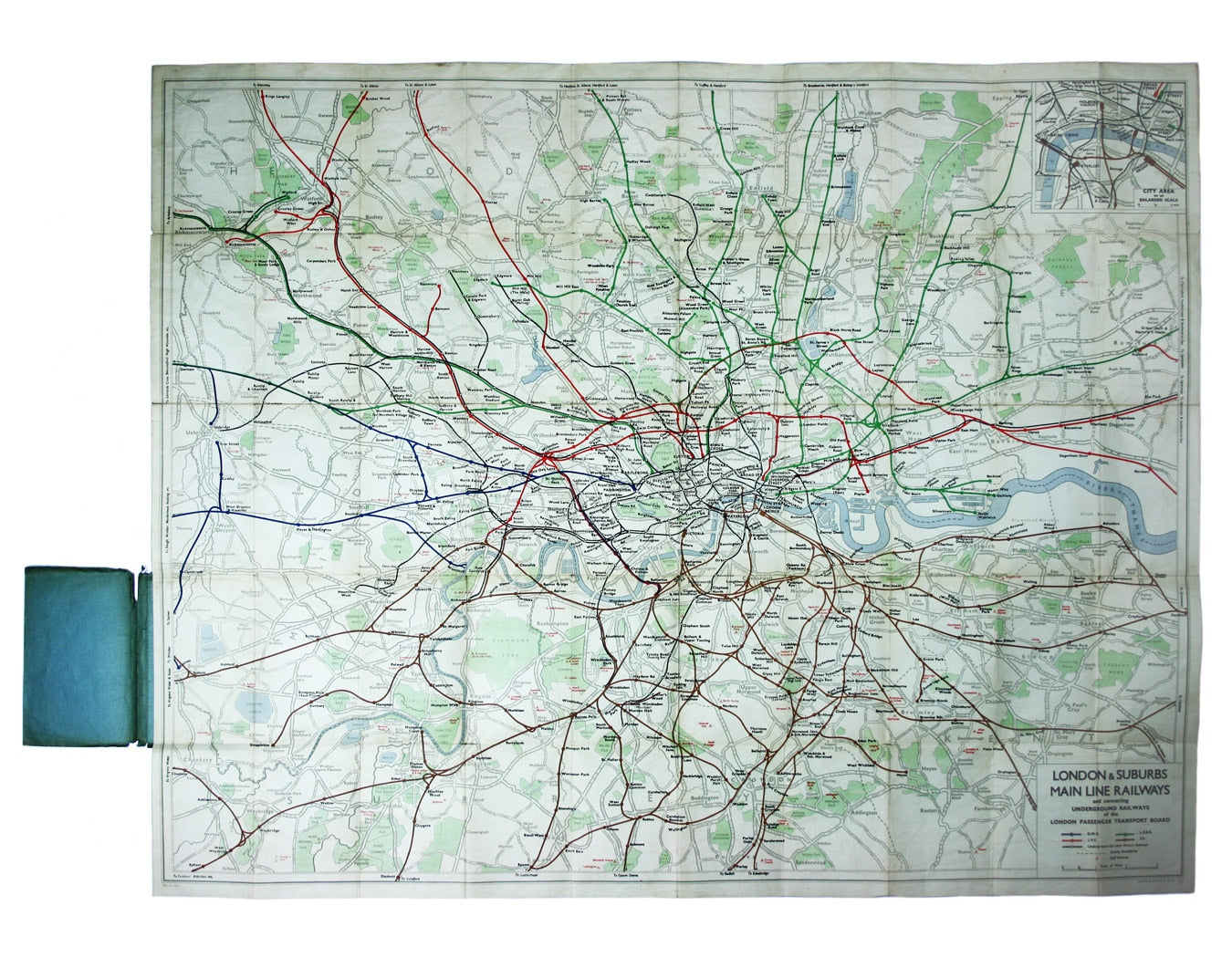
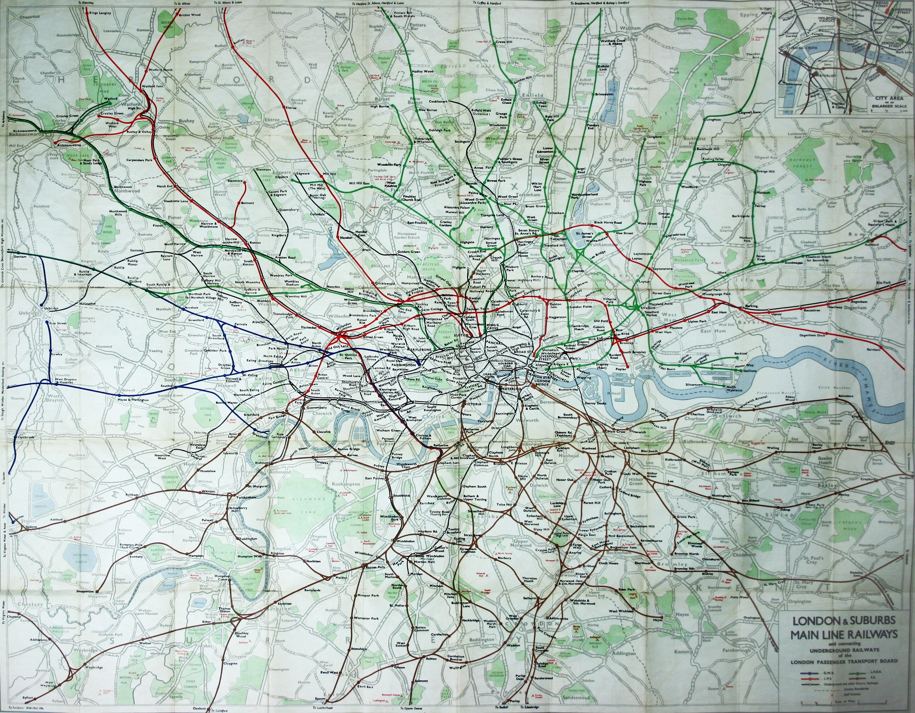
Philip’s Railways of London
SKU: 8681
Title:
Philip’s Railways of London
Date of publication:
Printed Measurement:
Colour:
Mapmaker:
Published in March 1935, this is a commercially available map showing the operating area of the recently formed London Passenger Transport Board, already rebranded as London Transport.
Although the LPTB also integrated travel by bus and coach the focus here is on the railways, differentiating between the overland lines operated by the ‘big four’ companies and London Underground. As well as public transport, prominence is given to relatively new form of private travel, by air. Read more
The London Aerodrome at Hendon, the London Air Park at Hanworth, and Britain’s major international airport at Croydon were among the dozen or so aerodromes, RAF and civil, which had sprung up within the LPTB area. The map also marks golf courses, possibly indicating an emphasis on using the network for leisure travel.
Condition & Materials
Lithographed folding map of the London railways, 96 x 120 cm, inset of 'City area on an enlarged scale' to upper right corner, printed in colours, laid on linen and folding into blue-green publisher’s card covers, a little rubbed and worn. Read less