

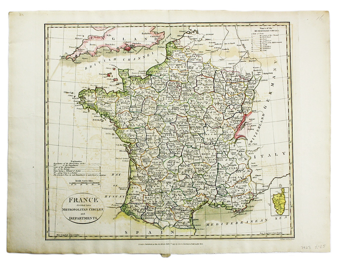
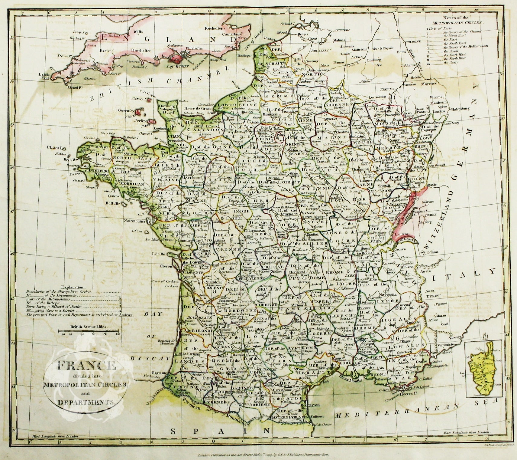
Cruttwell’s Map of France
SKU: 7983
Title:
Cruttwell’s Map of France
Date of publication:
Printed Measurement:
Publisher:
Colour:
Mapmaker:
Engraver:
France divided into Metropolitan Circles and Departments
This map was engraved by Samuel John Neele for the atlas volume to Cruttwell’s Gazeteer, published by G & JJ Robinson. Read more
Condition & Materials
Copper engraving, approx 38 x 42 cm, original hand colour, slight offsetting, blank verso. Read less