

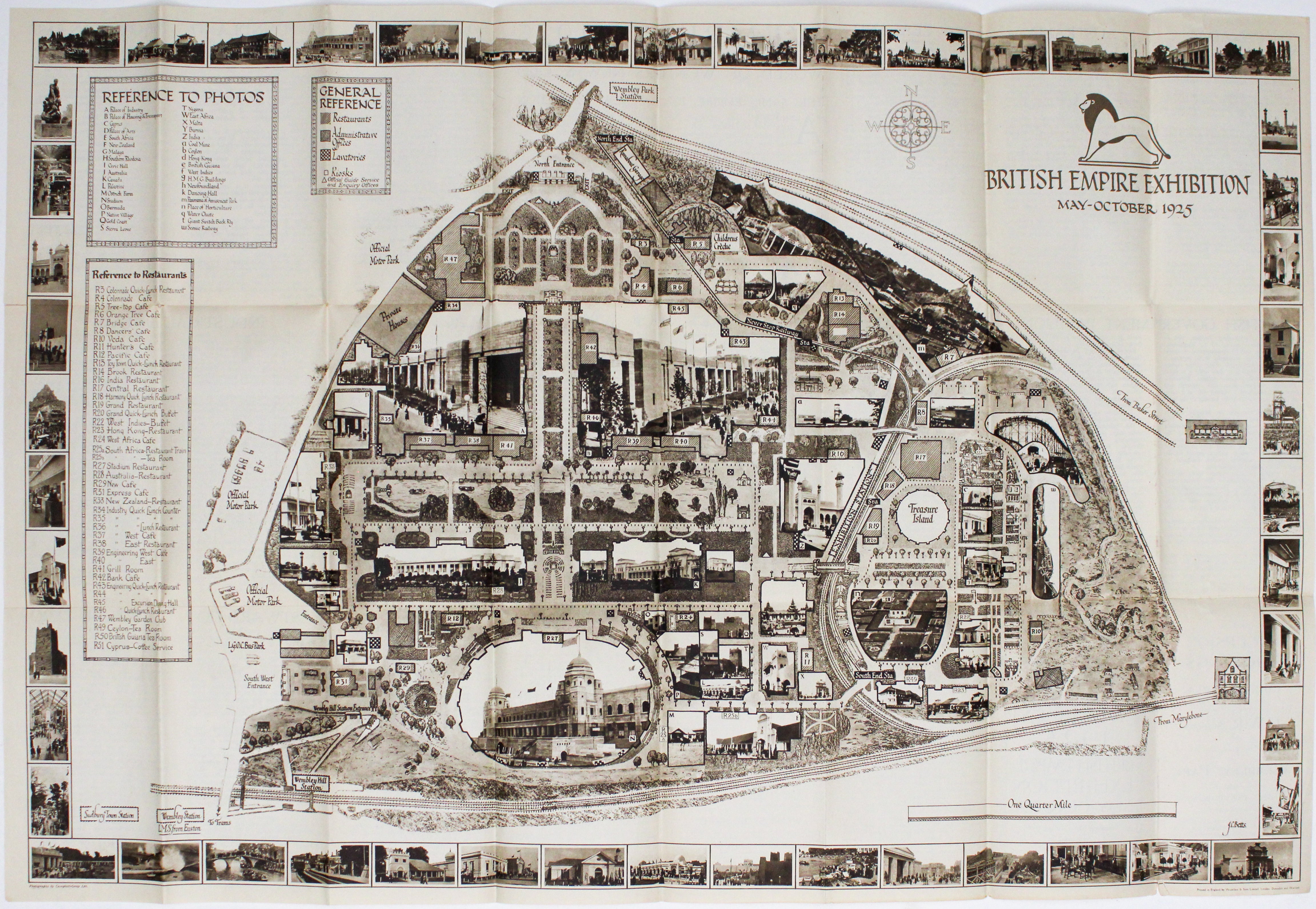
Betts' British Empire Exhibition Map
SKU: 9745
Title:
Betts' British Empire Exhibition Map
Date of publication:
Publisher:
Colour:
Mapmaker:
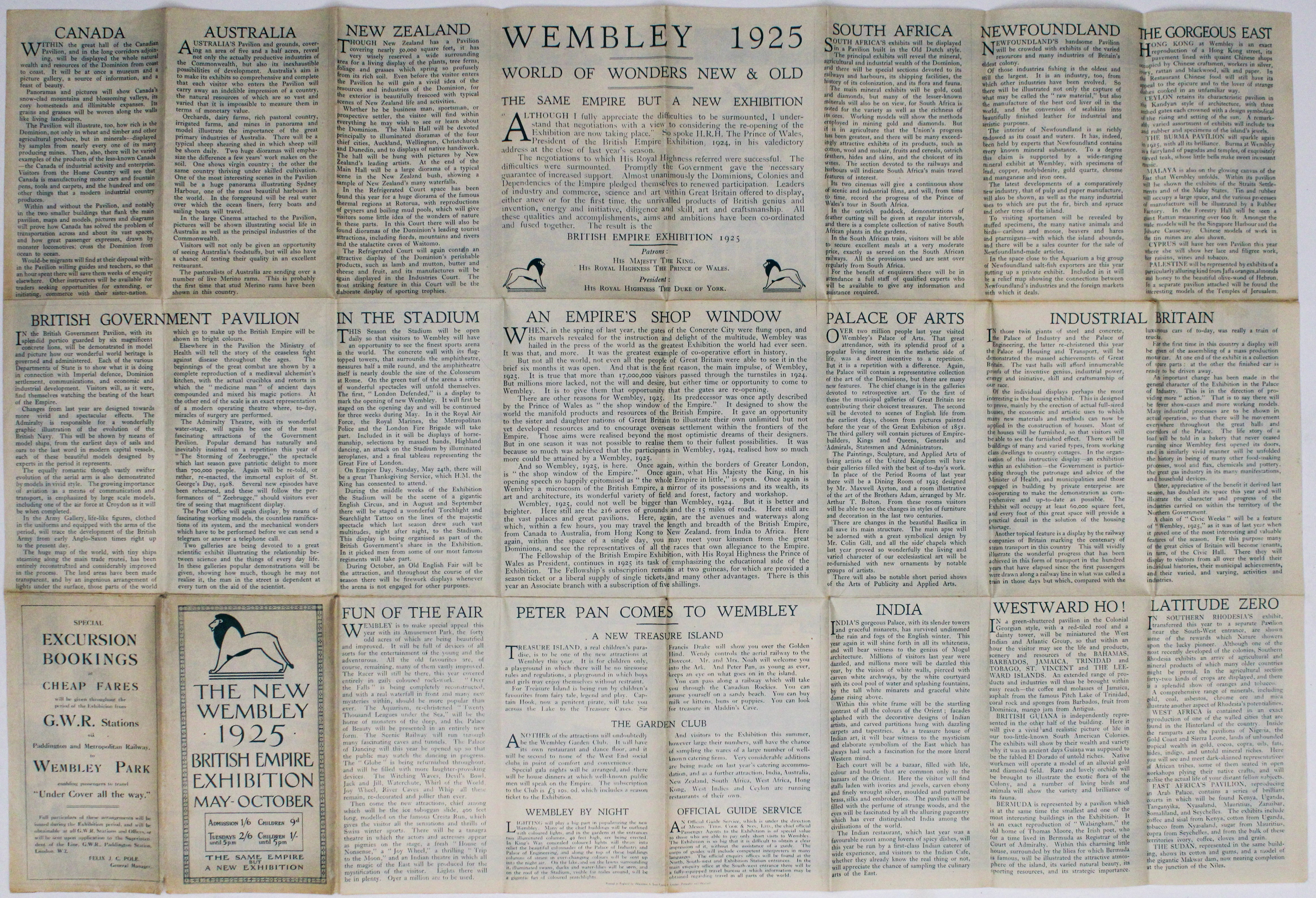
The British Empire Exhibition originally ran between April and November 1924, but it was not a financial success, and the decision was taken to reopen it after a winter break, with some variations. J.C. Betts’ map was created for this new, 1925 season. He was a founder member of the Clement Danes Studio, and he designed an elegant map of the central area for the Underground Group, issued in Winter 1924/25 and Summer 1925.
Condition & Materials Read more
Folding plan, printed area 50.5 x 75 cm, printed in sepia, photographs in the border credited to Campbell-Gray Ltd, minor wear to folds, text on verso. Read less