
SDUK Map of Calcutta
This map of Calcutta includes inset views of the Writers’ Buildings, Government House and Esplanade Row. Calcutta expanded rapidly under the Gover...
View full details

This map of Calcutta includes inset views of the Writers’ Buildings, Government House and Esplanade Row. Calcutta expanded rapidly under the Gover...
View full details

Motus in Coelo Spirales This chart shows the irregular orbits of Mercury and Venus on Tycho Brahe’s model, as observed from Earth, for the years 17...
View full details

The Daily Telegraph was one of a number of newspapers to sponsor London underground maps, like our example from 1919 which also includes the tramwa...
View full details

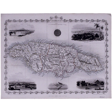
This map of Jamaica includes vignettes of Kingston, Port Royal, Port Antonio, and a sugar mill. The map was engraved by John Rapkin for John Tallis...
View full details

Cantebrigia, opulentissimi Anglie Regni, urbs celeberrimi nominis, ab Academie conditore Cantabro, cognominata: a Granta, fluvio vicino, Cairgrant;...
View full details

This map of Dublin was engraved by Edmund Turrell after William Barnard Clarke for The Society for the Diffusion of Useful Knowledge. The SDUK was ...
View full details

This map of Malaya has an inset regional map locating Malaya in the context of ‘adjacent terrritories’. A previous owner of this, map Lieutenant D...
View full details

Bacon’s Map of the World on Mercator’s Projection Condition & MaterialsLithographed folding map, sheet size 48 x 66 cm. Original hand colour, a...
View full details

Beck’s 1938 passenger map features on its reverse an enlargement of the central London area with interchange stations named inside large diamonds. ...
View full details

Underground map of London with some motor bus connections, September 1916 issue. The London General Omnibus Company was by this point owned by the ...
View full details

The May 1925 issue of Stingemore’s passenger map shows Wembley Exhibition Grounds, and its covers advertise the number of escalators and other amen...
View full details

Victoria or Port Phillip Engraved by John Rapkin for the Illustrated Atlas, this map includes vignettes of Melbourne, the River Glenelg, a kangaroo...
View full details

Smith's New Map of England and Wales, with part of Scotland including the turnpike and principal cross roads, the course of the rivers and navigabl...
View full details

London, the Bastion of Liberty On returning to Blandford Studio in 1946 after his war service with the Air Ministry, Kerry Lee spent six months wor...
View full details

This is the North Eastern sheet of Stanford’s Library Map, extending as far east as Straford and West Ham; further sheets were available to extend ...
View full details

Wallis's Guide for Strangers, through London, and its Evirons, 1821 The stranger will here find an alphabetical list of streets corresponding to a ...
View full details

Stanford’s map of London and the twelve miles round was published in various editions between (at least) 1860 and 1903. Condition & MaterialsLi...
View full details
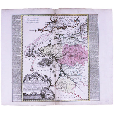
Brittische Übermacht zur See wieder Franckreich Ao. 1759... Superiorite Britannique par Mer contre La France l'An 1759... This map is a contemporar...
View full details

This map of the Dominion of Canada was made by John Bartholomew & Son for Dawson Brothers. It features insets of the environs of Montreal, New...
View full details

This important map of the ‘Gulag’, the Soviet system of forced labour camps, is seemingly the earliest published example of what was to become one ...
View full details

Course of the River Mole. From Box Hill Bridge to Leatherhead shewing the situation of the various apertures called Swallows This map charting the ...
View full details

Map showing the Western/Eastern Half of Equatorial Africa and the Explorations by Land and Water of Henry M. Stanley in the Years 1874-77 This map ...
View full details
