
Tenth edition of Anson's Voyage
A voyage round the world, in the years MDCCXL, I II, III, IV by George Anson, esq; now Lord Anson... compiled from his his letters and papers by Ri...
View full details

A voyage round the world, in the years MDCCXL, I II, III, IV by George Anson, esq; now Lord Anson... compiled from his his letters and papers by Ri...
View full details

An historical disquisition concerning the knowledge which the ancients had of India; and the progress of trade with that country prior to the disco...
View full details

History of the Azores, or Western Islands; containing an account of the government, laws, and religion, the manners, ceremonies, and character of t...
View full details

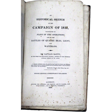
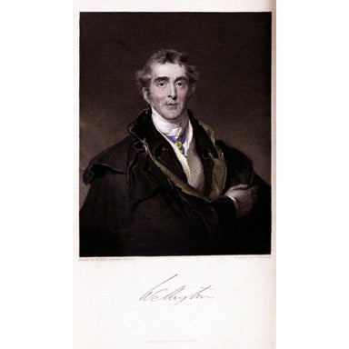
An Historical Sketch of the Campaign of 1815, illustrated by plans of the operations and of the battles of Quatre Bras, Ligny, and Waterloo... seco...
View full details

Picturesque antiquities of Scotland Adam de Cardonnel (1746/7-1820) trained as a surgeon, but ‘his easy circumstances left him leisure to indulge h...
View full details

Reuben Ramble's Travels in the Counties of England This is a county atlas designed for children or ‘the little geographer’, with simple text by Sam...
View full details

Hierokleous Philosophou Hypomne ma eis ta to n Pythagoreion epe ta chrysa. Hieroclis philosophi Commentarius in Aurea Pythagoreorum carmina Neopla...
View full details

The Road from Oxford to Coventry continued to Darby... This map was published as sheet 82 in the 1698 folio edition of Ogilby’s pioneering road atl...
View full details

The Extended Road from Oakham to Richmond... commencing at Oakham aforesaid & extending to Barnsley in Yorkshire This map was published as she...
View full details

The Continuation of the Road from London to Holy-Head... Plate 3d., commencing at the City of Lichfield & extending to the City of Chester This...
View full details

Robert Morden's county maps, like this one of Northumberland, were engraved to illustrate Gibson's edition of William Camden's Britannia, first pub...
View full details

This map of Calcutta includes inset views of the Writers’ Buildings, Government House and Esplanade Row. Calcutta expanded rapidly under the Gover...
View full details

The Daily Telegraph was one of a number of newspapers to sponsor London underground maps, like our example from 1919 which also includes the tramwa...
View full details

Bowen’s New General Map of America appeared in a number of publications, and features widely held cartographic misconceptions of the time, such as ...
View full details

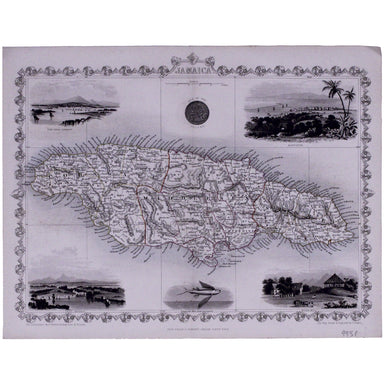
This map of Jamaica includes vignettes of Kingston, Port Royal, Port Antonio, and a sugar mill. The map was engraved by John Rapkin for John Tallis...
View full details

This plan of the town and harbour of Mahon, St. Philip’s Castle, and its fortifications was engraved by Isaac Basire and published in Nicholas Tind...
View full details

This map of Dublin was engraved by Edmund Turrell after William Barnard Clarke for The Society for the Diffusion of Useful Knowledge. The SDUK was ...
View full details

A Mapp of the Parish of St Giles’s in the Fields John Stow's A Survey of the Cities of London and Westminster was originally published in 1598 and ...
View full details

This map of Dorset was published in Philip Lea’s edition of Christopher Saxton’s county atlas, commonly known as the Lea-Saxton or Saxton-Lea. Chr...
View full details

Bacon’s Map of the World on Mercator’s Projection Condition & MaterialsLithographed folding map, sheet size 48 x 66 cm. Original hand colour, a...
View full details

Beck’s 1938 passenger map features on its reverse an enlargement of the central London area with interchange stations named inside large diamonds. ...
View full details

Underground map of London with some motor bus connections, September 1916 issue. The London General Omnibus Company was by this point owned by the ...
View full details

A New and Accurate Map of the City of Westminster, the Dutchy of Lancaster and Places Adjacent This ward plan of Westminster was engraved by Benjam...
View full details

The May 1925 issue of Stingemore’s passenger map shows Wembley Exhibition Grounds, and its covers advertise the number of escalators and other amen...
View full details

Cassell's 'immense map' of London, of which this is the central sheet, was prepared for the Weekly Dispatch and published in nine parts between Jan...
View full details

Cassell's 'immense map' of London, of which this is the south sheet, was prepared for the Weekly Dispatch and published in nine parts between Janua...
View full details

Victoria or Port Phillip Engraved by John Rapkin for the Illustrated Atlas, this map includes vignettes of Melbourne, the River Glenelg, a kangaroo...
View full details

Smith's New Map of England and Wales, with part of Scotland including the turnpike and principal cross roads, the course of the rivers and navigabl...
View full details

London, the Bastion of Liberty On returning to Blandford Studio in 1946 after his war service with the Air Ministry, Kerry Lee spent six months wor...
View full details

This is the North Eastern sheet of Stanford’s Library Map, extending as far east as Straford and West Ham; further sheets were available to extend ...
View full details

Wallis's Guide for Strangers, through London, and its Evirons, 1821 The stranger will here find an alphabetical list of streets corresponding to a ...
View full details

Stanford’s map of London and the twelve miles round was published in various editions between (at least) 1860 and 1903. Condition & MaterialsLi...
View full details
