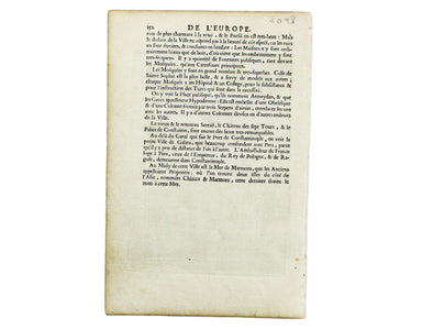
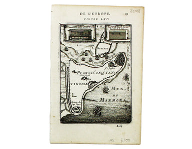
Mallet’s Plan of Constantinople
This plan of Constantinople is from Mallet’s Description de l’Univers, first published in Paris in 1683 and reprinted with German text in Frankfurt...
View full details

This plan of Constantinople is from Mallet’s Description de l’Univers, first published in Paris in 1683 and reprinted with German text in Frankfurt...
View full details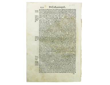
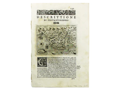
Constantinopoli / Descrittione di Constantinopoli First published in 1572, our example of Porcacchi’s map of Constantinople is from the second edit...
View full details
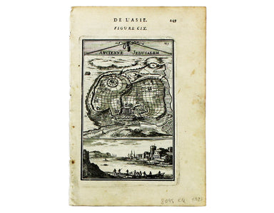
This map of Ancient Jerusalem is from Mallet’s Description de l’Univers, first published in Paris in 1683 and reprinted with German text in Frankfu...
View full details
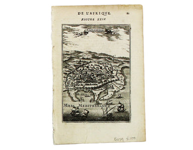
This map of Alexandria is from Mallet’s Description de l’Univers, first published in Paris in 1683 and reprinted with German text in Frankfurt the ...
View full details
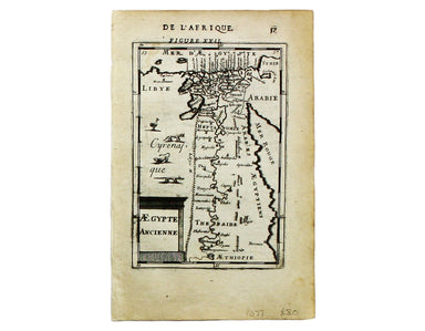
This map of ancient Egypt is from Mallet’s Description de l’Univers, first published in Paris in 1683 and reprinted with German text in Frankfurt t...
View full details
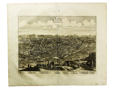
Dapper’s plan of Cairo follows Matteo Pagano’s magnificent 21 sheet wall map, published in Venice in 1549. Cairo was one of the great trading centr...
View full details
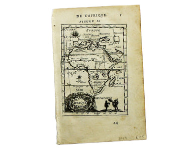
This map of the continent of Africa is from Mallet’s Description de l’Univers, first published in Paris in 1683 and reprinted with German text in F...
View full details
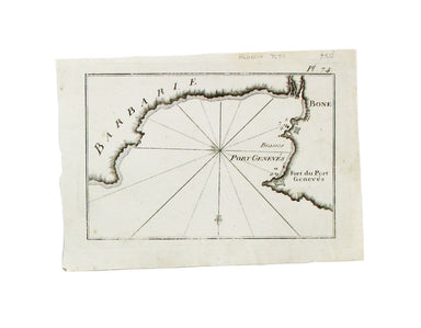
The practical pocket sea atlas by Marseilles hydrographer Joseph Roux, charting the ports and harbours of the Mediterranean, remained popular half ...
View full details
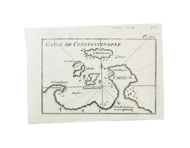
This sea chart shows the environs of Marmara Island on the southern coast of the Sea of Marmara, Turkey. The practical pocket sea atlas by Marseill...
View full details
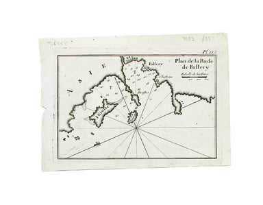
A sea chart of Foça, Turkey; near Smyrna. The practical pocket sea atlas by Marseilles hydrographer Joseph Roux, charting the ports and harbours of...
View full details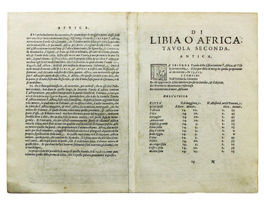
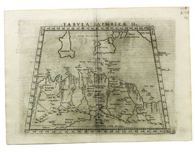
Tabula Aphricae II Ruscelli’s map of North Africa, following Gastaldi, was first issued in his edition of Ptolemy’s Geographia printed by Valgrisi ...
View full details
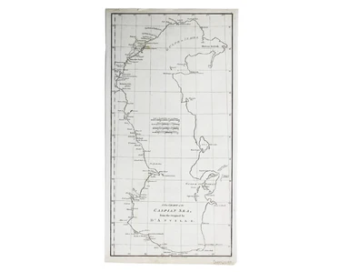
Condition & Materials Copper engraving, 52.5 x 26.5 cm; a chart of the Caspian Sea after Jean Baptiste Bourguignon d'Anville, black and white, ...
View full details
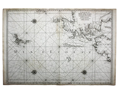
Carte de la Mer d’Ecosse, Contenant les Isles et Costes Septentrionales et Occidentales d’Ecosse et les Costes Septentrionales d’Irlande This detai...
View full details
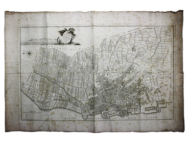
A Plan of the Town and Township of Liverpool, from an actual survey taken in the year 1785 by C. Eyes This map of Liverpool was surveyed and publis...
View full details
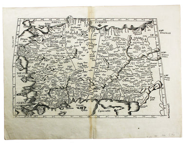
Tabula Prima Asiae continet Pontum, Bithyniam, Asiae propriae dictam, in qua Phyrgia Lyciam Pamphiliam, in qua Pisidia, Galatiam, in qua Paphlagoni...
View full details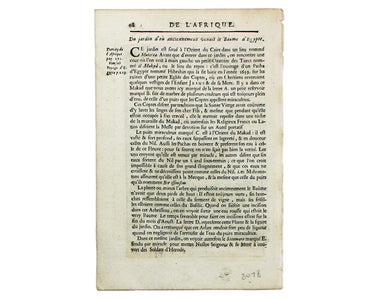
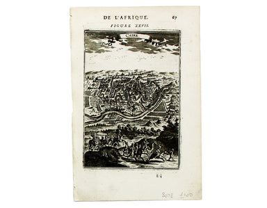
This map of Cairo is from Mallet’s Description de l’Univers. It derives, ultimately, from Matteo Pagano’s magnificent 21 sheet wall map, published ...
View full details
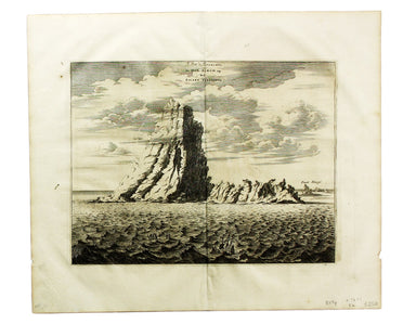
Le Pik de Teneriffe/De Piek-Bergh op het Eilant Tenerifto The Anaga mountain range meets the sea in the northeastern part of Tenerife, close to the...
View full details
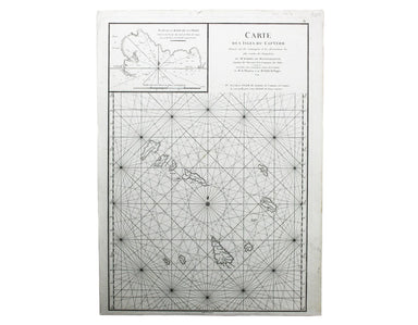
Carte des Isles du Cap-Verd This chart of the Cape Verde islands was engraved by Guillaume de la Haye. D’Après de Mannevillette (1707-1780) was a p...
View full details
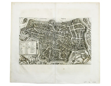
This map of Augsburg was published by Merian and his heirs in various works, including the Archontologia cosmica, Theatrum Europaeum and the Topogr...
View full details

[Title-page] Anglorum Indoles Studia et Actiones In attempting to define the character of the English there is a strong emphasis on trade and disco...
View full details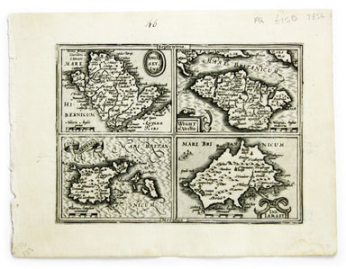
Anglesey Ins[ula]; Wight ol[im] Vectis; Ins[ula] Garnsey; Ins[ula] Iarsay This map of Anglesey, the Isle of Wight, Guernsey and Jersey was engraved...
View full details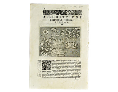
Isola Hebride, et Orcade First published in 1572, our map of the Hebrides and Orkney islands is from the second edition of L’Isole piu famose del M...
View full details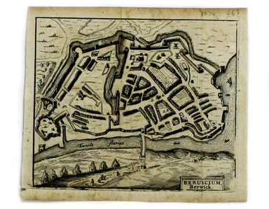
This map of Berwick-upon-Tweed is from Hermannides' Magna Britannia. Nearly all of the plans are based on the small inset plans shown on John Speed...
View full details
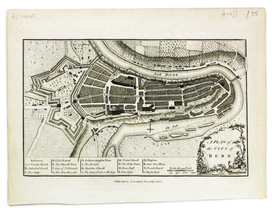
This map of Berne was first published in 'A collection of plans of the capital cities of Europe' in 1771. The plates seem to have been acquired by ...
View full details
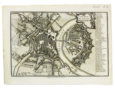
Thus plan of Dresden was first published in 'A collection of plans of the capital cities of Europe' in 1771. The plates seem to have been acquired ...
View full details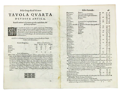
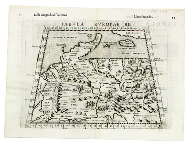
This map of Ptolemaic Germany and Denmark is from the fourth edition of Ruscelli’s Italian translation of the Geographia. It is illustrated with de...
View full details
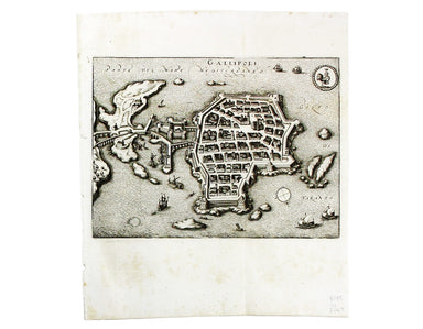
This map of Gallipoli in Apulia was published by Merian and his heirs in various works, including the Itinerarium Italiae of 1640, the Archontologi...
View full details
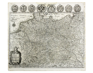
Nova Totius Germania Descriptio. Deutschland This map of Germany was published by Merian and his heirs in various works, including editions of the ...
View full details
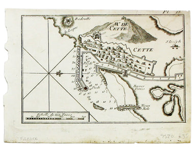
Condition & Materials A chart of Sète in southern France, copper engraving, 14 x 20 cm, black and white as issued, blank verso.
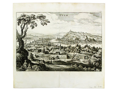
This map of Lyons was published by Merian and his heirs in various works, including the Archontologia Cosmica and Theatrum Europaeum. Condition &am...
View full details
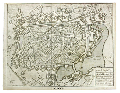
Condition & Materials Copper engraving, 39.5 x 49.5 cm, engraved by J. Basire, black and white as issued, blank verso; map of Mons.
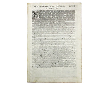
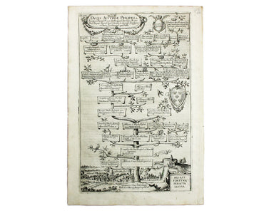
The Babenburg Family Tree The March or Margraviate of Austria had been governed by the Babenburg family since the late tenth century. In 1156 Austr...
View full details
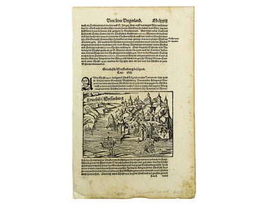
Kriechich Wyssenburg This map of Belgrade showing the confluence of the rivers Danube and Sava at Belgrade, Serbia, is from Sebastian Münster's Cos...
View full details
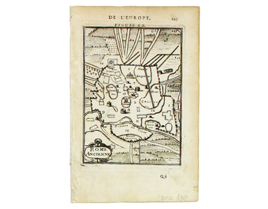
Rome Ancienne This plan of ancient Rome is from Mallet’s Description de l’Univers, first published in Paris in 1683 and reprinted with German text ...
View full details
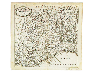
Ligures, Taurini etc, item Rhaetiae pars Clüver is regarded as one of the founders of historical geography; his Introductionis in universam geograp...
View full details
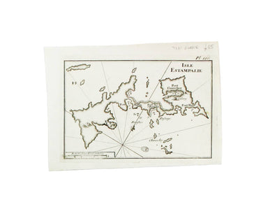
This chart of Astypalaia in the Dodecanese is from the practical pocket sea atlas by Marseilles hydrographer Joseph Roux, charting the ports and ha...
View full details
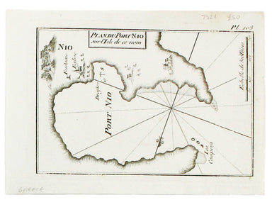
This chart of Ios in the Cyclades is from the practical pocket sea atlas by Marseilles hydrographer Joseph Roux, charting the ports and harbours of...
View full details
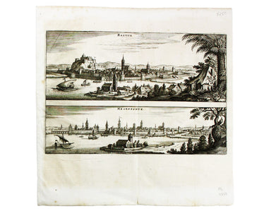
This map of Dubrovnik and Chalcis waspublished by Merian and his heirs in various works, including the Archontologia Cosmica and Theatrum Europaeum...
View full details
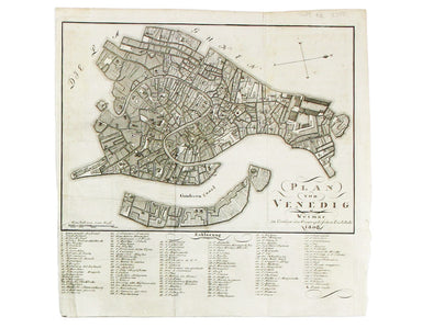
Condition & Materials Copper engraving, 23 x 24.5 cm, black and white as issued, blank verso. Stadtplan of Napoleonic Venice.
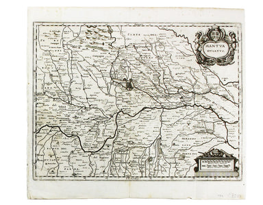
Condition & Materials Copper engraving, 27.5 x 37 cm, black and white, blank verso. Map showing the Duchy of Mantua.
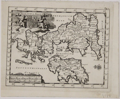
Britannia Magna This miniature map of the British Isles oriented with East at the top was published in James Beeverell’s ‘Les Delices de la Grand B...
View full details
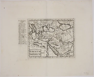
In the margin to the left of this map is an incomplete list of sultans of the Ottoman Empire. The map was published in Wagner’s ‘Delineatio Provinc...
View full details
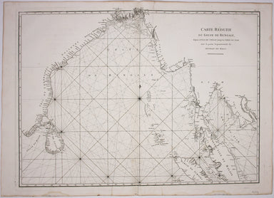
Carte Reduite du Golfe de Bangale D’Après de Mannevillette (1707-1780) was a practical seaman as well as a mapmaker; his sea atlas was published in...
View full details
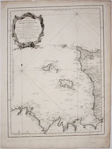
Carte reduite des Isles de Jersey Grenesey et d'Aurigny avec les Costes de Normandie et de Bretagne qui en sont voisines This chart covers the Chan...
View full details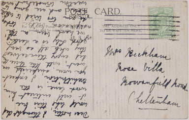

The Central London Railway produced a considerable quantity of advertising material in the Edwardian period. Other postcards included views of Lots...
View full details
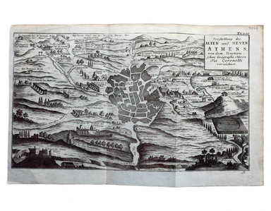
Vorstellung des Alten und Neven Athens, von dem Venetiani – schen Geographo Herrn Pat. Coronelli verzeichnet Coronelli’s plan retains features of t...
View full details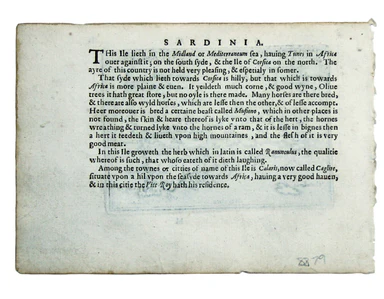
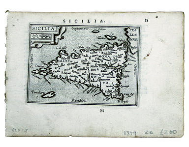
Two English printers dipped a toe in the vernacular atlas market at approximately the same time with pocket editions of the Ortelius atlas: ‘These ...
View full details
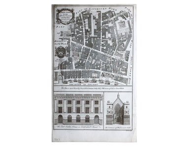
Tower Street Ward with their [sic] divisions into Parishes according to a new survey This plan of Tower Street was published in the greatly expande...
View full details
