

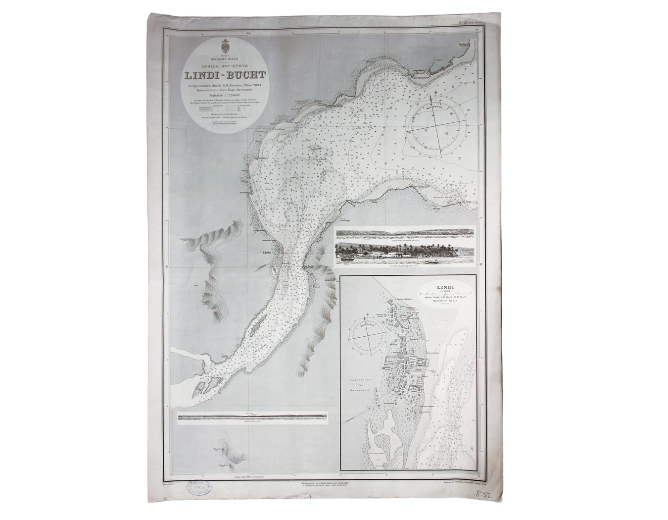
German Naval Chart of Lindi, East Africa
SKU: 8752
Title:
German Naval Chart of Lindi, East Africa
Date of publication:
Printed Measurement:
Publisher:
Colour:
Mapmaker:
Engraver:
Indischer Ocea – Afrika, Ost Küst – Lindi-Bucht
This Imperial German Naval Office chart shows sands, soundings etc, with interior detail of relief, vegetation, roads and settlements. It includes inset profiles and a view of the port of Lindi. Read more
Germany consolidated its hold over German East Africa in the late 1880s and 1890s. Lindi is now in southern Tanzania.
Condition & Materials
Sheet size 76.5 x 56 cm, black and white, date-stamped 27 May 1896, laid on linen. Read less