

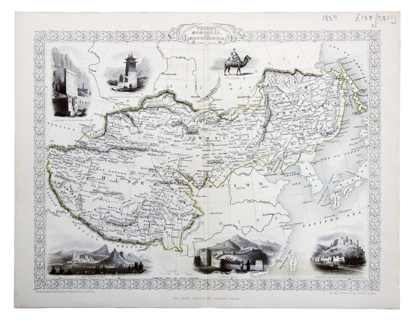
Tallis’ Map of Tibet, Mongolia & Manchuria
SKU: 8810
Title:
Tallis’ Map of Tibet, Mongolia & Manchuria
Date of publication:
Printed Measurement:
Colour:
Mapmaker:
Engraver:
Thibet, Mongolia, and Mandchouria
This map was engraved by John Rapkin for the ‘Illustrated Atlas’; with vignettes including Leh in Ladakh, a stretch of the Great Wall of China and Llhasa engraved by George Greatbach after Henry Winkles. Read more
This example was published in 'The British Colonies; Their History, Extent, Condition and Resources' by R Montgomery Martin.
Condition & Materials
Steel engraving, 26 x 33 cm, original outline colour, blank verso. Read less