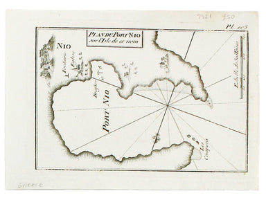
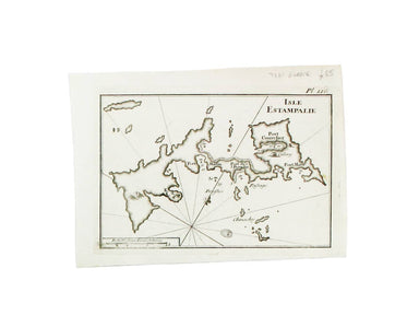
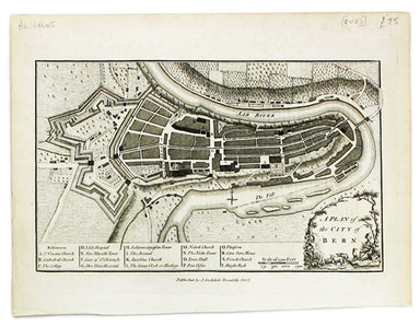
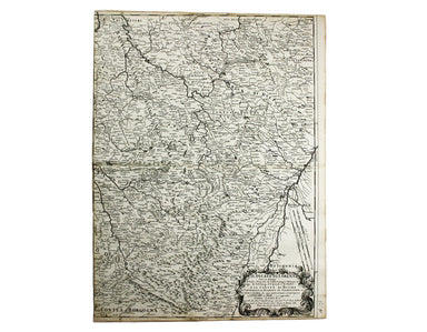
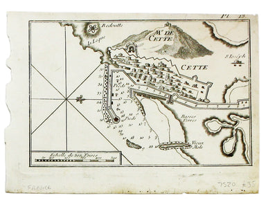
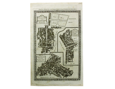
Andrews’ Map of Berne
This map of Berne was first published in 'A collection of plans of the capital cities of Europe' in 1771. The plates seem to have been acquired by ...
View full details
This map of Berne was first published in 'A collection of plans of the capital cities of Europe' in 1771. The plates seem to have been acquired by ...
View full details
This plan of Cologne was first published in 'A collection of plans of the capital cities of Europe' in 1771. The plates seem to have been acquired ...
View full details
Thus plan of Dresden was first published in 'A collection of plans of the capital cities of Europe' in 1771. The plates seem to have been acquired ...
View full details
Ligures, Taurini etc, item Rhaetiae pars Clüver is regarded as one of the founders of historical geography; his Introductionis in universam geograp...
View full details
Il Ducato di Lorena (Lorraine) This map of Lorraine is from Mercurio Geografico, an unusual and finely engraved work. Condition & Materials Cop...
View full details
Il Ducato di Bar diviso ne suoi tre Baliaggi de Barleduc, di S. Michel, e Bassigny […] e li Territorii della Citta e Vescovati di Metz, Tul e Verdu...
View full details
[Title-page] Description de l’Univers Tome I This is the title-page for the first volume of Mallet’s Description de l’Univers printed by Denis Thie...
View full details
This map of Berwick-upon-Tweed is from Hermannides' Magna Britannia. Nearly all of the plans are based on the small inset plans shown on John Speed...
View full details
This map of ancient Egypt is from Mallet’s Description de l’Univers, first published in Paris in 1683 and reprinted with German text in Frankfurt t...
View full details
This chart of Ios in the Cyclades is from the practical pocket sea atlas by Marseilles hydrographer Joseph Roux, charting the ports and harbours of...
View full details
This chart of Astypalaia in the Dodecanese is from the practical pocket sea atlas by Marseilles hydrographer Joseph Roux, charting the ports and ha...
View full details
Condition & Materials A chart of Sète in southern France, copper engraving, 14 x 20 cm, black and white as issued, blank verso.
A sea chart of Foça, Turkey; near Smyrna. The practical pocket sea atlas by Marseilles hydrographer Joseph Roux, charting the ports and harbours of...
View full details
This sea chart shows the environs of Marmara Island on the southern coast of the Sea of Marmara, Turkey. The practical pocket sea atlas by Marseill...
View full details
The practical pocket sea atlas by Marseilles hydrographer Joseph Roux, charting the ports and harbours of the Mediterranean, remained popular half ...
View full details
Plan of Coleman Street and Bassishaw Wards; Plan of Portsoken Ward; Plan of Cripplegate Ward Condition & Materials Copper engraving, 34 x 22 cm...
View full details