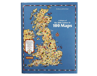
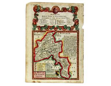
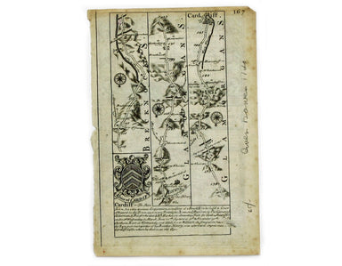
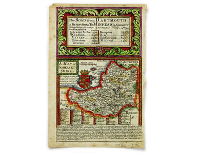
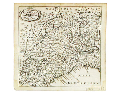
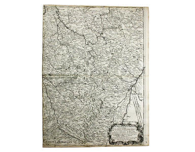
A History of the 20th Century in 100 Maps
Free UK and ROI shipping; £5 to rest of world “…shows you all you need to know about the power of maps to inform, entertain and induce wonder. ‘A H...
View full detailsFree UK and ROI shipping; £5 to rest of world “…shows you all you need to know about the power of maps to inform, entertain and induce wonder. ‘A H...
View full detailsThis map of Berne was first published in 'A collection of plans of the capital cities of Europe' in 1771. The plates seem to have been acquired by ...
View full detailsThis plan of Cologne was first published in 'A collection of plans of the capital cities of Europe' in 1771. The plates seem to have been acquired ...
View full detailsThus plan of Dresden was first published in 'A collection of plans of the capital cities of Europe' in 1771. The plates seem to have been acquired ...
View full detailsCondition & Materials Copper engraving, 15.5 x 15.5 cm, modern hand-colour, blank verso; a map of Middlesex engraved by Toms for Thomas Badesla...
View full detailsVeromandui This map of the modern Aisne is named here for the Viromandui, a Belgic tribal name. Condition & Materials Copper engraving, 9.5 x 1...
View full detailsThis map of Eastern Friesland is from the first edition of Tabularum geographicarum contractarum libri, a geographical work which is normally catal...
View full detailsThis map of Franconia, including Frankfurt and Nuremberg in modern Bavaria, is from the first edition of Tabularum geographicarum contractarum libr...
View full detailsThis map of Northen Bavaria is from the first edition of Tabularum geographicarum contractarum libri, a geographical work which is normally catalog...
View full detailsThis map of Southwestern Germany is from the first edition of Tabularum geographicarum contractarum libri, a geographical work which is normally ca...
View full detailsThis map of Udrone from is the first edition of Tabularum geographicarum contractarum libri, a geographical work which is normally catalogued under...
View full detailsCondition & Materials Copper engraving, 9.5 x 13.4 cm, recent hand-colour, Latin text on verso; miniature map of Artois.
Thus miniature map of Dithmarschen in Holstein, flanked by the Eider and the Elbe isfrom the first edition of Tabularum geographicarum contractarum...
View full detailsCondition & Materials Copper engraving, 9.5 x 13.4 cm, recent hand-colour, Latin text on verso; map of Hainault.
This miniature map of Hesse is from the first edition of Tabularum geographicarum contractarum libri, a geographical work which is normally catalog...
View full detailsCondition & Materials Copper engraving, 9.5 x 13.4 cm, recent hand-colour, Latin text on verso; map of Liège.
This miniature map of Nassau is from the first edition of Tabularum geographicarum contractarum libri, a geographical work which is normally catalo...
View full detailsTrans-Isula D. Condition & Materials Copper engraving, 9.5 x 13.4 cm, recent hand-colour, Latin text on verso; map of Overjissel.
A miniature map of Salzburg and Carinthia. Condition & Materials Copper engraving, 10 x 13.5 cm, recent hand-colour, Latin text on verso;
This miniature map of Saxony is from the first edition of Tabularum geographicarum contractarum libri, a geographical work which is normally catalo...
View full detailsThis miniature map of the Electoral Palatinate is from the first edition of Tabularum geographicarum contractarum libri, a geographical work which ...
View full detailsThis map of Radnorshire was engraved by Emanuel Bowen for John Owen’s “Britannia Depicta”, a pocket road book derived from Ogilby’s innovative atla...
View full detailsThis map of Herefordshire was engraved by Emanuel Bowen for John Owen’s Britannia Depicta, a pocket road book derived from Ogilby’s innovative atla...
View full detailsThis map of Berskhire was engraved by Emanuel Bowen for John Owen’s Britannia Depicta, a pocket road book derived from Ogilby’s innovative atlas of...
View full detailsThis map of Bedforshire was engraved by Emanuel Bowen for John Owen’s Britannia Depicta, a pocket road book derived from Ogilby’s innovative atlas ...
View full detailsThis map of Norfolk was engraved by Emanuel Bowen for John Owen’s Britannia Depicta, a pocket road book derived from Ogilby’s innovative atlas of ...
View full detailsThis map of Northamptonshire was engraved by Emanuel Bowen for John Owen’s Britannia Depicta, a pocket road book derived from Ogilby’s innovative a...
View full detailsThis map of Oxfordshire was engraved by Emanuel Bowen for John Owen’s Britannia Depicta, a pocket road book derived from Ogilby’s innovative atlas ...
View full detailsThis map of Somerset was engraved by Emanuel Bowen for John Owen’s Britannia Depicta, a pocket road book derived from Ogilby’s innovative atlas of ...
View full detailsThis map of ancient Egypt is from Butler's Atlas of Ancient Geography and was engraved by Sidney Hall. Condition & Materials Copper engraving,...
View full detailsThis characteristically clear and elegant map of Lincolnshire is by John Cary, one of the leading cartographic engravers, publishers and globe-make...
View full detailsLigures, Taurini etc, item Rhaetiae pars Clüver is regarded as one of the founders of historical geography; his Introductionis in universam geograp...
View full detailsIl Ducato di Lorena (Lorraine) This map of Lorraine is from Mercurio Geografico, an unusual and finely engraved work. Condition & Materials Cop...
View full detailsIl Ducato di Bar diviso ne suoi tre Baliaggi de Barleduc, di S. Michel, e Bassigny […] e li Territorii della Citta e Vescovati di Metz, Tul e Verdu...
View full detailsCondition & Materials Copper engraving, 10.5 x 12.6 cm, original hand-colour, lightly browned, blank verso; leaf from the same work, with the ...
View full details[Title-page] Description de l’Univers Tome I This is the title-page for the first volume of Mallet’s Description de l’Univers printed by Denis Thie...
View full detailsThis map of Berwick-upon-Tweed is from Hermannides' Magna Britannia. Nearly all of the plans are based on the small inset plans shown on John Speed...
View full detailsThis map of Cambridgeshire was first issued in The London Magazine, which between 1747 and 1754 published a complete set of English county maps by ...
View full detailsThis map of Sussex was first issued in The London Magazine, which between 1747 and 1754 published a complete set of English county maps by Thomas K...
View full detailsThis map of County Durham was engraved by J & C Walker after Creighton for Lewis’ Topographical Dictionary. Condition & Materials Steel eng...
View full detailsThis map of the United Kingdom of the Netherlands is from 'A Modern and Ancient General Atlas, comprehending all the Empires, Kingdoms, States in t...
View full detailsLes 13 Cantons Suisses et leurs Alliez This map of 13 Swiss Canton is from Mallet’s Description de l’Univers. Condition & Materials Copper engr...
View full detailsChapelle du St Sepulchre de N.S. Jesus Christ à Jerusalem The Church of the Holy Sepulchre, Jerusalem, from Mallet’s Description de l’Univers. Cond...
View full detailsThis map of France is from Mallet’s Description de l’Univers. Condition & Materials Copper engraving, 15 x 10.5 cm, recent hand-colour, French...
View full detailsHere's King Christian V, as he appears in Mallet’s ‘Description de l’Univers. Condition & Materials Copper engraving, 15 x 10.5 cm, recent han...
View full detailsThis map of ancient Egypt is from Mallet’s Description de l’Univers, first published in Paris in 1683 and reprinted with German text in Frankfurt t...
View full detailsCercle de Baverie This map of Bavaria is from Mallet’s Description de l’Univers. Condition & Materials Copper engraving, 15 x 11.5 cm, recent h...
View full detailsThis map of France is from Mallet’s Description de l’Univers. Condition & Materials Copper engraving, 15 x 10.5 cm, recent hand-colour, light ...
View full details