

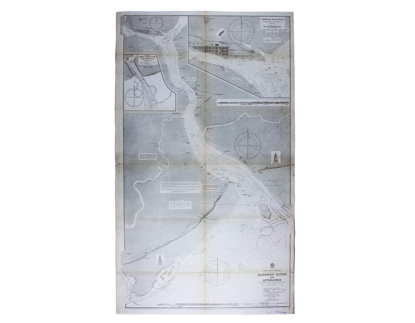
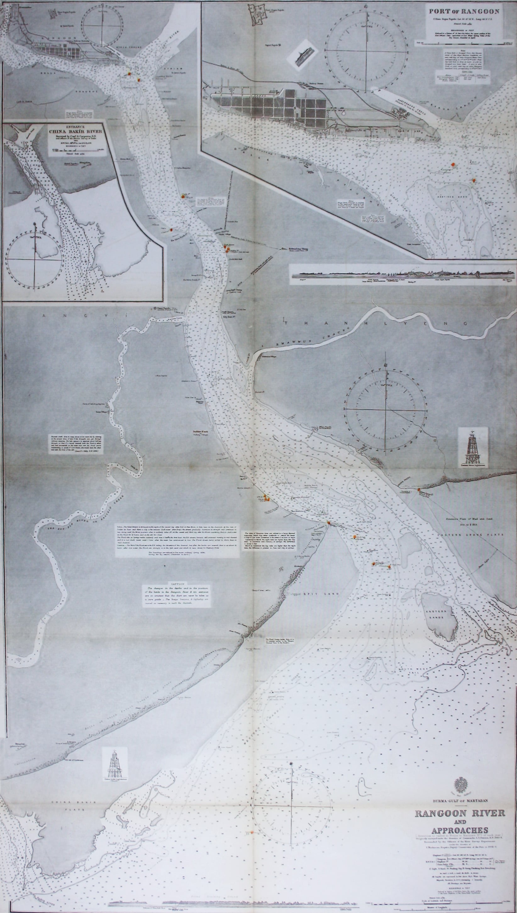
Admiralty Chart of the Approach to Rangoon
SKU: 8458
Title:
Admiralty Chart of the Approach to Rangoon
Date of publication:
Printed Measurement:
Colour:
Burma – Gulf of Mataban – Rangoon River and Approaches
This chart covers the mouth of the river between Rangoon (Yangon) and the sea. It shows villages, pagodas, beacons, waterways, sands and soundings; there are reference notes on creeks and tides and an inset plan of the port of Rangoon, the entrance to the China Bakir River (To River) and two coastal profiles.
Read more
Condition & Materials
Engraved chart of the approach to Rangoon, 95 x 66 cm, engraved by Davies and Company, black and white (lighthouses/beacons highlighted in colour), first published in 1885 with corrections to 1922, ink stamp to lower right hand corner, folded into 12 panels, blank verso. Read less