

Reuben Ramble's' county atlas for children
Reuben Ramble's Travels in the Counties of England This is a county atlas designed for children or ‘the little geographer’, with simple text by Sam...
View full details

Reuben Ramble's Travels in the Counties of England This is a county atlas designed for children or ‘the little geographer’, with simple text by Sam...
View full details

The Road from Oxford to Coventry continued to Darby... This map was published as sheet 82 in the 1698 folio edition of Ogilby’s pioneering road atl...
View full details

The Extended Road from Oakham to Richmond... commencing at Oakham aforesaid & extending to Barnsley in Yorkshire This map was published as she...
View full details

The Continuation of the Road from London to Holy-Head... Plate 3d., commencing at the City of Lichfield & extending to the City of Chester This...
View full details

Robert Morden's county maps, like this one of Northumberland, were engraved to illustrate Gibson's edition of William Camden's Britannia, first pub...
View full details

Cantebrigia, opulentissimi Anglie Regni, urbs celeberrimi nominis, ab Academie conditore Cantabro, cognominata: a Granta, fluvio vicino, Cairgrant;...
View full details

This map of Dorset was published in Philip Lea’s edition of Christopher Saxton’s county atlas, commonly known as the Lea-Saxton or Saxton-Lea. Chr...
View full details

Smith's New Map of England and Wales, with part of Scotland including the turnpike and principal cross roads, the course of the rivers and navigabl...
View full details

De Custen van Engelandt tusschen de droochten van Weembrugh en Poortlandt This chart of part of the Dorset coast features woodcut coastal profiles ...
View full details

Course of the River Mole. From Box Hill Bridge to Leatherhead shewing the situation of the various apertures called Swallows This map charting the ...
View full details

Blaeu and the rival Golden Age Dutch cartographic publishing house of Janssonius raced to bring out atlases of the British Isles in the 1630s and e...
View full details

Huntington, both shire and shire towne with the ancient citie Ely described This is an unusual example of John Speed’s map of Huntingdonshire – it ...
View full details

Robert Morden's county maps, like this one of Cornwall, were engraved to illustrate Gibson's edition* of William Camden's Britannia. Camden was an ...
View full details

Robert Morden's country maps, like this one of Suffolk, were engraved to illustrate Gibson's edition* of William Camden's Britannia. Camden was an ...
View full details

Robert Morden's county maps, like this one of Surrey, were engraved to illustrate Gibson's edition* of William Camden's Britannia. Camden was an El...
View full details

Thousands of miles of roads were surveyed for John Ogilby’s pioneering road atlas, the ‘Britannia’. The decorative cartouche on this map of the roa...
View full details

Thousands of miles of roads were surveyed for John Ogilby’s pioneering road atlas, the ‘Britannia’. This sheet shows the roads between the Cumbrian...
View full details

Thousands of miles of roads were surveyed for John Ogilby’s pioneering road atlas, the ‘Britannia’. This sheet covers the road between High Barnet ...
View full details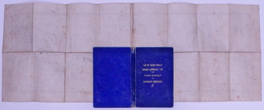
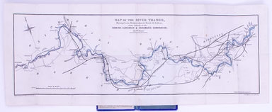
Map of the River Thames, shewing locks, bridges, adjacent roads & railways, drawn expressly for the Rowing Almanack & Oarsman’s Companion T...
View full details

This pictorial route map of the Devon General by an anonymous draughtsman for the principal bus operator in south Devon makes playful references to...
View full details
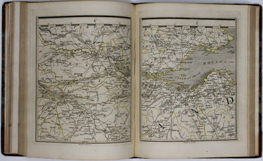
Cary’s new map of England and Wales, with part of Scotland. On which are carefully laid down All the Direct and Principal Cross Roads the Course of...
View full details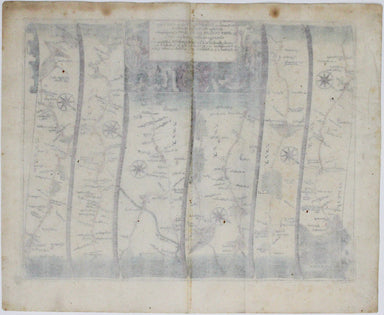
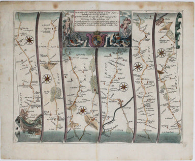
Our journey to Hythe begins in London and follows the road through East Peckham and Eltham, reaching Hythe via Maidstone. Thousands of miles of roa...
View full details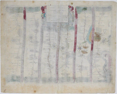
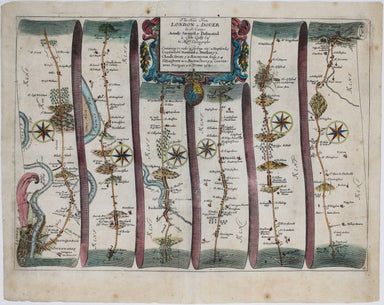
Our journey to Dover begins in London and follows the road through Deptford, Blackheath, Shooter’s Hill, and Dartford, reaching Dover via Rochester...
View full details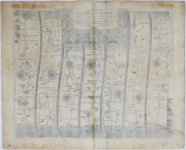
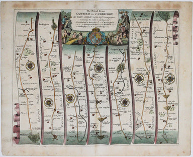
Our journey takes us along the road between the university towns of Oxford and Cambridge, via Bedford. Thousands of miles of roads were surveyed fo...
View full details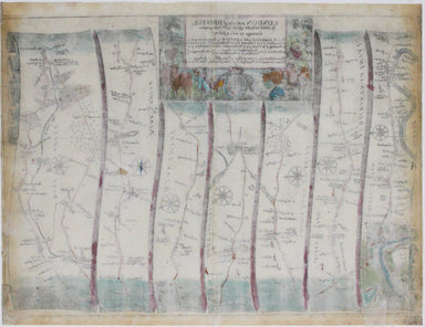
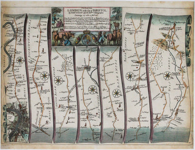
Our journey begins in London and follows the road west through Knightsbridge and Kensington (with Hyde Park to one side), Hammersmith and Turnham G...
View full details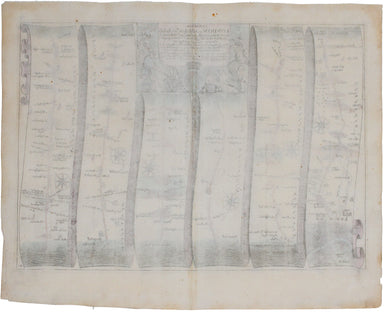
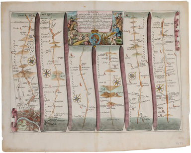
This road map includes London, Islington, and Highgate, and extends as far as Towcester. It was published as sheet 21 in the 1698 folio edition of ...
View full details
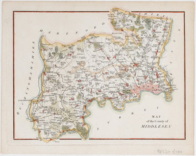
This attractive, detailed map of the county of Middlesex is unsigned; as yet, we have been unable to identify the engraver. Do feel free to write t...
View full details
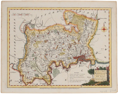
Ellis' map of Middlesex conveys a wealth of detailed information: borough towns are shown with stars identifying the number of Members returned to ...
View full details
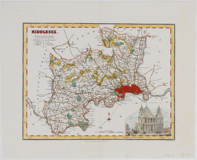
This map of Middlesex included a vignette of St. Paul's Cathedral. It was published in James Bell’s 'New and Comprehensive Gazetteer of England and...
View full details
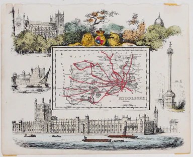
This map of Middlesex was published in Reuben Ramble's ‘Travels through the Counties of England’, an uncommon county atlas for children. Reuben Ram...
View full details
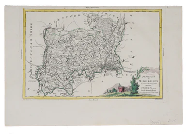
This map of Middlesex was engraved by Giuliano Zuliano after Giovanni Pitteri and published in Antonia Zatta's ‘Atlante Novissimo’. This was his ...
View full details
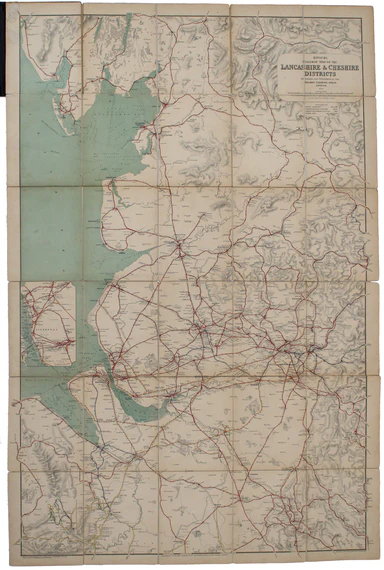
The Railway Clearing House allocated revenue on occasions where one company’s train ran over another’s track, and promoted standardisation (of ever...
View full details
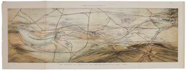
This plan of the Manchester Shipping Canal was published as a supplement to ‘The Illustrated London News’, February 3rd 1883. Construction began in...
View full details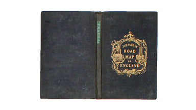
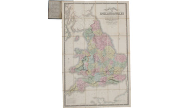
New Road Map of England & Wales... shewing all the lines of railway, canals &c., describing the picturesque scenery and forming a complete ...
View full details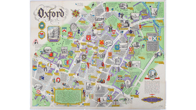
This pictorial plan of central Oxford was printed for the recently nationalised British Railways (Western Region). The arms of the University and t...
View full details
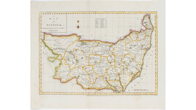
This map of Suffolk is from a series of maps engraved between 1787-1791 by Edward Sudlow after John Haywood. It was subsequently published in atlas...
View full details
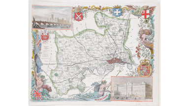
This map of Middlesex is illustrated with vignettes of Buckingham Palace (before its early 20th century re-modelling) and the ‘new’ Houses of Parli...
View full details
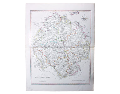
This characteristically clear and elegant map of Herefordshire is by John Cary, one of the leading cartographic engravers, publishers and globe-mak...
View full details
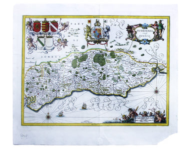
Suthsexia, vernacule Sussex Condition & Materials Copper engraving, 38.5 x 50.5 cm, modern hand-colour, closed centrefold split with some margi...
View full details
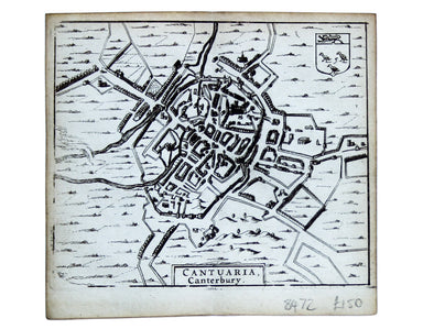
This map of Canterbury is from Hermannides' Magna Britannia. Nearly all of the plans are based on the small inset plans shown on John Speed's count...
View full details
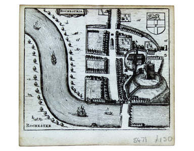
This map of Rochester is from Hermannides' Magna Britannia. Nearly all of the plans are based on the small inset plans shown on John Speed's county...
View full details
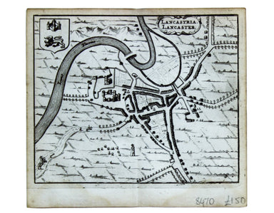
This map of Lancaster is from Hermannides' Magna Britannia. Nearly all of the plans are based on the small inset plans shown on John Speed's county...
View full details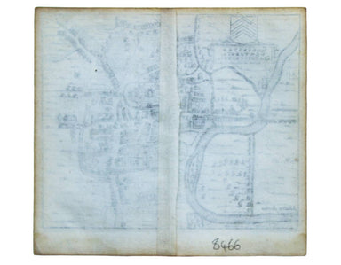
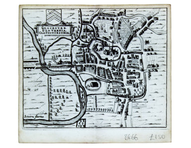
This map of Gloucester is from Hermannides' Magna Britannia. Nearly all of the plans are based on the small inset plans shown on John Speed's count...
View full details
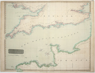
John Thomson's maps, like this one of the Channel, are characteristic of the Edinburgh school of cartography. It flourished at the beginning of the...
View full details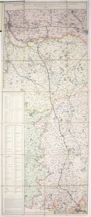
Map of the Grand Junction Railway and its Adjacent Country. [Copied by permission from the Company’s official map.] Shewing all the the stations on...
View full details
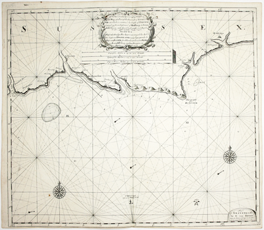
A new gradually encreasing Compass-Map of part of the Sea Coasts of England, in which is contained the Coasts of Sussex, extending from Eastwards o...
View full details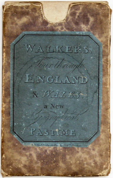
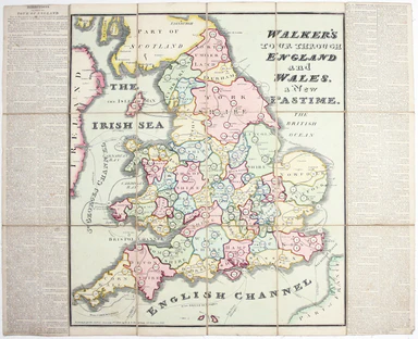
A New Geographical Pastime: Walker’s Tour through England and Wales Most games of this nature were educational, and in this case players learn as t...
View full details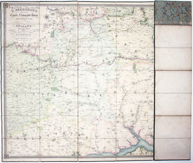
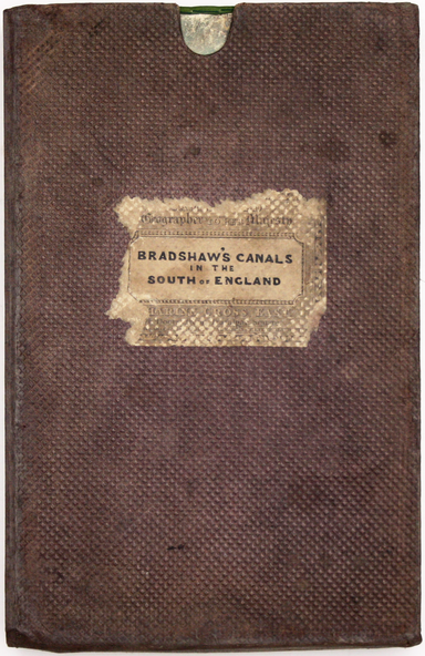
G. Bradshaw’s Map of Canals, Navigable Rivers, Rail Roads etc. in the Southern Counties of England. From actual survey shewing heights of the ponds...
View full details
