

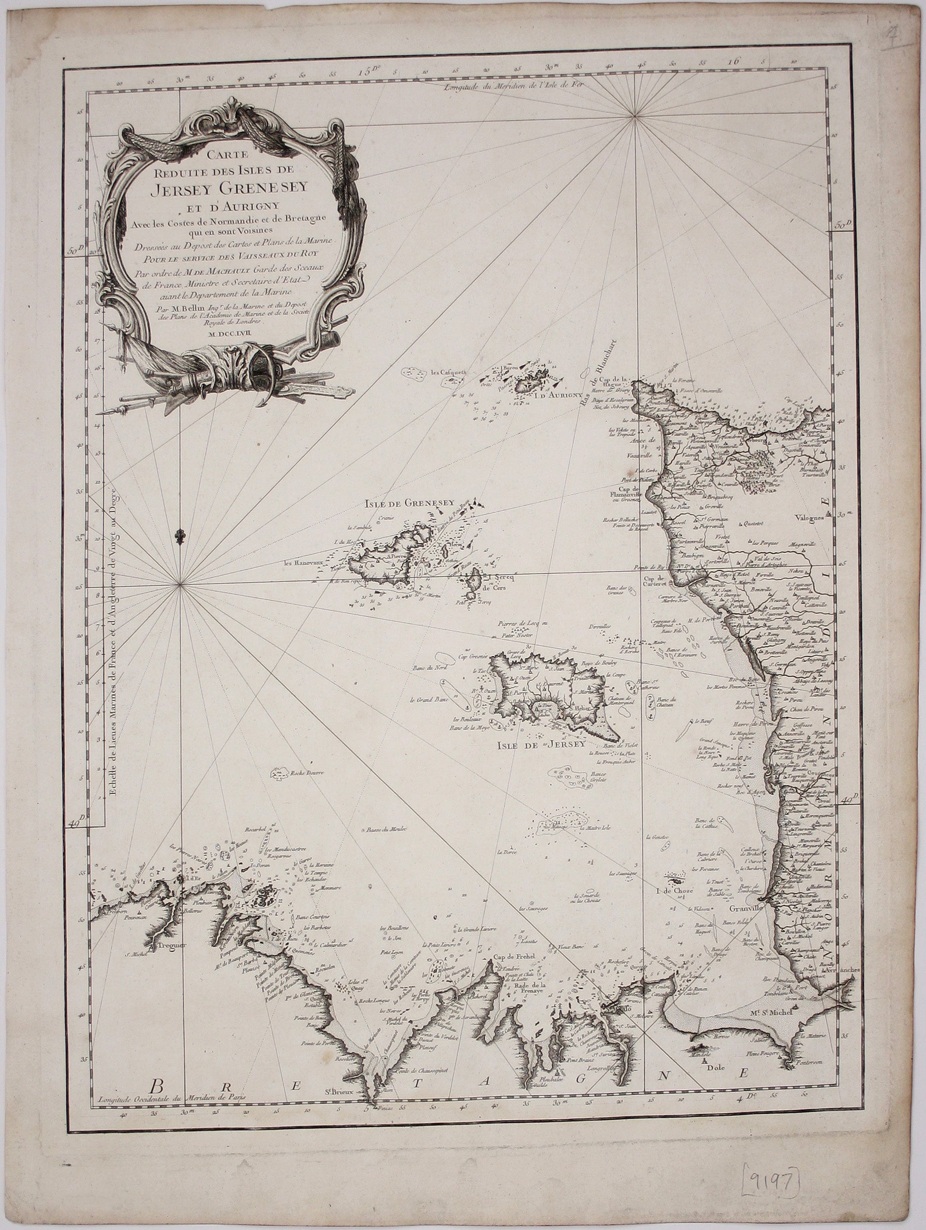
Bellin’s Chart of the Channel Islands
SKU: 9197
Title:
Bellin’s Chart of the Channel Islands
Date of publication:
Printed Measurement:
Publisher:
Colour:
Mapmaker:
Carte reduite des Isles de Jersey Grenesey et d'Aurigny avec les Costes de Normandie et de Bretagne qui en sont voisines
This chart covers the Channel islands of Jersey, Guernsey and Alderney along with the neighbouring coasts of Brittany and Normandy. Read more
Jacques Nicolas Bellin the elder (1703-1772) was first chief hydrographic engineer of the "Dépôt des cartes, plans et journaux du Ministère de la Marine," charged early in the reign of Louis XV with mapping the coasts of France first and then the rest of the world. He was also a member of the Royal Society of London.
Condition & Materials
Copper engraving, 59 x 44 cm, black and white, margins a trifle dusty, blank verso. Read less