

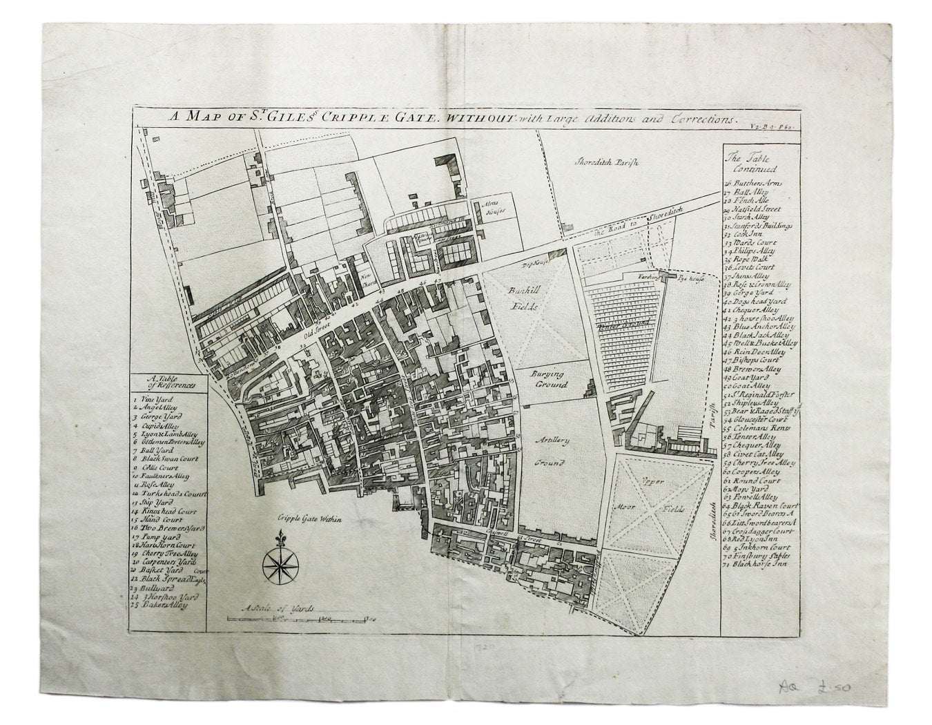
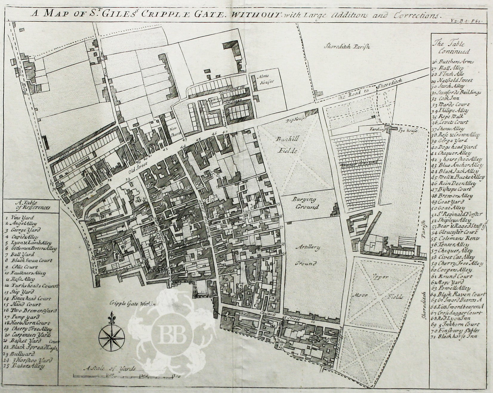
Blome’s Ward Plan of St Giles Cripplegate
SKU: 8151
Title:
Blome’s Ward Plan of St Giles Cripplegate
Date of publication:
Printed Measurement:
Colour:
Mapmaker:
John Stow's A Survey of the Cities of London and Westminster was originally published in 1598 and 1603, but revised and expanded works under his name appeared over the following two centuries.
This detailed ward plan of St Giles Cripplegate was commissioned towards the end of his life by Richard Blome (1635-1705) for a proposed Survey or description of the citties of London and Westm[inste].r (entered in the Registers of the Stationers' Company in 1695) which never materialized. The plates were sold and Blome's name erased after his death and they were included in John Strype's edition of Stow's Survey printed in 1720 (which itself took over a decade to see through the press, despite the backing of a large consortium of booksellers), and in the edition of 1754-55.
Read more
Condition & Materials
Copper engraving, 28.5 x 36 cm, black and white as issued, blank verso. Read less