

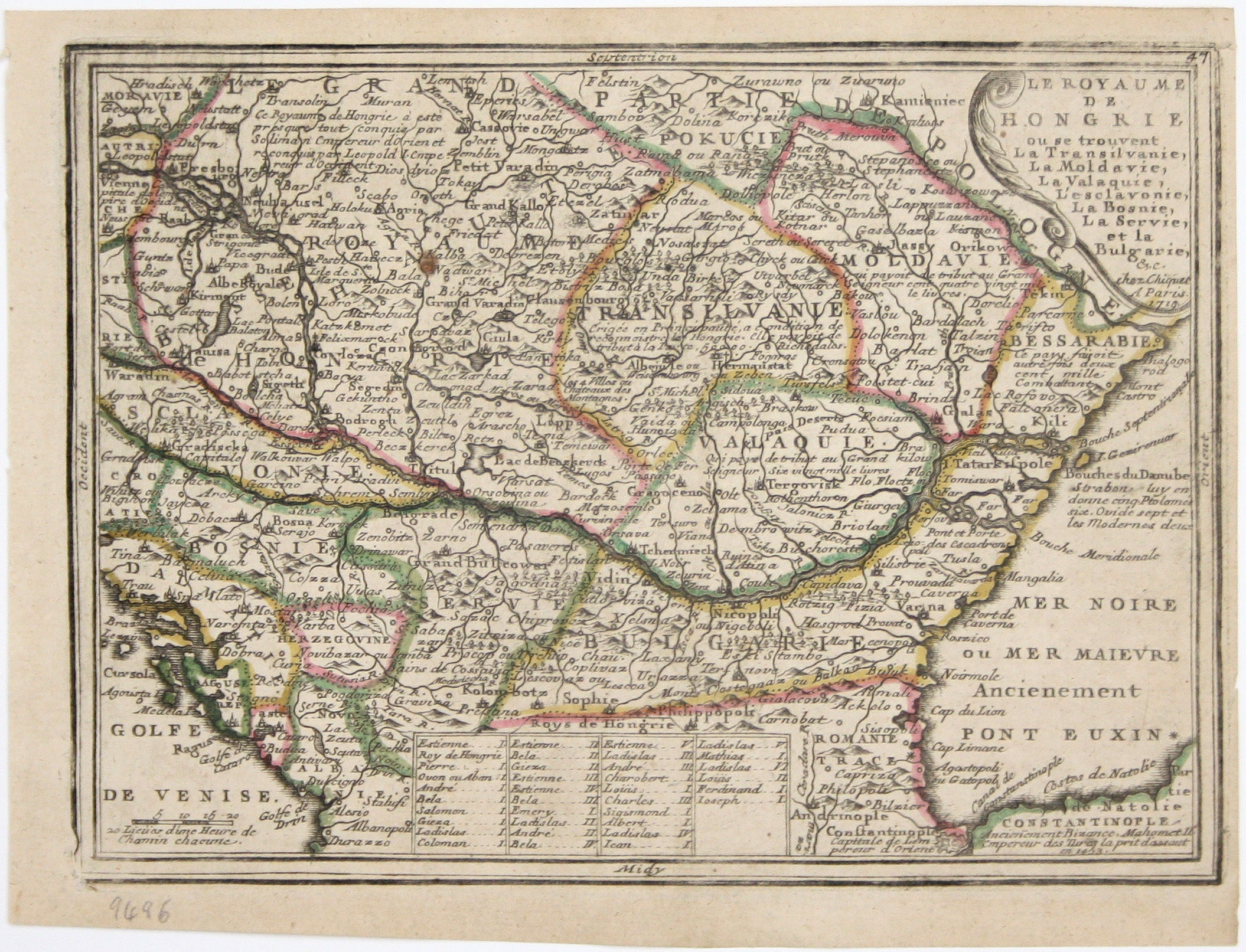
Chiquet’s Map of Hungary & Balkans
SKU: 9496
Title:
Chiquet’s Map of Hungary & Balkans
Date of publication:
Printed Measurement:
Colour:
Mapmaker:
Le Royaume de Hongrie, ou se trouvent la Transilvanie, la Moldavie, la Valaquie, la Bosnie la Servie et la Bulgarie, &c
Our map of Hungary and the Balkans was published in Chiquet’s ‘Le nouveau et curieux atlas géographique et historique ...’. Chiquet (1673-1721) was a relatively successful Parisian engraver, print and mapseller. He published Antoine Menard’s ‘Le nouveau et curieux atlas’ in 1711, and reprinted it with Menard’s name burnished from the plate and replaced with his own and a new date, 1719, as here. Read more
Condition & Materials
Copper engraving, 16.3 x 22.2 cm, original hand colour in outline, marginal crease to top right hand corner, blank verso. Read less