

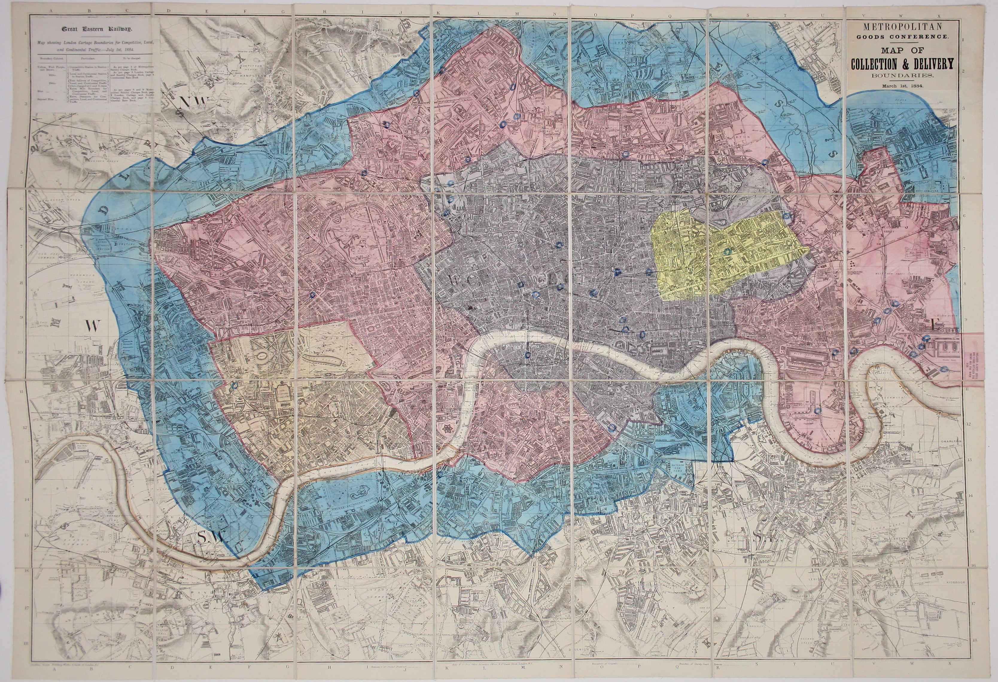
GER Metropolitan Goods Conference Map of London
SKU: 9199
Title:
GER Metropolitan Goods Conference Map of London
Date of publication:
Printed Measurement:
Colour:
Mapmaker:
Metropolitan Goods Conference Map of Collection & Delivery Boundary
This map is a variant of the London plan typically issued with Kelly’s Directory, and our example seems to have been customised for internal use by employees of the Great Eastern Railway. Read more
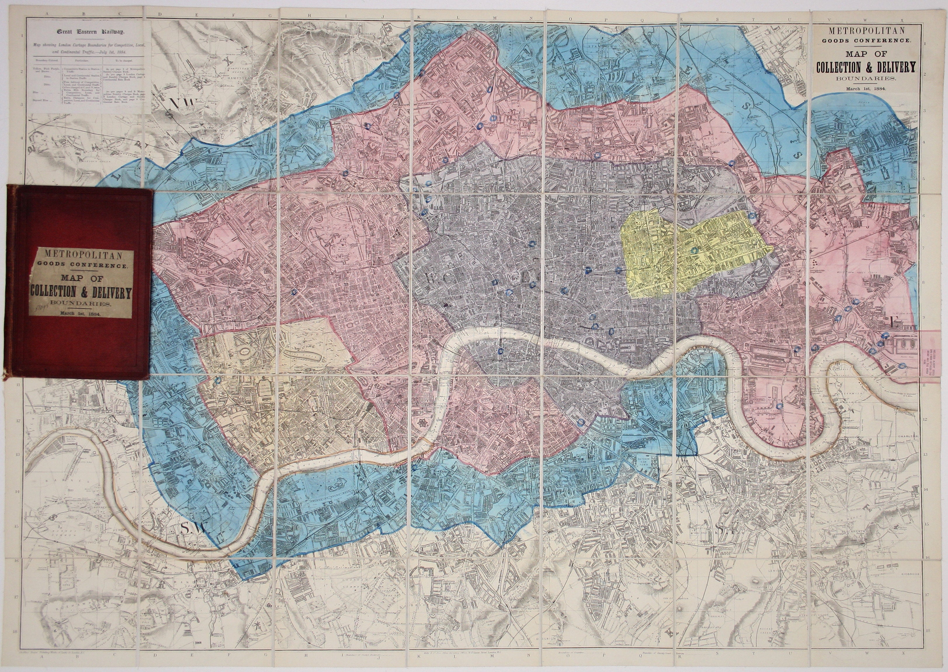
A paper label pasted to the top left corner of the map contains a legend detailing charges to be levied by the GER on goods received in the differently coloured zones; the title is also printed on a paper label.
Condition & Materials
Lithographed plan of London, sheet size 71 x 96 cm, original hand colour, dissected into 28 panels and laid on linen, folding into slightly dusty maroon cloth boards with publisher’s paper label.
References
Hyde, Printed maps of Victorian London, 61 (27).
Read less