

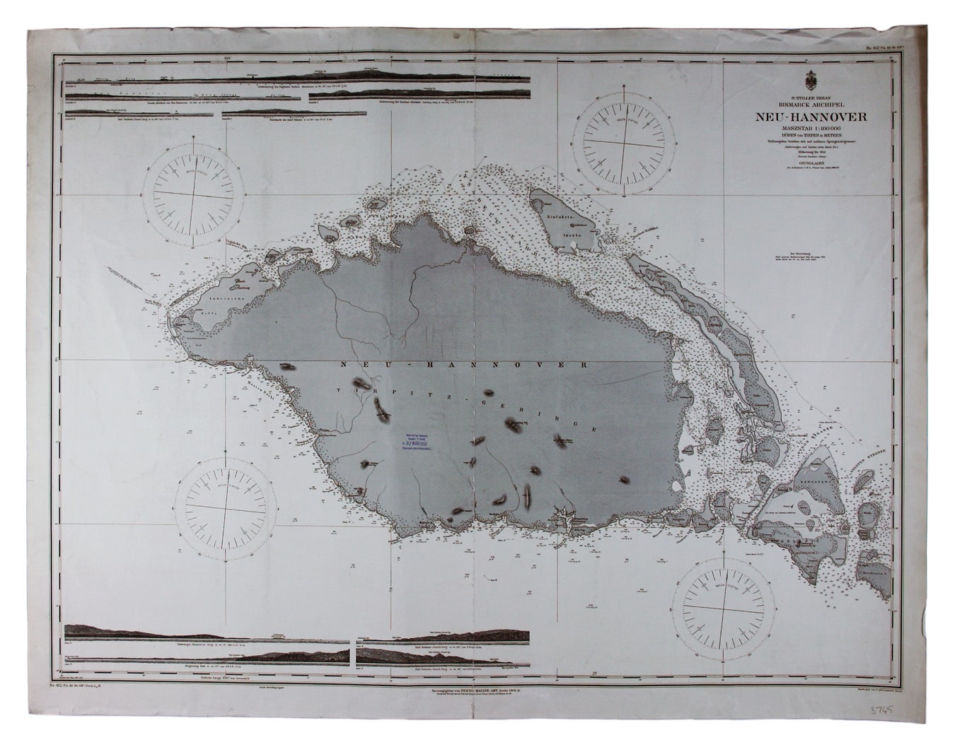
German Naval Chart of New Hanover, Papua New Guinea
SKU: 8745
Title:
German Naval Chart of New Hanover, Papua New Guinea
Date of publication:
Printed Measurement:
Colour:
Mapmaker:
Engraver:
Bismark Archipel – Neu Hannover
This is a German chart of New Hanover Island or Lavongai in the Bismarck Archipelago of Papua New Guinea. Read more
German New Guinea, a German protectorate between 1884 and its surrender to Australian troops in 1914, formed the first part of the German colonial empire.
Condition & Materials
Imperial German Naval Office chart, sheet size 67 x 91 cm, engraved by F. Müllhaupt, black and white, centrefold, date-stamped 24 December 1909, blank verso; breakwaters and lights highlighted in colour; shows sands, soundings etc, with interior detail of relief, vegetation, roads and settlements; inset profiles.
A Note on Shipping
Shipping rates are not available for this item. Select ‘pick up’ at checkout to collect it from the shop, or contact us for a custom quote. We will email you an invoice for the item price plus shipping, and you can complete the transaction securely online. Read less