

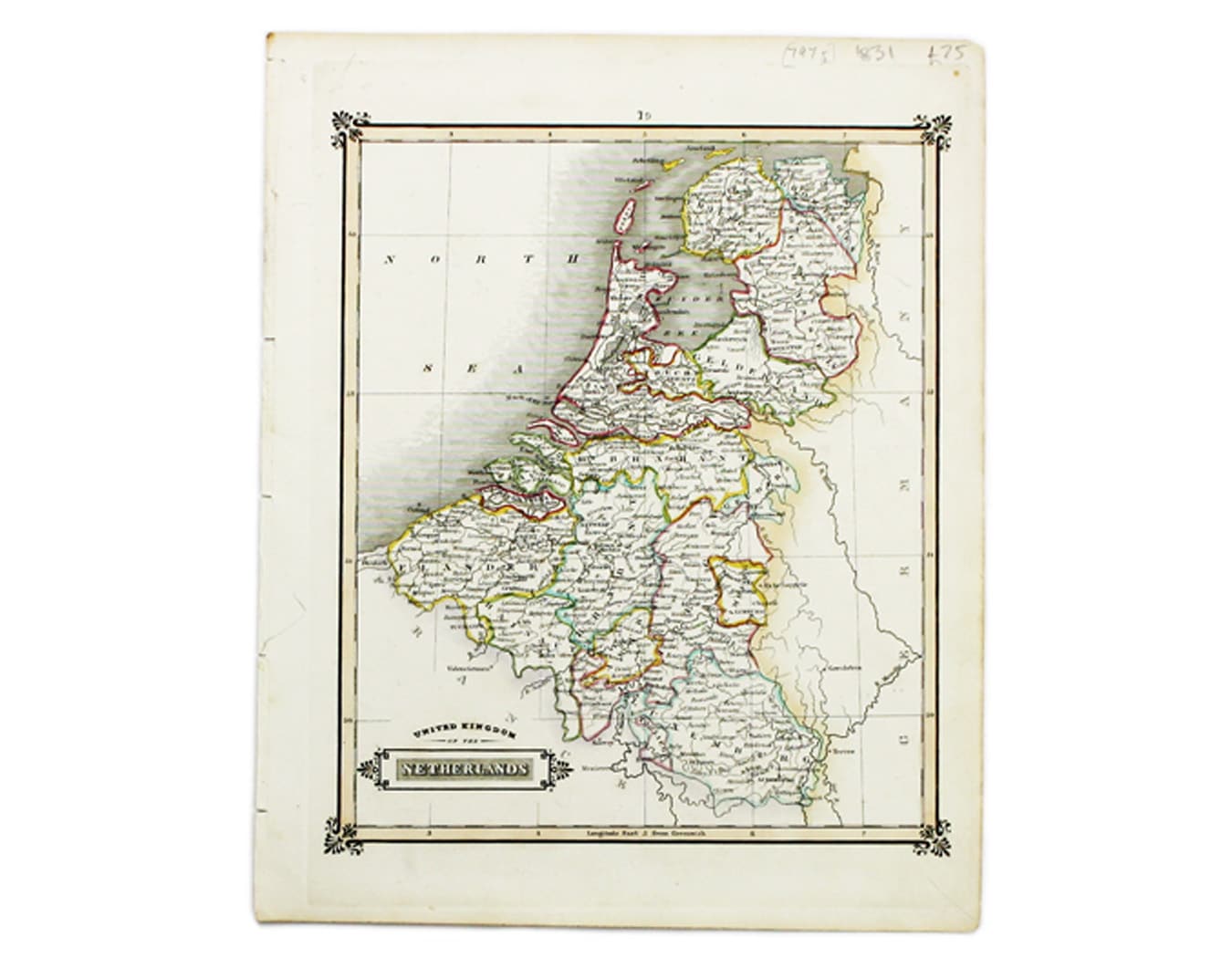
Lizars’ Map of the United Kingdom of the Netherlands
SKU: 7975
Title:
Lizars’ Map of the United Kingdom of the Netherlands
Date of publication:
Printed Measurement:
Colour:
Mapmaker:
This map of the United Kingdom of the Netherlands is from 'A Modern and Ancient General Atlas, comprehending all the Empires, Kingdoms, States in the World'.
Lizars trained as a painter, but in 1812 took over the Edinburgh publishing and engraving business established by his father. The United Kingdom of the Netherlands was created at the end of the Napoleonic Wars; Belgium became independent in 1830. Read more
Condition & Materials
Copper engraving, 27.5 x 22 cm, original hand-colour in outline, blank verso. Read less