

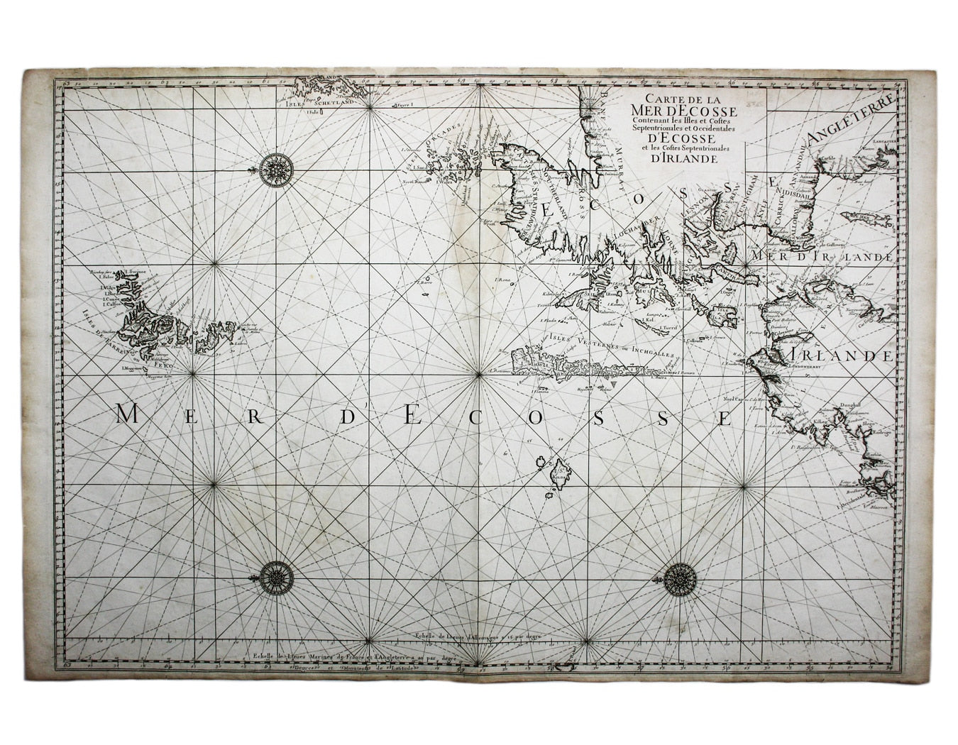

Loon’s Chart of the Northwest Coast of Scotland
SKU: 8365
Title:
Loon’s Chart of the Northwest Coast of Scotland
Date of publication:
Printed Measurement:
Publisher:
Colour:
Mapmaker:
Carte de la Mer d’Ecosse, Contenant les Isles et Costes Septentrionales et Occidentales d’Ecosse et les Costes Septentrionales d’Irlande
This detailed chart of the Atlantic northwest of the British Isles includes coverage of the Faroe Islands and St Kilda’s as well as the Western Isles, the Orkneys and Shetland Islands. Read more
The map is from the original, French edition of the ‘Neptune François’, swiftly copied in Amsterdam by Pierre Mortier working in partnership with Parisian publisher Alexis Hubert Jaillot, and issued with French, Dutch and English text with Paris and Amsterdam imprints within the same year.
Koeman explains that the plates of Mortier’s ‘counterfeited copy’ were very precisely re-engraved - causing considerable confusion at French customs when exported - but to the titles of each chart was added: “levee et Gravé par Ordre du Roy, à Paris”.
Condition & Materials
Copper engraving, 87.5 x 61 cm, engraved by Hendrik van Loon, black and white, light waterstaining, one or two marginal nicks and tears closed on verso, printed on heavy chart paper, blank verso.
References
see Koeman M.Mor 1 and M.Mor 3
Shirley, Maps in the Atlases of the British Library, M.Nep-1a Read less