

Maitland’s Plan of Cheap Ward
SKU: 8816
Title:
Maitland’s Plan of Cheap Ward
Date of publication:
Printed Measurement:
Colour:
Mapmaker:
Engraver:
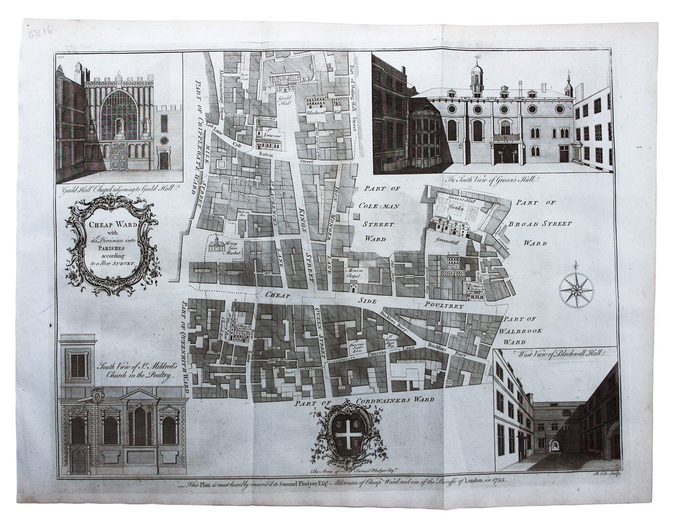
Cheap Ward with its divisions into Parishes according to a new survey
This ward plan of Cheap was published in the greatly expanded second edition of Maitland’s History of London. Read more
Significant buildings, such as Guildhall, are represented pictorially on the map; views of Guildhall Chapel, Grocers’ Hall etc, and with the arms of contemporary Alderman Sir Samuel Fludyer, with dedication in lower margin.
Condition & Materials
Copper engraving, 36.5 x 47 cm, engraved by Benjamin Cole, black and white, blank verso
References
Hyde, Ward Maps, 53. Read less