

Maitland’s Plan of Tower Street Ward
SKU: 8817
Title:
Maitland’s Plan of Tower Street Ward
Date of publication:
Printed Measurement:
Colour:
Mapmaker:
Engraver:
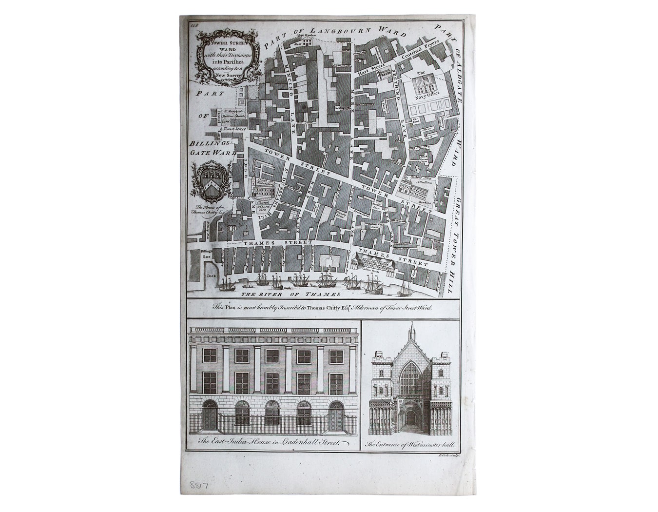
Tower Street Ward with their [sic] divisions into Parishes according to a new survey
This plan of Tower Street was published in the greatly expanded second edition of Maitland’s History of London. Read more
Significant buildings, such as Custom House and the Navy Office, are represented pictorially on the map; with the arms of contemporary Alderman Sir Thomas Chitty and views of East India House and Westminster Hall in the panel at the foot.
Condition & Materials
Copper engraving, 37 x 23.5 cm, engraved by Benjamin Cole, black and white, blank verso.
References
Hyde, Ward Maps, 102. Read less