

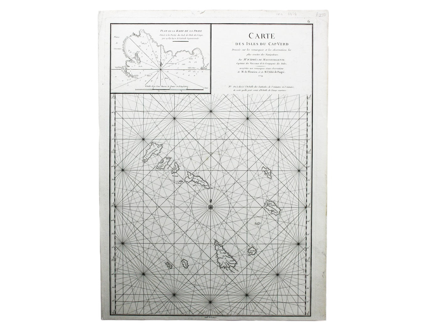

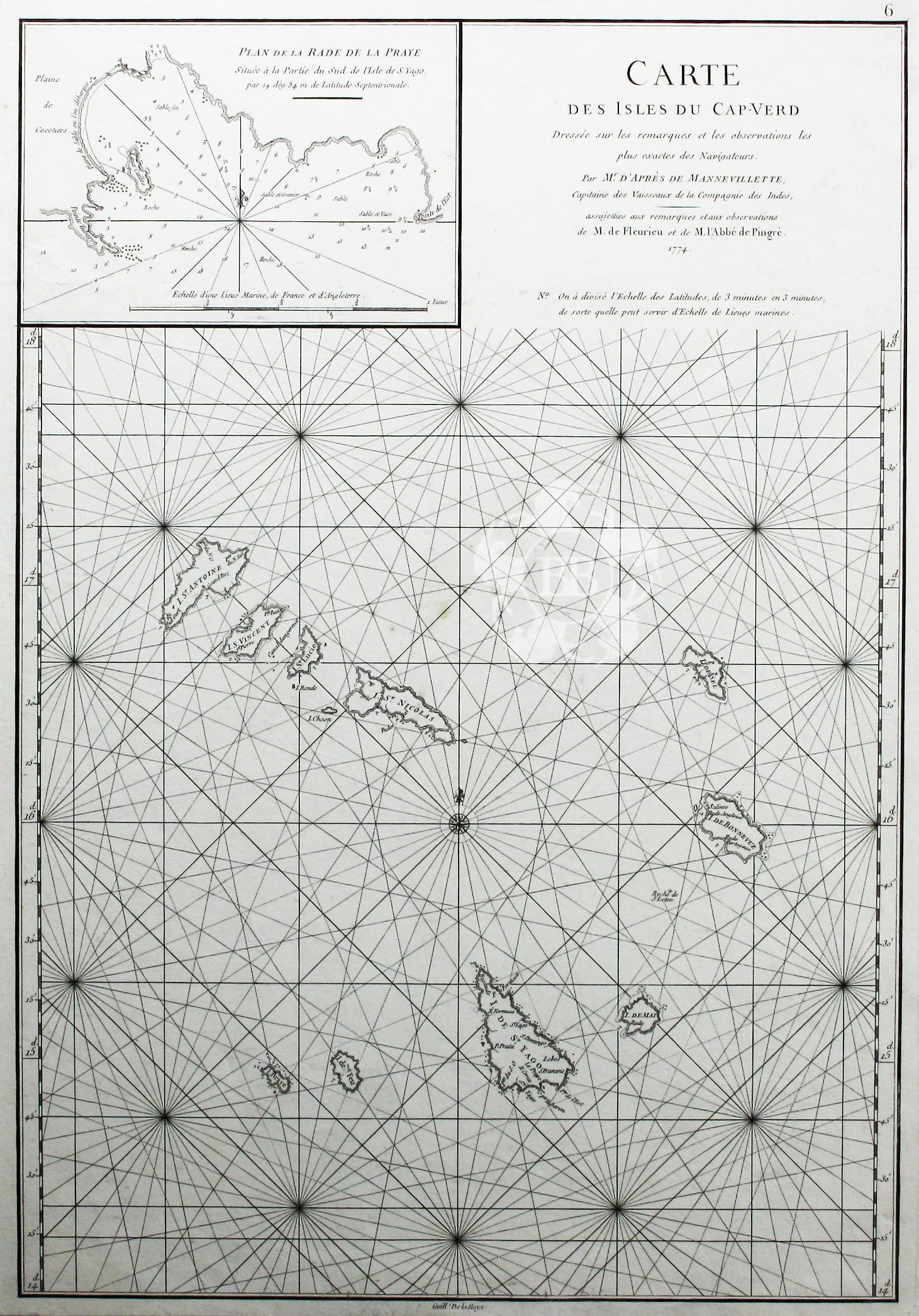
Mannevillette’s Map of the Cape Verde Islands
SKU: 6434
Title:
Mannevillette’s Map of the Cape Verde Islands
Date of publication:
Printed Measurement:
Colour:
Engraver:
Carte des Isles du Cap-Verd
This chart of the Cape Verde islands was engraved by Guillaume de la Haye. Read more
D’Après de Mannevillette (1707-1780) was a practical seaman as well as a mapmaker; his sea atlas was published in Paris in 1745 with the backing of the Academie des Sciences under the title Le Neptune Oriental. He continued to revise and augment his charts over the next thirty years, and issued an expanded version of the Atlas and a supplement 1775-81.
Condition & Materials
Copper engraved sea-chart, 48 x 33 cm, black and white as issued, blank verso. Read less