

Manuscript Map of Etchu Province, Honshu Island
SKU: 9387
Title:
Manuscript Map of Etchu Province, Honshu Island
Date of publication:
Printed Measurement:
Colour:
Mapmaker:
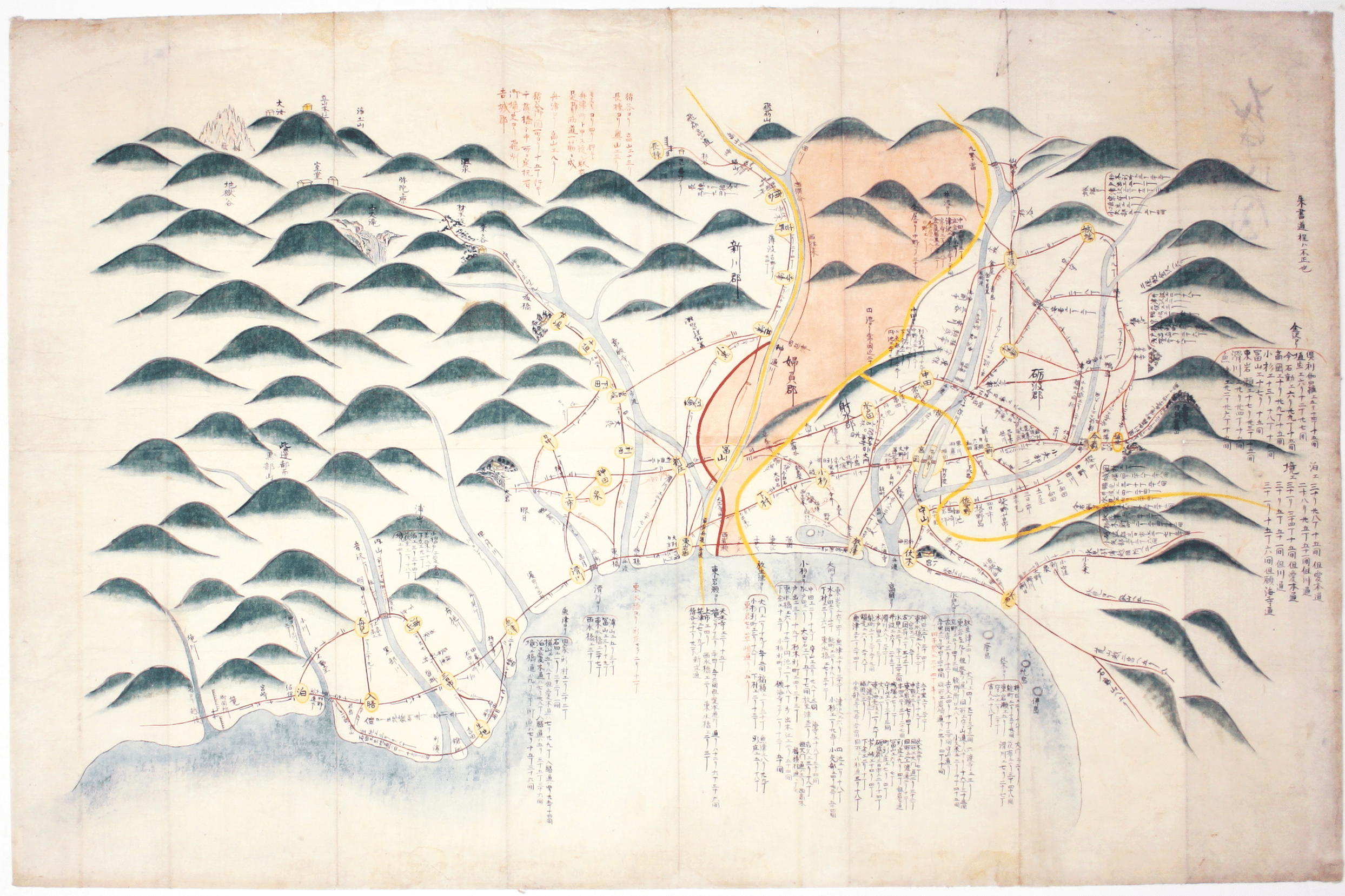
The focus of this map is Toyama, a significant sea-port in what was once Etchu province on Honshu. On stylistic grounds the map appears to date from the mid 19th century, and the script is pre-Meji era.
Toyama and the surrounding towns are shown in the yellow circles, linked by red roads, and regions are also named. It is unsigned (on the back of the map is written 'Etchu Map'). Read more
Most of the text concerns distances, a form of mileage table. There is a note, top right, which appears to indicate that the information in red is less certain than the information in black. Various other things are shown on the map: shrines and temples, hot springs, and a gate where travellers would have to show passports.
Condition & Materials
Manuscript map, sheet size 48.2 x 73.7 cm, ink on laid paper. Read less