Bryars & Bryars
Map of Allied-Occupied Germany & Austria
Map of Allied-Occupied Germany & Austria
Couldn't load pickup availability
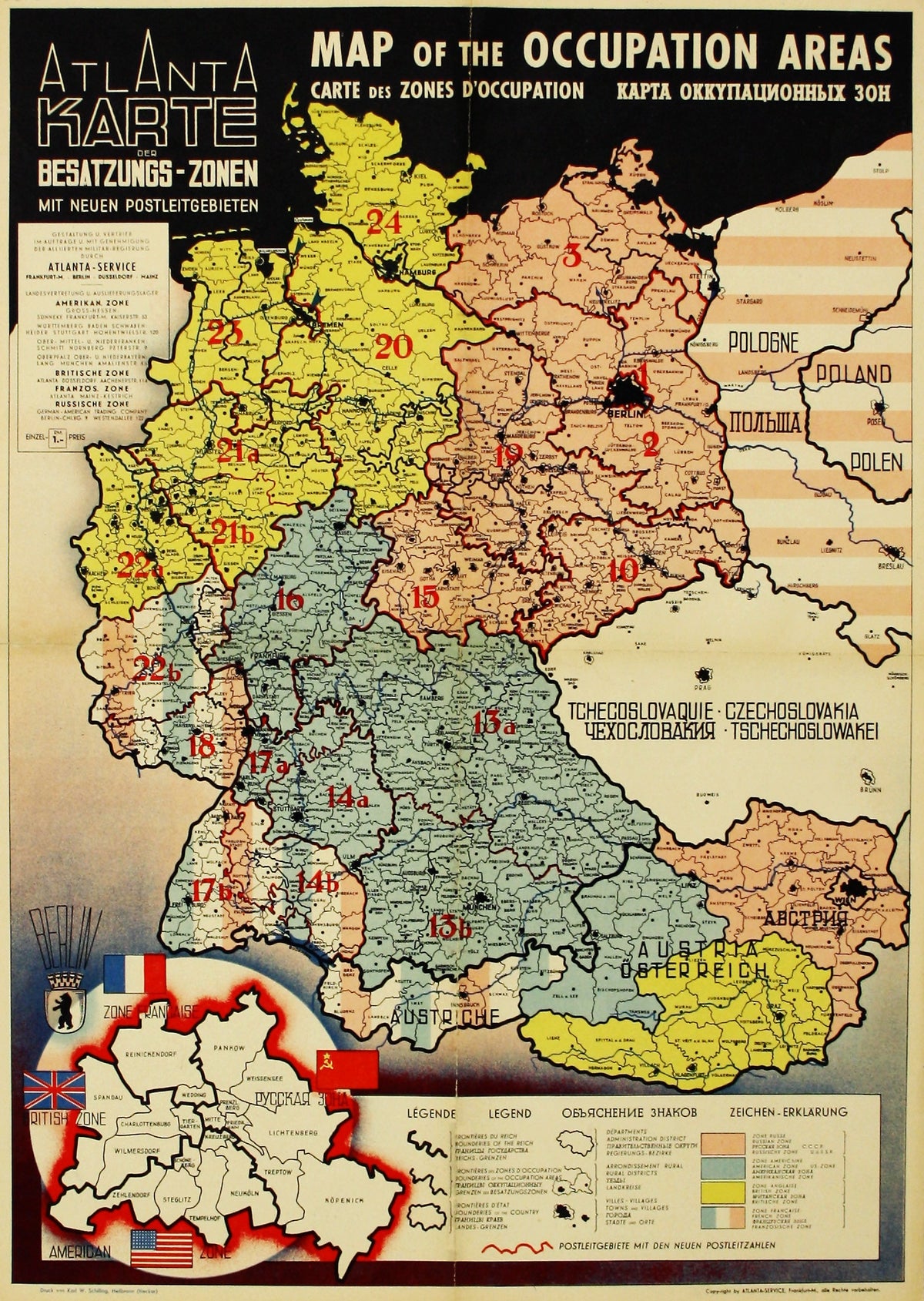
Map of the Occupied Areas / Carte des Zones d’Occupation / Karte der Besatzungs-Zonen mit Neuen Postleitgebieten / [in Cyrillic:] Karta Okkupacionnych Zon
Published with the approval of the Allied Military Government, with a cover price of one Reichsmark, the map shows the partition of Germany and Austria into French, British, American and Russian zones, as agreed at the Potsdam Conference in August 1945. An inset shows the division of Berlin.
The map carries a wealth of detail, including the postal delivery zones and new postcodes. The postal code system introduced by the Allies after the war was in fact a continuation of the system maintained by the Third Reich. However, post codes 4 to 9 and 11 and 12 were abandoned as these applied to regions of Poland, the Soviet Union and Austria.
The draughtsman has been identified as Johannes Sünnecke, although little further information is as yet forthcoming about either him or Atlanta-Service, beyond the range of maps produced in the early postwar period.
Condition & Materials
Separately issued map of Allied-occupied Germany and Austria, 55 x 39 cm, printed in colours, folded, with some restoration to verso along the folds, blank verso.
Share