

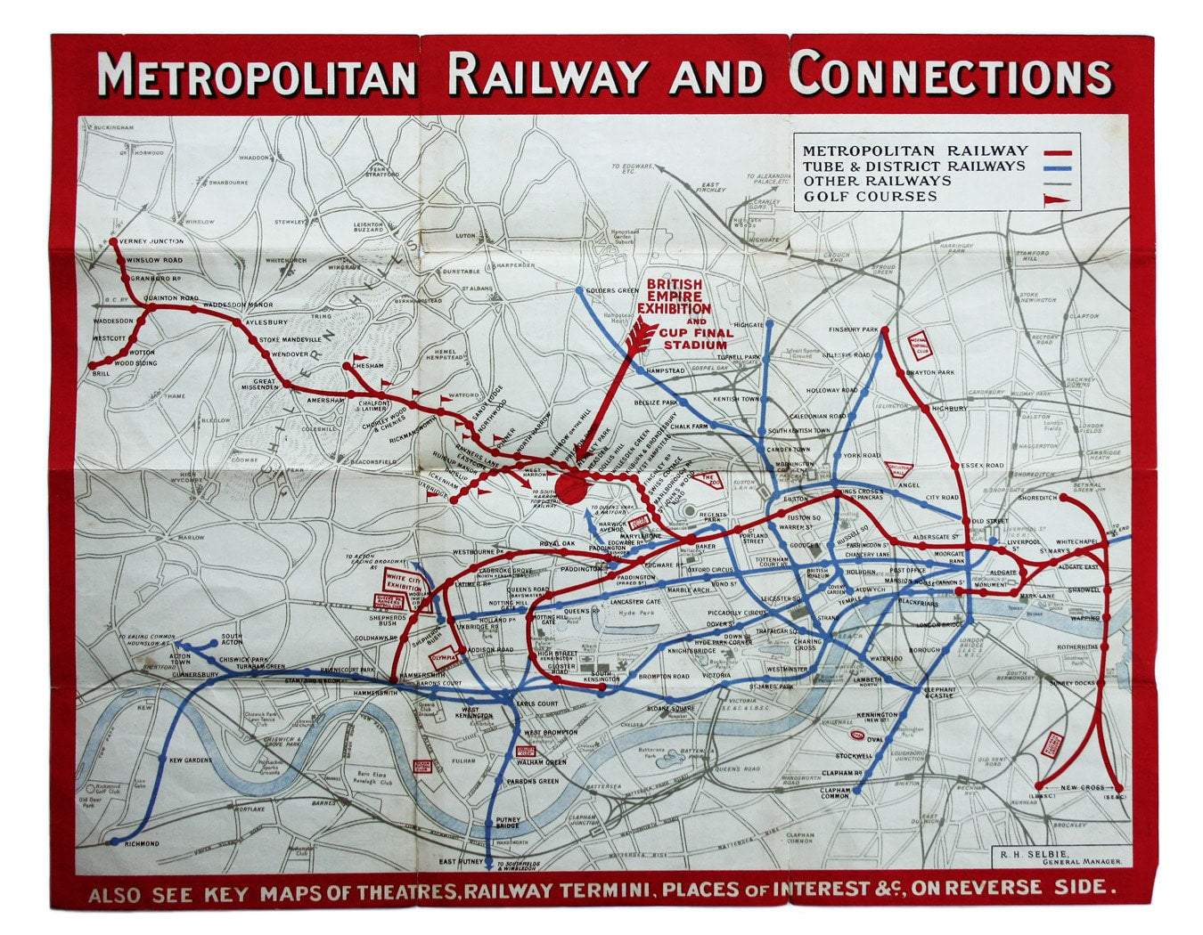
Metropolitan Railway & Connections Passenger Map, British Empire Exhibition Issue
SKU: 8477
Title:
Metropolitan Railway & Connections Passenger Map, British Empire Exhibition Issue
Date of publication:
Printed Measurement:
Publisher:
Colour:
Mapmaker:
In 1933 the Met became part of the LPTB. Here though, the Tube and other railways fade into the background.
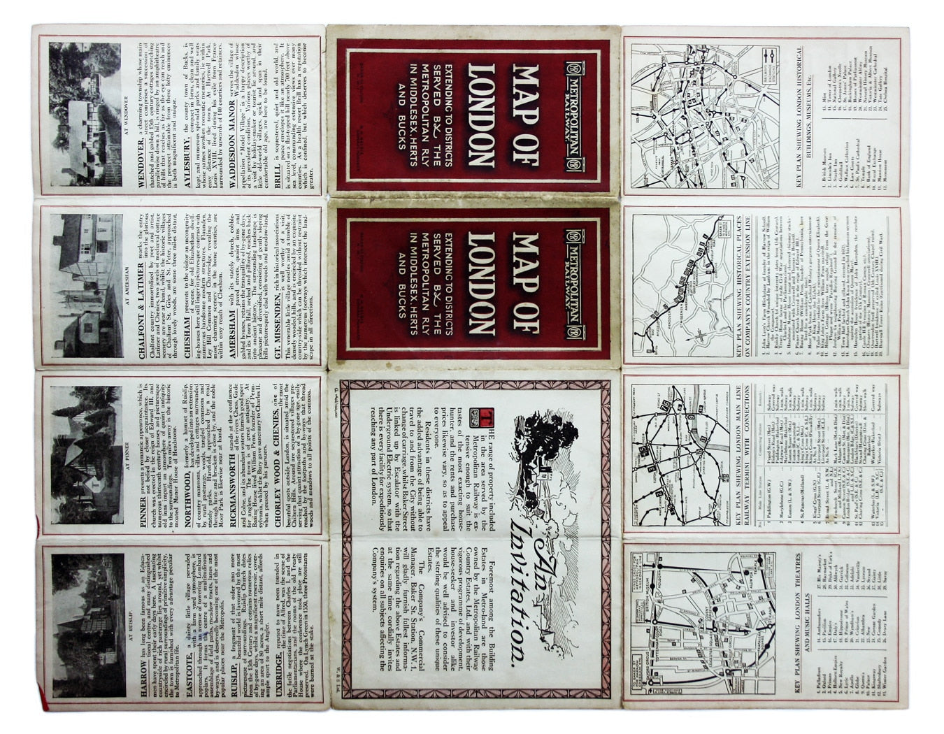
The emphasis is on work/life balance, commuting from Metro-land (a term coined by the railway company’s Publicity Department) with its golf courses, rapidly diminishing countryside and ‘beauty spots’ such as Pinner and Ruislip, “a fragment of that older and more beautiful world”. A panel on the verso extols the virtues of living in Metro-land, by purchasing from the Metropolitan Railway Country Estates, Ltd: unlike any of their competitors, the Met was directly involved in residential property development.
Read more
Conditions & Materials
Passenger map of the Metropolitan Railway, 43 x 34 cm, printed in colours with travel information on verso, wear to intersections of a couple of folds, a couple of short splits; dark red covers, print code G1608/100,000, undated but c. 1924-25, with large red arrow indicating the British Empire Exhibition and Cup Final Stadium. Read less