

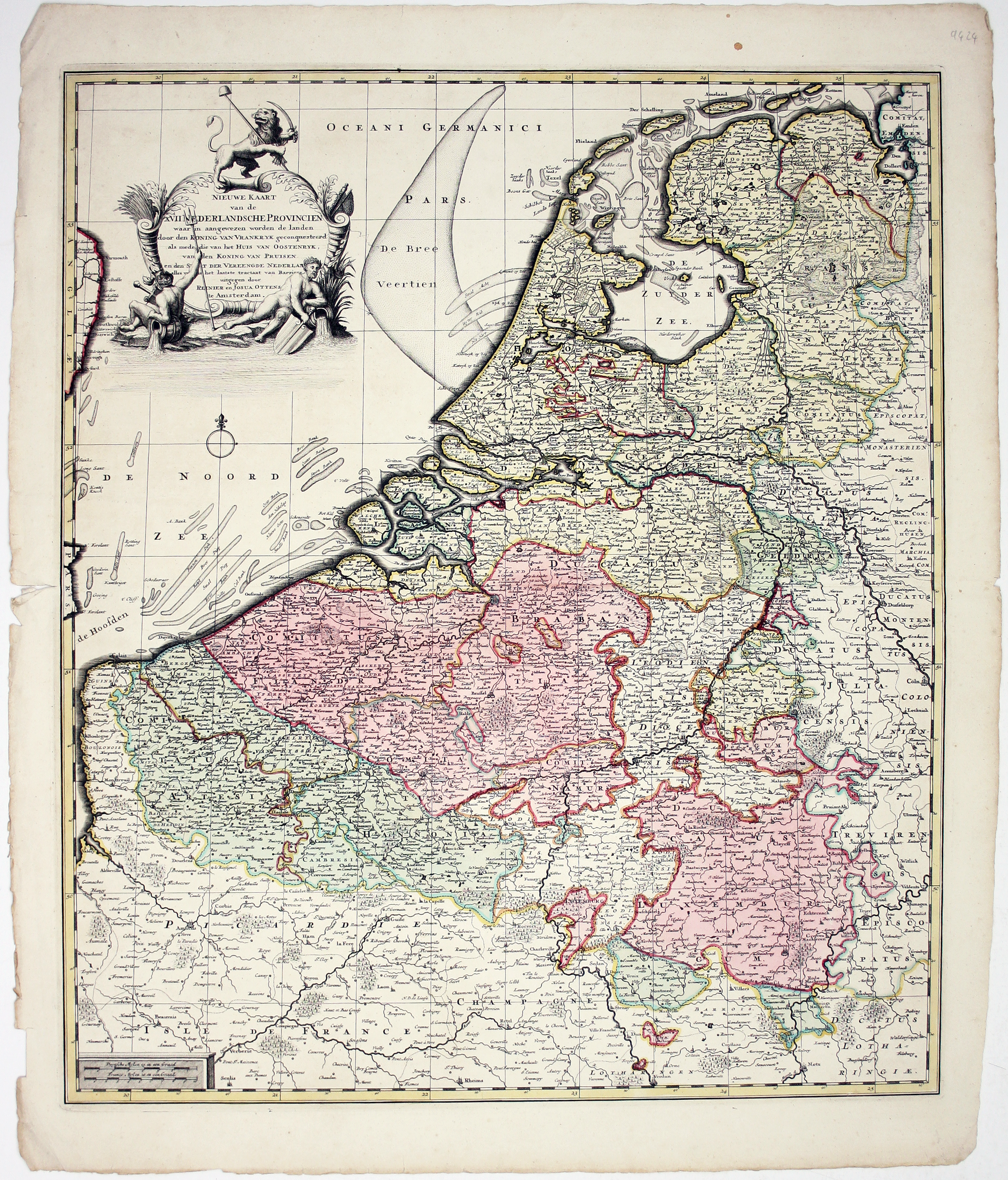
Ottens’ Map of the Low Countries
SKU: 9424
Title:
Ottens’ Map of the Low Countries
Date of publication:
Printed Measurement:
Colour:
Nieuwe Kaarte van der XVII Nederlandsche Provincien: waar in aangewezen worden de landen door den Koning van Vrankryk geconquesteerd als mede die van het Huis van Oostenryk, van den Koning van Pruisen en den Staat der Vereenigde Nederlanden, alles volgens het laatste tractaat van Barriere
Our map shows the original Seventeen Provinces of the Habsburg Netherlands, control of which, as the title explains, had by this time been divided between the Dutch Republic, Austria, Prussia, and France.
Read more
The map features an allegorical cartouche surmounted by a Dutch lion bearing a sword and Phrygian cap.
The map is correct according to the most recent ‘tractaat van Barriere’ or Barrièretraktaat; a series of ‘Barrier Treatries’ (mostly 1709-1715) allowed the Dutch to station troops in the Austrian Netherlands, partly paid for by the local inhabitants, as a first line of defence against the French.
Condition & Materials
Copper engraving, 59.5 x 51.5 cm, original hand colour, uncoloured cartouche, one or two marginal nicks and tears, blank verso. Read less