

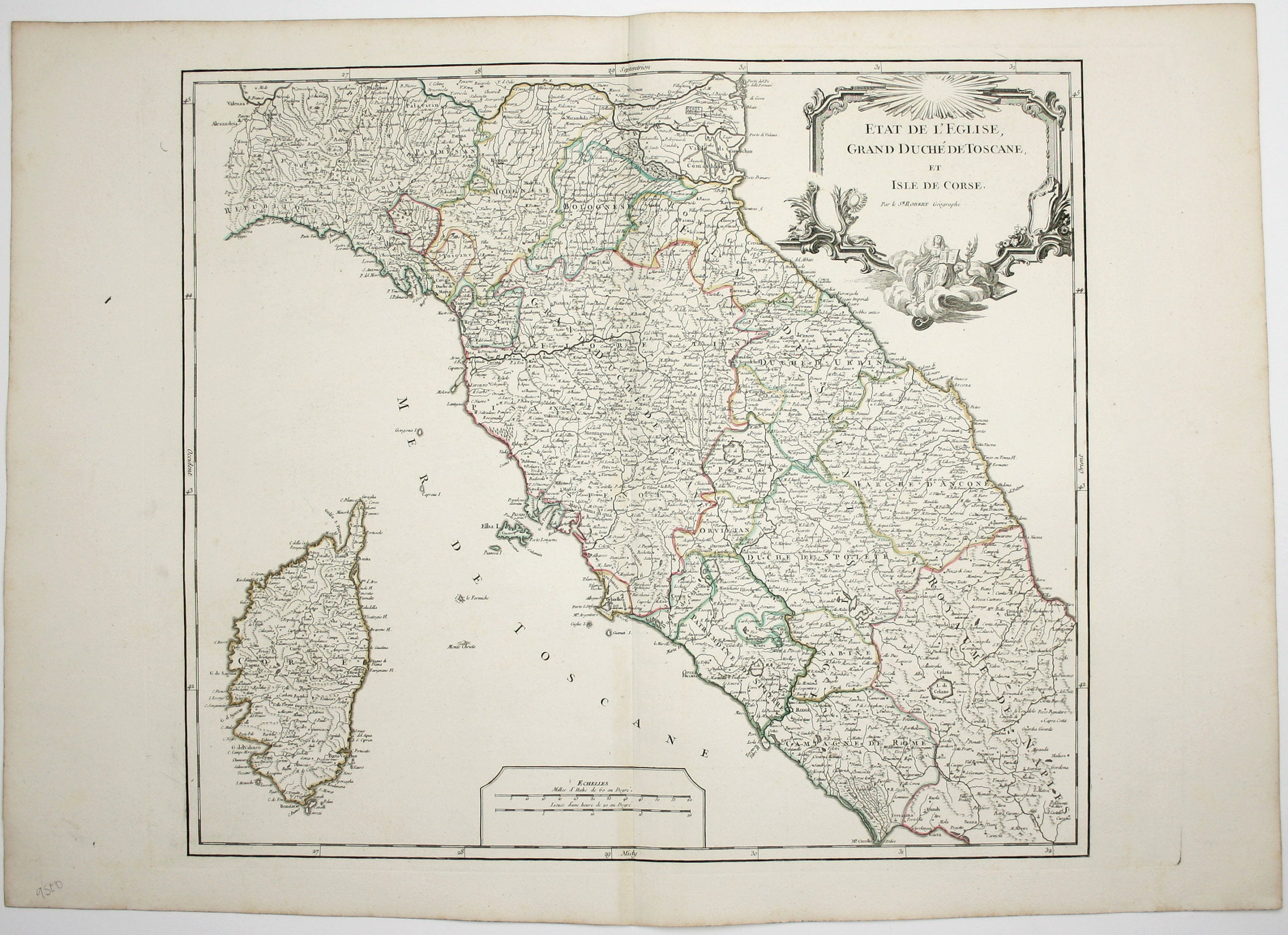
Robert de Vaugondy’s Map of the Papal States, Tuscany & Corsica
SKU: 9500
Title:
Robert de Vaugondy’s Map of the Papal States, Tuscany & Corsica
Date of publication:
Printed Measurement:
Colour:
Mapmaker:
Etat de l’Eglise, Grand Duché de Toscane, et Isle de Corse
This is a later state of Robert de Vaugondy’s map of the Papal States, Tuscany and Corsica. The original date (1750) and privilege (a sort of early forerunner of copyright) have been burnished from the plate. Read more
Condition & Materials
Copper engraving, 50 x 63 cm, original hand colour in outline, blank verso.
References
Pedley, Bel et Utile: the Work of the Robert de Vaugondy Family of Mapmakers, 356. Read less