

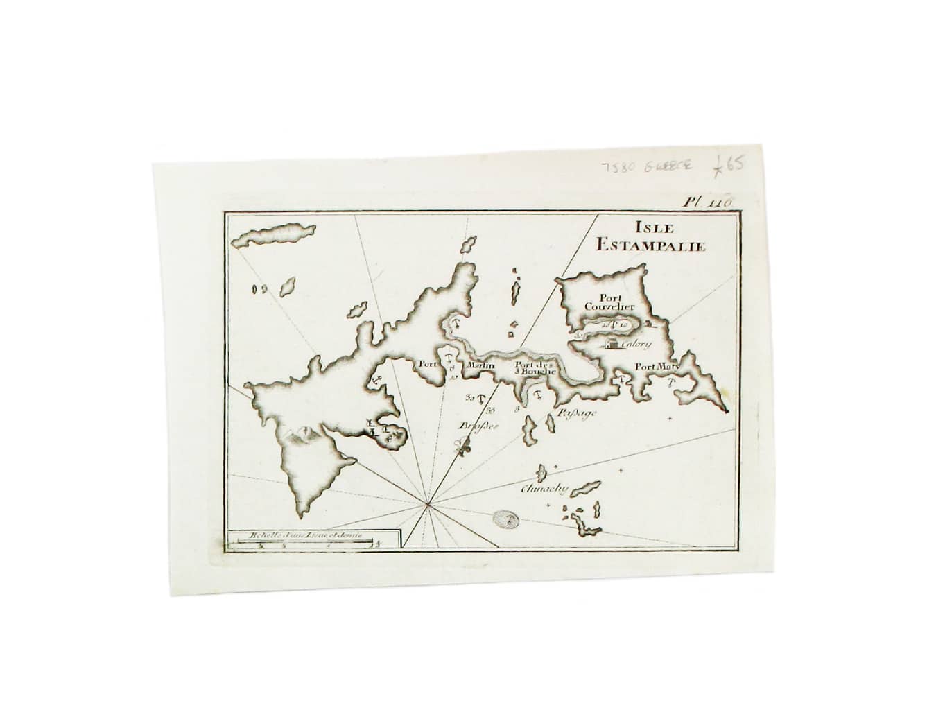
Roux’s Map of Astypalaia
SKU: 7580
Title:
Roux’s Map of Astypalaia
Date of publication:
Printed Measurement:
Publisher:
Colour:
Mapmaker:
This chart of Astypalaia in the Dodecanese is from the practical pocket sea atlas by Marseilles hydrographer Joseph Roux, charting the ports and harbours of the Mediterranean.
The atlas remained popular half a century after its first appearance in 1764. This edition, expanded to 163 charts, was published by a French bookseller in Napoleon’s short-lived client state, the Ligurian Republic. Read more
Condition & Materials
Copper engraving, 14.5 x 20 cm, black and white as issued, blank verso. Read less