

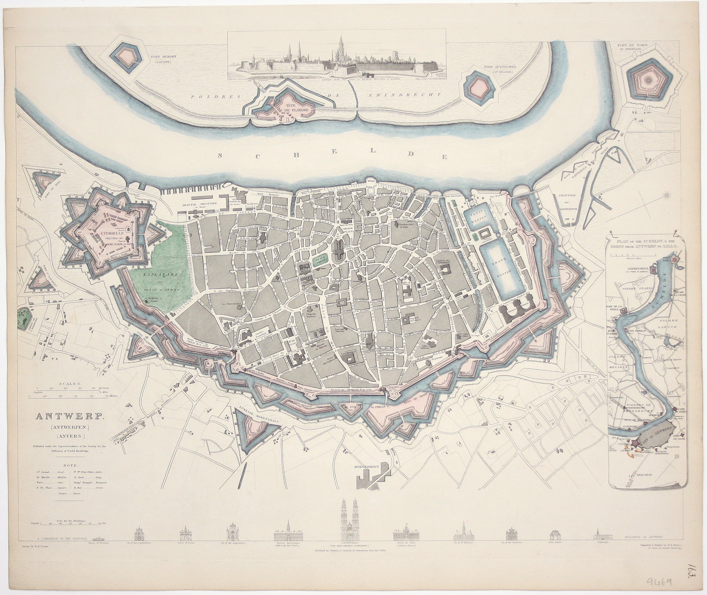
SDUK Map of Antwerp
SKU: 9469
Title:
SDUK Map of Antwerp
Date of publication:
Printed Measurement:
Publisher:
Colour:
Mapmaker:
Engraver:
This map of Antwerp, engraved by Benjamin Rees Davies after William Barnard Clarke, includes elevations of principal buildings and a view of the city. It was published by the SDUK.
The Society for the Diffusion of Useful Knowledge was founded in 1826 with the high-minded aim of making 'useful' information available to the self-taught. Read more
Some of the material was decidedly abstruse, subscribers fell away and the Society was wound up in 1848; however, the series of 209 maps published over a 14 year period from 1829 onwards were highly praised for their superior quality, accuracy and aesthetic appeal and remain an outstanding achievement.
Condition & Materials
Steel engraving, approx 31.5 x 40 cm, original hand colour to map with black and white elevations and view, numbered in and old hand, blank verso. Read less