

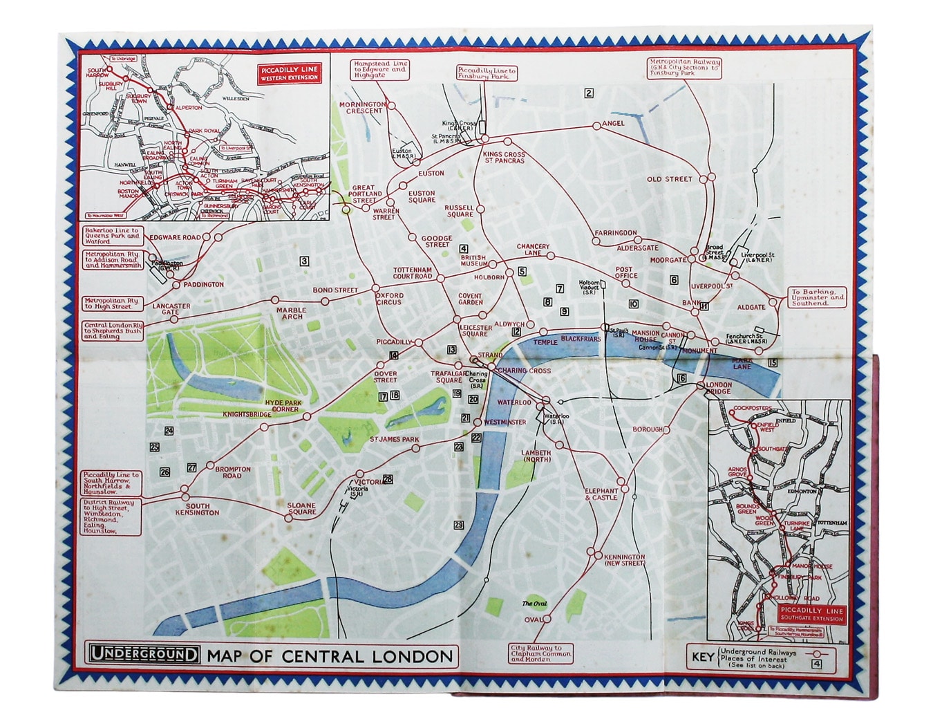
Stingemore’s 1932 Passenger Map of Central London
SKU: 8955
Title:
Stingemore’s 1932 Passenger Map of Central London
Date of publication:
Printed Measurement:
Publisher:
Colour:
Mapmaker:
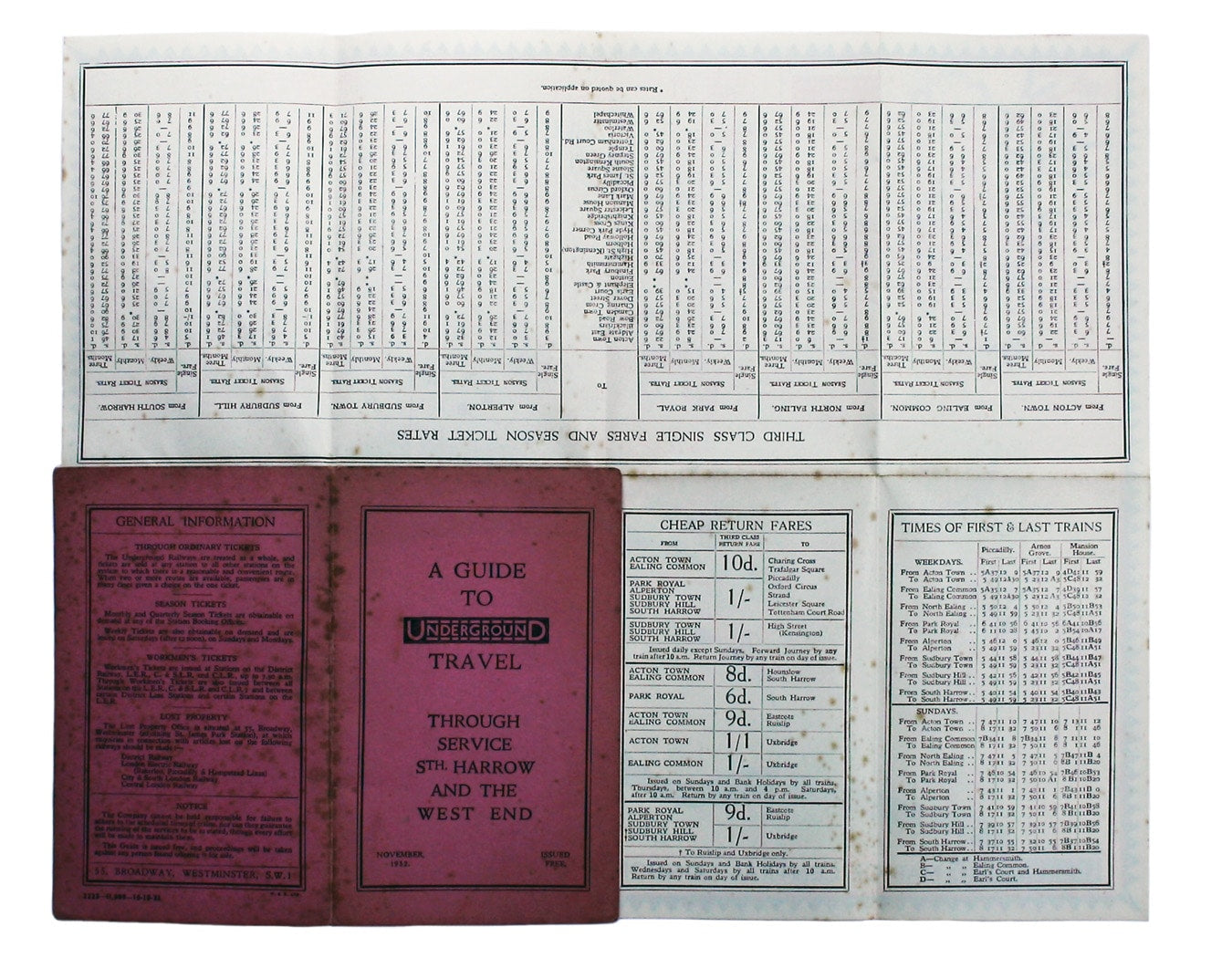
Underground Map of Central London/A Guide to Underground Travel, Through Service Sth. Harrow and the West End
Leboff and Demuth draw attention to the delicate way in which the lines are drawn (so that they do not ‘swamp’ the important street names) and note the striking border, which they suggest helped to present the Underground as a ‘friendly and personal’ organisation. Read more
Fred Stingemore was also responsible for the series of three-panel general maps of the system which were given to passengers between 1925 and 1932.
Condition & Materials
Central area map of London, 27 x 33.5, printed in colours, folding into salmon-pink card covers, light spotting to both map and covers; information about fares, journey times, first and last trains etc. on verso. Printed in 11,000 copies in October 1932 for distribution in November.
References
Leboff and Demuth, No Need to Ask p. 74) Read less