

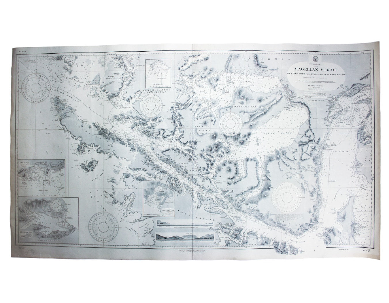

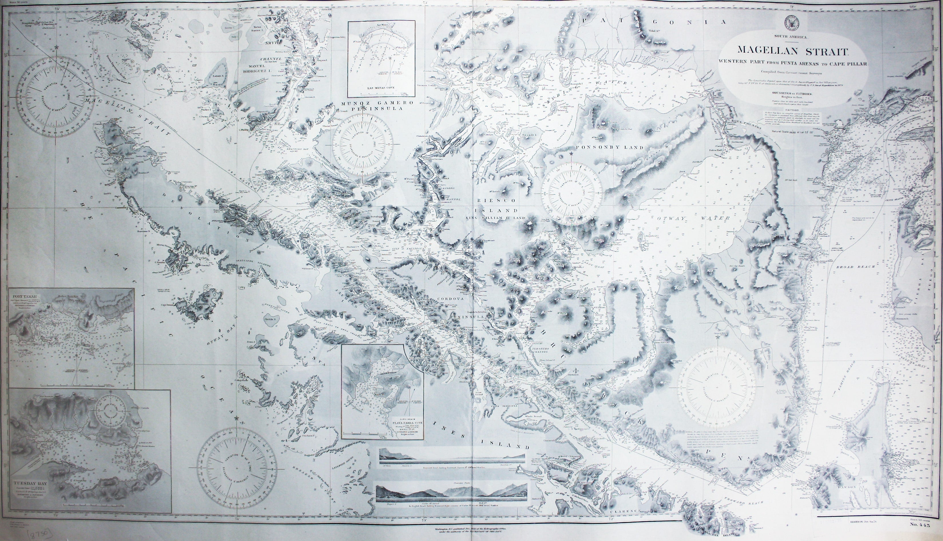
US Naval Chart of the western part of the Magellan Strait
SKU: 8750
Title:
US Naval Chart of the western part of the Magellan Strait
Date of publication:
Printed Measurement:
Colour:
Mapmaker:
South America – Magellan Strait – Western part from Punta Arenas to Cape Pillar
This US naval chart of the Magellan Strait shows soundings, anchorages and relief. Read more
Condition & Materials
Sheet 445, sheet size 69.5 x 122 cm, black and white, ink stamp confirming corrections to 17 April 1925, centrefold, blank verso.
A Note on Shipping
Shipping rates are not available for this item. Select ‘pick up’ at checkout to collect it from the shop, or contact us for a custom quote. We will email you an invoice for the item price plus shipping, and you can complete the transaction securely online. Read less