

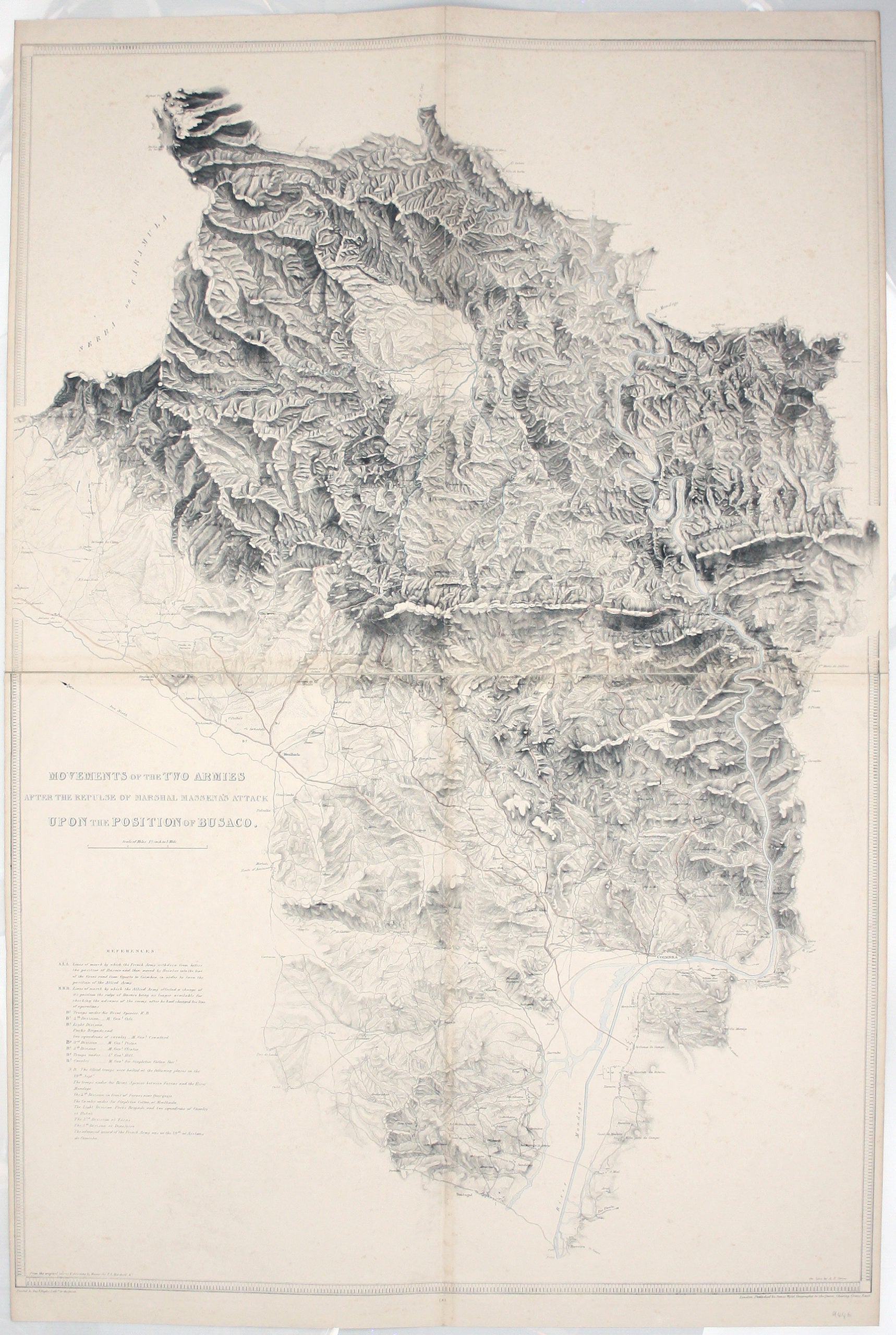
Wyld’s Map of the Battle of Bussaco
SKU: 9446
Title:
Wyld’s Map of the Battle of Bussaco
Date of publication:
Printed Measurement:
Colour:
Mapmaker:
Movements of the two armies after the repulse of Marshall Massena’s attack upon the position of Bussaco
This map was lithographed by AR Grive and printed by Day & Haghe, published by Wyld in ‘Maps & plans showing the principal movements, battles and sieges in which the British Army was engaged during the war from 1808 to 1814 in the Spanish Peninsula and the south of France’. Read more
The plan was taken from the original survey and drawing of Major Sir Thomas Livingstone Mitchell. Mitchell was probably not present at Wellington’s 1810 victory at Bussaco, where Anglo-Portuguese forces repulsed five determined attacks against their positions on the heights. He may have have joined the British Army in Portugal as a volunteer (effectively a junior officer serving without pay), but nothing is documented until he was commissioned into the 95th Rifles in 1811, at the age of 19.
Mitchell’s skills as a surveyor and draughtsman were swiftly recognised, and at the conclusion of the Peninsula campaign he was selected by Quartermaster-General Sir George Murray to produce full, official plans of all the Peninsular battlefields, a task which took approximately four years. With Murray’s support, he went on to become Surveyor General of New South Wales, known for his contribution to the exploration and mapping of Australia. Names he conferred, such as Mount Napier, recalled his Peninsula service.
Condition & Materials
Lithograph, two sheets joined with linen tape, sheet size 125 x 83 cm, original hand colour heightening troop dispositions, roads etc, slight spotting, blank verso. Read less