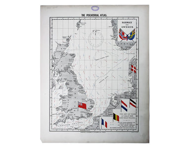
Olsen’s Chart of Tides in The North Sea & British Waters
The Piscatorial Atlas was the product of a decade or more of reports and correspondence with British fishermen This map was published in the ‘Pisca...
View full details

The Piscatorial Atlas was the product of a decade or more of reports and correspondence with British fishermen This map was published in the ‘Pisca...
View full details
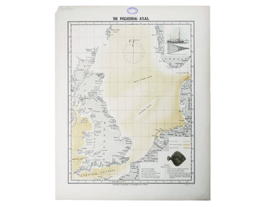
The fish with a face only a mother could love This map was published in the ‘Piscatorial Atlas of the North Sea, English and George’s Channels’, a ...
View full details
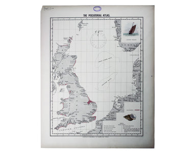
Why is it proverbially assumed to be very easy to run a whelk stall? They look like hard work to me This map was published in the ‘Piscatorial Atla...
View full details
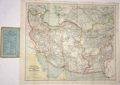
This map of Persia, Afghanistan and Balochistan is part of the Authentic Imperial Maps series published by the London Geographical Institute. Condi...
View full details
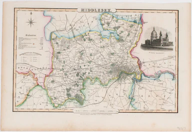
This finely engraved map of Middlesex, with a vignette view of St.Pauls Cathedral, was printed from a steel plate and apparently among the first co...
View full details
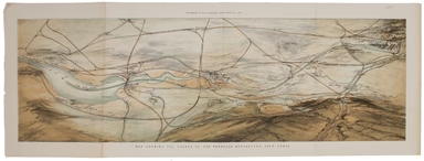
This plan of the Manchester Shipping Canal was published as a supplement to ‘The Illustrated London News’, February 3rd 1883. Construction began in...
View full details
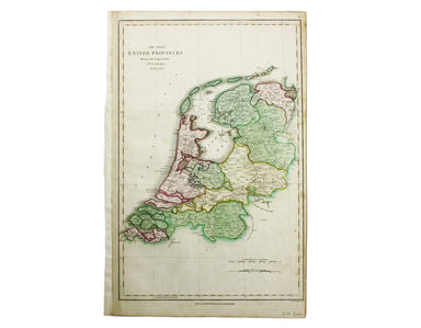
The Seven United Provinces This map of the Netherlands was prepared for Playfair’s New General Atlas. Condition & Materials Copper engraving, ...
View full details
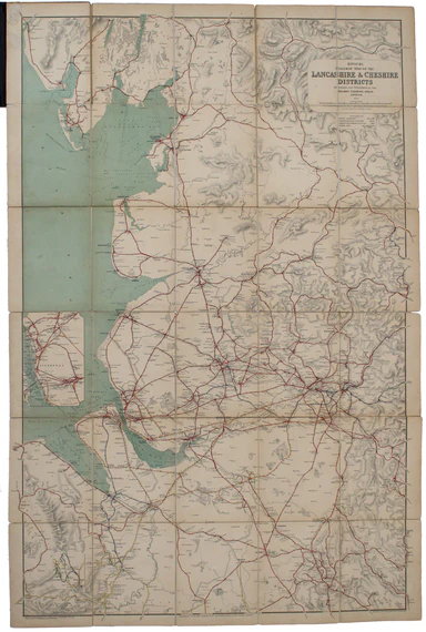
The Railway Clearing House allocated revenue on occasions where one company’s train ran over another’s track, and promoted standardisation (of ever...
View full details
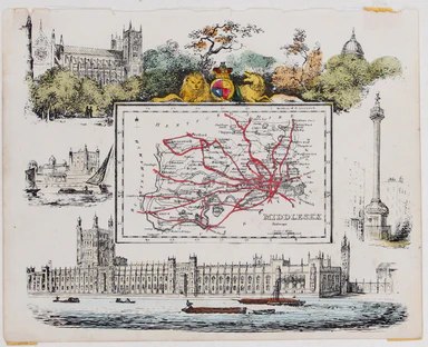
This map of Middlesex was published in Reuben Ramble's ‘Travels through the Counties of England’, an uncommon county atlas for children. Reuben Ram...
View full details
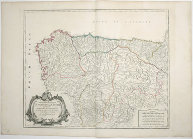
Partie Septentrionale de la Couronne de Castille où se trouvent les Royaumes de Castille Vieille, de Leon, de Gallice, des Asturies, la Biscaye et ...
View full details
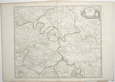
Environs de Paris This is a later state of Robert de Vaugondy’s road map of Italy, showing the Venetian Republic, Papal States, Kingdom of Naples e...
View full details
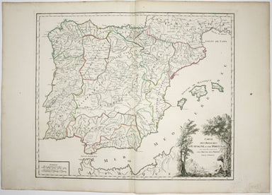
Carte des Royaumes d’Espagne et de Portugal dans laquelle sont tracées les routes de postes This is a later state of Robert de Vaugondy’s road map ...
View full details
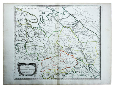
Sarmatia utraque Europaea et Asiatica This map shows parts of European Russia and Ukraine in antiquity. For Greco-Roman geographers and ethnographe...
View full details
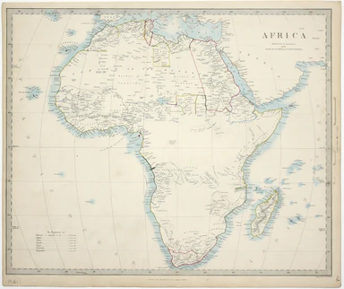
This map of Africa reflects the state of European knowledge of the interior before the mid 19th century search for the sources of the Nile. It mark...
View full details
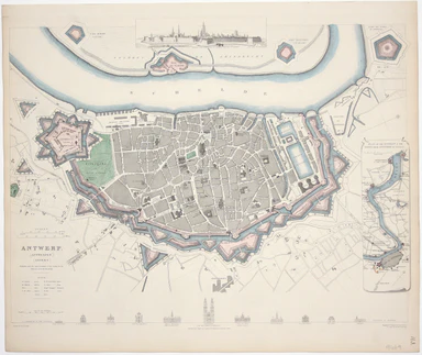
This map of Antwerp, engraved by Benjamin Rees Davies after William Barnard Clarke, includes elevations of principal buildings and a view of the ci...
View full details
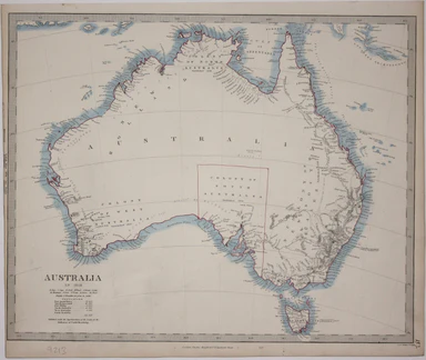
This map of Australia has a table in the bottom left, showing the European population (supposedly revised to 1846 but with the original figure give...
View full details
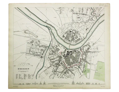
This map of Dresden engraved by William Henshall after William Barnard Clarke. Condition & Materials Steel engraving, 33 x 37 cm, original han...
View full details
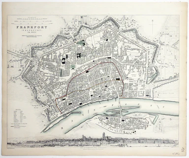
This map of Frankfurt, view of the city at the foot of the map, was published by the SDUK. The Society for the Diffusion of Useful Knowledge was fo...
View full details
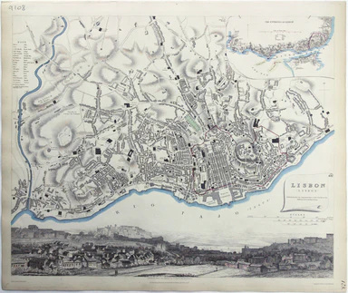
This map of Lisbon was engraved by Josiah Henshall after William Barnard Clarke. It was published by the Society for the Diffusion of Useful Knowle...
View full details
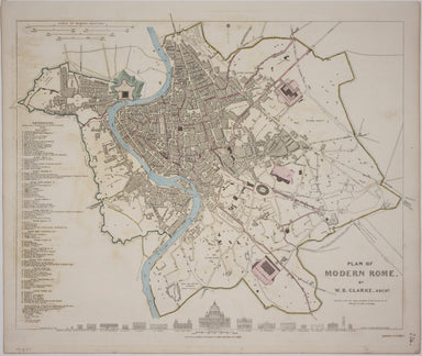
At the foot of this map are architectural elevations of some of Rome’s most famous post-classical buildings, dominated by St Peter’s. Rome was then...
View full details
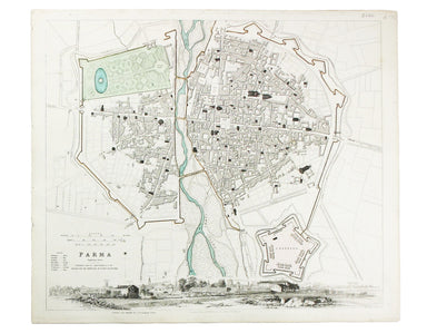
This map includes a panoramic view of Parma at its foot, blank. The Society for the Diffusion of Useful Knowledge was founded in 1826 with the high...
View full details
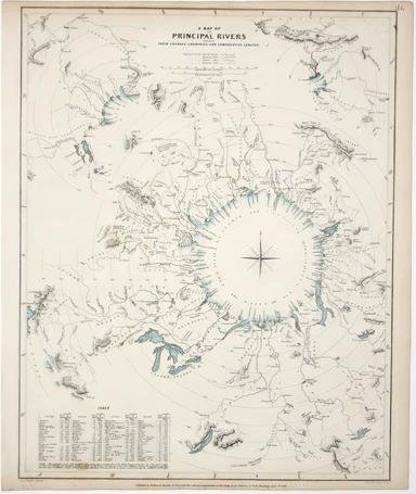
A Map of the Principal Rivers shewing their courses, countries and comparative lengths The Society for the Diffusion of Useful Knowledge was founde...
View full details
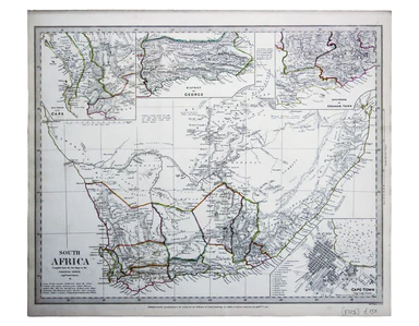
This map of South Africa, including an inset of Cape Town, was engraved by John & Charles Walker. It was published by the SDUK. The Society for...
View full details
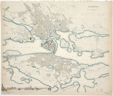
This map of Stockholm, with a view of of the city on a scroll bottom left, was published by the SDUK. The Society for the Diffusion of Useful Knowl...
View full details
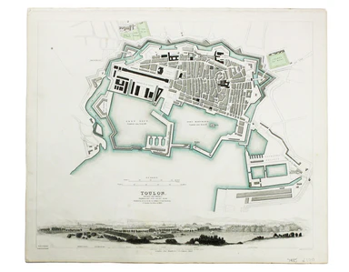
This map of Toulon was engraved by BR Davies after WB Clarke. Condition & Materials Steel engraving, 33 x 40 cm, original hand colour, blank ve...
View full details
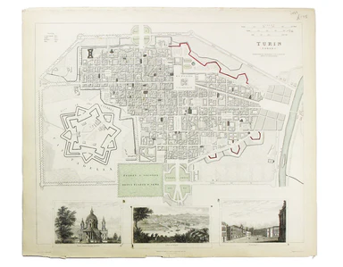
This map of Turin was published by the SDUK. The Society for the Diffusion of Useful Knowledge was founded in 1826 with the high-minded aim of maki...
View full details
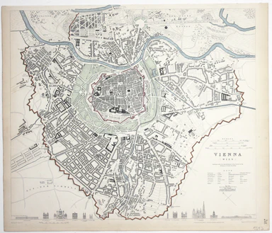
This map of Vienna was published by the SDUK. The Society for the Diffusion of Useful Knowledge was founded in 1826 with the high-minded aim of mak...
View full details
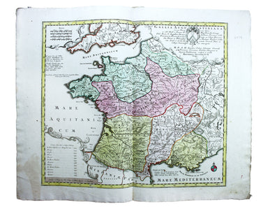
Gallia Augustiniana in suas provincias divisa… A map of Roman Gaul, with Lotter’s imprint. In 1756 Lotter succeeded his father-in-law, Georg Mattha...
View full details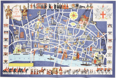
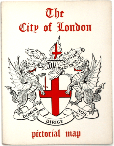
Mary Sims and Mary Camidge, both signing as 'of Maps and Guides, Ltd', each produced posters for British Railways (Eastern Region) in 1960. They th...
View full details
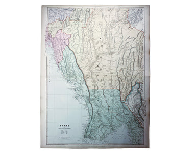
This map of Burma was published in the second trade edition of Stanford’s London Atlas. Edward Stanford (senior) acquired Arrowmsith's stock in 187...
View full details
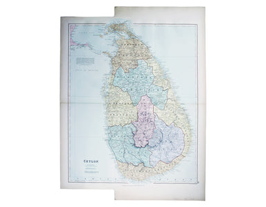
This map of Sri Lanka was published in the first trade edition of Stanford’s ‘London Atlas’. Edward Stanford (senior) acquired Arrowmsith's stock i...
View full details
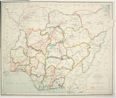
Outline Map shewing Railways of Nigeria The map shows the railways of Nigeria completed and under construction. A gummed Nigerian revenue stamp has...
View full details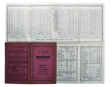
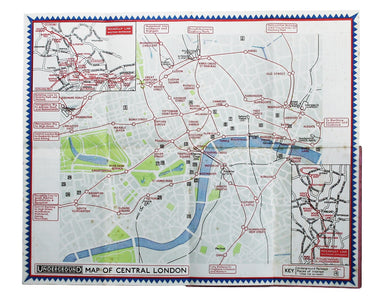
Underground Map of Central London/A Guide to Underground Travel, Through Service Sth. Harrow and the West End Leboff and Demuth draw attention to t...
View full details
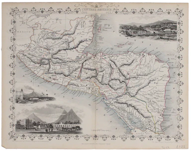
This map of Central America was engraved by John Rapkin for John Tallis' popular ‘Illustrated Atlas’. It includes black and white vignettes of Beli...
View full details
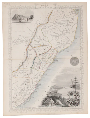
This map of Natal was engraved by John Rapkin for John Tallis' popular ‘Illustrated Atlas’. It includes vignettes of Port Natal engraved by William...
View full details
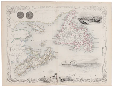
This map of Nova Scotia was engraved by John Rapkin for John Tallis' popular ‘Illustrated Atlas’; it includes black and white vignettes of Halifax,...
View full details
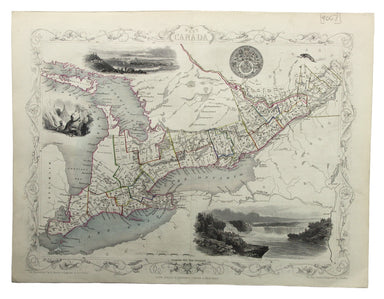
This map of West Canada was engraved by John Rapkin for the ‘Illustrated Atlas’. The map also includes black and white vignettes of Kingston, Ontar...
View full details
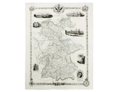
This map of Germany was engraved by John Rapkin for the Illustrated Atlas. John Rogers engraved a number of vignettes: the Palace at Saxe Gotha, bi...
View full details
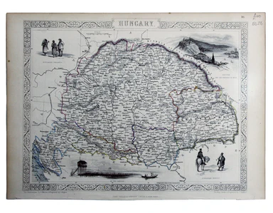
This map of Hungary was engraved by John Rapkin for the ‘Illustrated Atlas’. It features vignettes, including Budapest, engraved by John Rogers. Co...
View full details
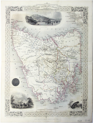
This map of Tasmania was engraved by John Rapkin for the ‘Illustrated Atlas'. John Rogers engraved the black and white vignettes including Hobart T...
View full details
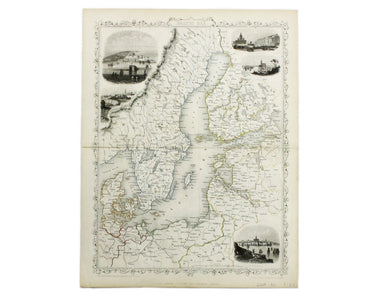
This map of the Baltic Sea was engraved by John Rapkin for the Illustrated Atlas. Vignettes including Kronstadt and St Petersburg were engraved by ...
View full details
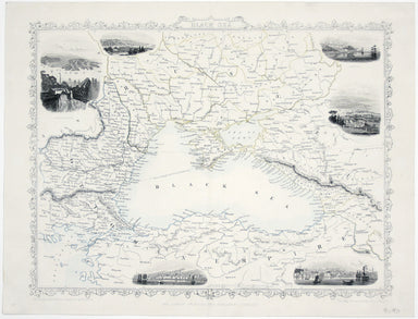
This map of the Black Sea has been updated to show the 300 miles of submarine telegraph cable laid between Varna and Balaclava by Robert Stirling N...
View full details
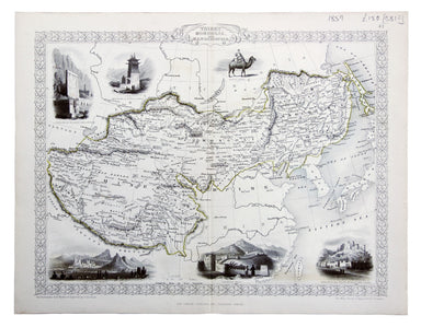
Thibet, Mongolia, and Mandchouria This map was engraved by John Rapkin for the ‘Illustrated Atlas’; with vignettes including Leh in Ladakh, a stret...
View full details
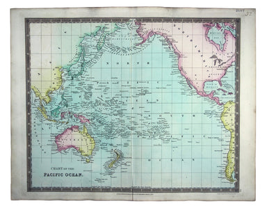
This chart of the Pacific Ocean features two regions named New South Wales. Cook’s New South Wales in Australia remains familiar, but the other, on...
View full details
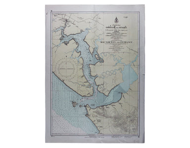
Mae Nam Wen and Entrance, Surveyed by the Hydrographic Department, Royal Thai Navy, March-May 1944 This is a Thai chart of the Mae Nam Welu estuary...
View full details
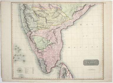
This map covers the southern part of the subcontinent (Mumbai is near the upper border), and includes the northern part of Sri Lanka. Pink denotes ...
View full details
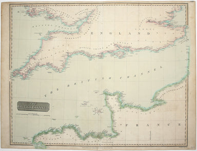
John Thomson's maps, like this one of the Channel, are characteristic of the Edinburgh school of cartography. It flourished at the beginning of the...
View full details
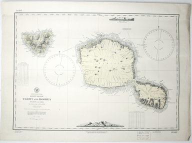
South Pacific Ocean – Society Islands – Tahiti and Moorea (Otaheite and Eimeo) This chart was derived from French surveys of 1869 and 1885. The fir...
View full details
